
| Memorials | : | 48 |
| Location | : | West Unity, Williams County, USA |
| Coordinate | : | 41.5708008, -84.4158020 |
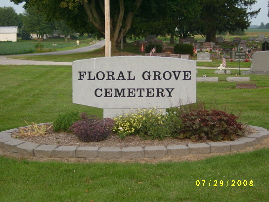
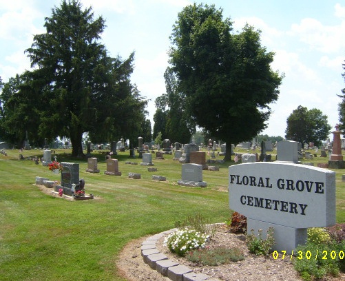
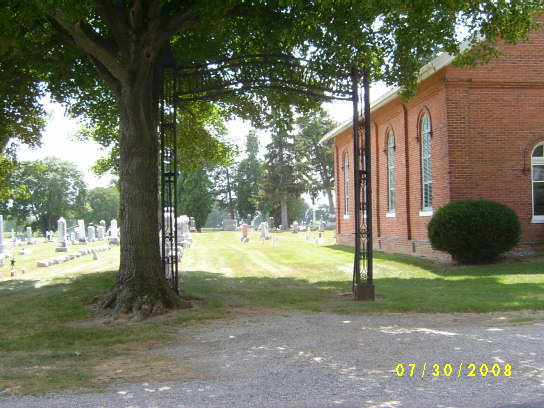
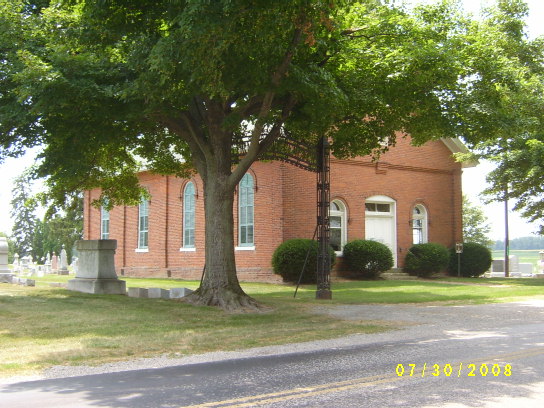
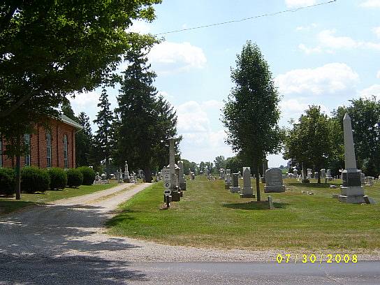
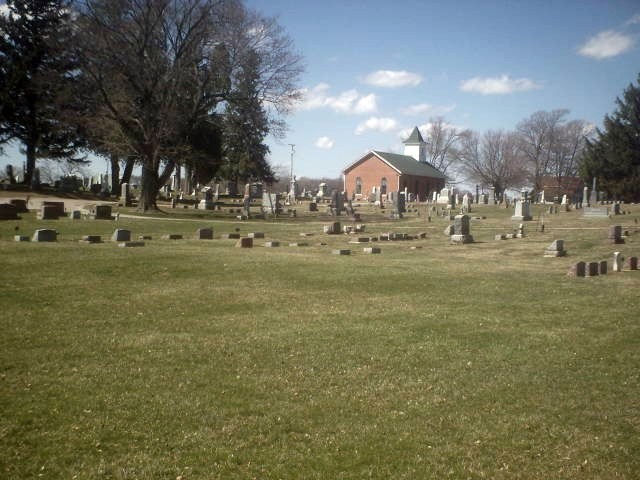
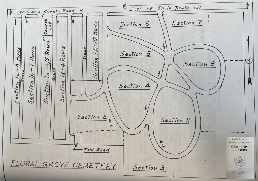
| Description | : | Floral Grove Cemetery is located southeast of West Unity. From West Unity, take State Rt. 191 south to County Road K. Turn east. The cemetery is located just past County Road 21. The Cemetery flanks three sides of the German Methodist Episcopal Church, which was built in 1869. An earlier frame church was built in 1851, and there were three burials before that time. A son of Jacob Pettit, and a son and daughter of Benjamin Combs, in 1850. The oldest tombstones are now broken and very hard to read, or not legible at all. The cemetery is well maintained... Read More |
frequently asked questions (FAQ):
-
Where is Floral Grove Cemetery?
Floral Grove Cemetery is located at West Unity, Williams County ,Ohio ,USA.
-
Floral Grove Cemetery cemetery's updated grave count on graveviews.com?
43 memorials
-
Where are the coordinates of the Floral Grove Cemetery?
Latitude: 41.5708008
Longitude: -84.4158020
Nearby Cemetories:
1. Beatty Cemetery
West Unity, Williams County, USA
Coordinate: 41.5881970, -84.3954710
2. Rings Cemetery
West Unity, Williams County, USA
Coordinate: 41.5928680, -84.4288400
3. Lockport Cemetery
Stryker, Williams County, USA
Coordinate: 41.5466690, -84.3927765
4. Goll Cemetery
Archbold, Fulton County, USA
Coordinate: 41.5558014, -84.3677979
5. Ely Cemetery
West Unity, Williams County, USA
Coordinate: 41.6135630, -84.3939880
6. Kunkle Cemetery
Williams County, USA
Coordinate: 41.5561150, -84.4762400
7. Bodel Cemetery
Stryker, Williams County, USA
Coordinate: 41.5277080, -84.4495600
8. Quaker Cemetery
West Unity, Williams County, USA
Coordinate: 41.6155770, -84.3834280
9. Beaver Creek Cemetery
West Unity, Williams County, USA
Coordinate: 41.6011009, -84.4738998
10. West Franklin Cemetery
Fayette, Fulton County, USA
Coordinate: 41.6224400, -84.3940900
11. Ely Cemetery
Fayette, Fulton County, USA
Coordinate: 41.6255989, -84.3824997
12. Bistline Cemetery
West Unity, Williams County, USA
Coordinate: 41.5995650, -84.4909490
13. Johnson Cemetery
Burlington, Fulton County, USA
Coordinate: 41.5791230, -84.3308020
14. French Cemetery
Springfield Township, Williams County, USA
Coordinate: 41.5039100, -84.4485500
15. Williams County Infirmary Cemetery
West Unity, Williams County, USA
Coordinate: 41.5571430, -84.5097860
16. Oakwood Cemetery
Stryker, Williams County, USA
Coordinate: 41.4978900, -84.4274700
17. Shiffler Cemetery
Jefferson Township, Williams County, USA
Coordinate: 41.5325012, -84.5063934
18. Kunkle Cemetery
Kunkle, Williams County, USA
Coordinate: 41.6255989, -84.4950027
19. Olive Branch Cemetery
Alvordton, Williams County, USA
Coordinate: 41.6527786, -84.4088898
20. Barrett Cemetery
Williams County, USA
Coordinate: 41.6293983, -84.4961014
21. Old Pulaski Cemetery
Williams County, USA
Coordinate: 41.5135994, -84.5119019
22. Bechtol Cemetery #2
Montpelier, Williams County, USA
Coordinate: 41.5782060, -84.5391850
23. Boynton Cemetery
Stryker, Williams County, USA
Coordinate: 41.4782982, -84.4389038
24. Saint Peters Cemetery
Archbold, Fulton County, USA
Coordinate: 41.5428009, -84.2882996