
| Memorials | : | 0 |
| Location | : | Bushmead, Bedford Borough, England |
| Coordinate | : | 52.2336110, -0.3675000 |
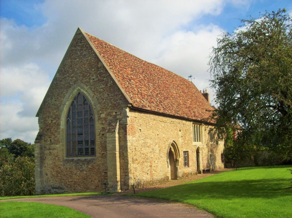
| Description | : | AKA The Priory Church of Saint Mary, Bushmead It is a Grade I listed building The priory was founded around 1195 by William, Chaplain of Colmworth |
frequently asked questions (FAQ):
-
Where is Bushmead Priory?
Bushmead Priory is located at Bushmead, Bedford Borough ,Bedfordshire ,England.
-
Bushmead Priory cemetery's updated grave count on graveviews.com?
0 memorials
-
Where are the coordinates of the Bushmead Priory?
Latitude: 52.2336110
Longitude: -0.3675000
Nearby Cemetories:
1. The Little Staughton cemetery burial ground
Little Staughton, Bedford Borough, England
Coordinate: 52.2450015, -0.3776441
2. St. Denys Churchyard
Colmworth, Bedford Borough, England
Coordinate: 52.2143200, -0.3785620
3. All Saints Churchyard
Little Staughton, Bedford Borough, England
Coordinate: 52.2539810, -0.3792070
4. St. Andrew's Church Cemetery
Great Staughton, Huntingdonshire District, England
Coordinate: 52.2677700, -0.3573400
5. St. Albans Woodland Burial Ground
Keysoe, Bedford Borough, England
Coordinate: 52.2411411, -0.4253732
6. St. Dunstan's Churchyard
Bolnhurst, Bedford Borough, England
Coordinate: 52.2158480, -0.4196000
7. Old Cemetery
Great Staughton, Huntingdonshire District, England
Coordinate: 52.2694189, -0.3546817
8. St Andrew Churchyard
Great Staughton, Huntingdonshire District, England
Coordinate: 52.2691765, -0.3504967
9. Brook End Baptist Chapel Chapelyard
Bedford Borough, England
Coordinate: 52.2553182, -0.4280018
10. St Nicholas Churchyard
Hail Weston, Huntingdonshire District, England
Coordinate: 52.2447100, -0.2945500
11. St. Peter's Churchyard
Pertenhall, Bedford Borough, England
Coordinate: 52.2762000, -0.4123000
12. St Mary Churchyard
Eaton Socon, Huntingdonshire District, England
Coordinate: 52.2156190, -0.2882830
13. St. Nicholas Churchyard
Wilden, Bedford Borough, England
Coordinate: 52.1845000, -0.4011000
14. St. Peter's Churchyard
Thurleigh, Bedford Borough, England
Coordinate: 52.2146800, -0.4578350
15. St. Neots Priory
St Neots, Huntingdonshire District, England
Coordinate: 52.2281710, -0.2705280
16. Little Paxton Cemetery
Little Paxton, Huntingdonshire District, England
Coordinate: 52.2548800, -0.2764600
17. Eynesbury Old Cemetery
Huntingdonshire District, England
Coordinate: 52.2243800, -0.2705300
18. New Street Baptist Church St Neots
St Neots, Huntingdonshire District, England
Coordinate: 52.2290700, -0.2686400
19. Parish Church of St. Mary the Virgin
St Neots, Huntingdonshire District, England
Coordinate: 52.2268700, -0.2671700
20. St. Neots Cemetery
St Neots, Huntingdonshire District, England
Coordinate: 52.2253680, -0.2641010
21. St Deny's Churchyard
Little Barford, Bedford Borough, England
Coordinate: 52.1982210, -0.2785350
22. St. Mary Magdalene Churchyard
Roxton, Bedford Borough, England
Coordinate: 52.1769310, -0.3146280
23. St Andrew Churchyard
Kimbolton, Huntingdonshire District, England
Coordinate: 52.2978950, -0.3895660
24. All Saints Churchyard
Ravensden, Bedford Borough, England
Coordinate: 52.1766273, -0.4252580