
| Memorials | : | 0 |
| Location | : | Little Barford, Bedford Borough, England |
| Coordinate | : | 52.1982210, -0.2785350 |
frequently asked questions (FAQ):
-
Where is St Deny's Churchyard?
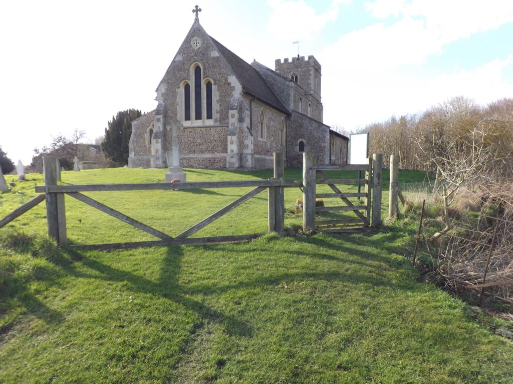
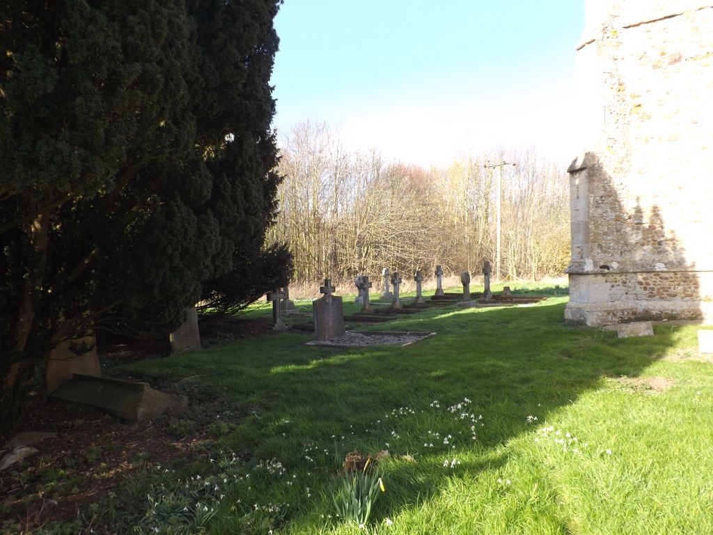
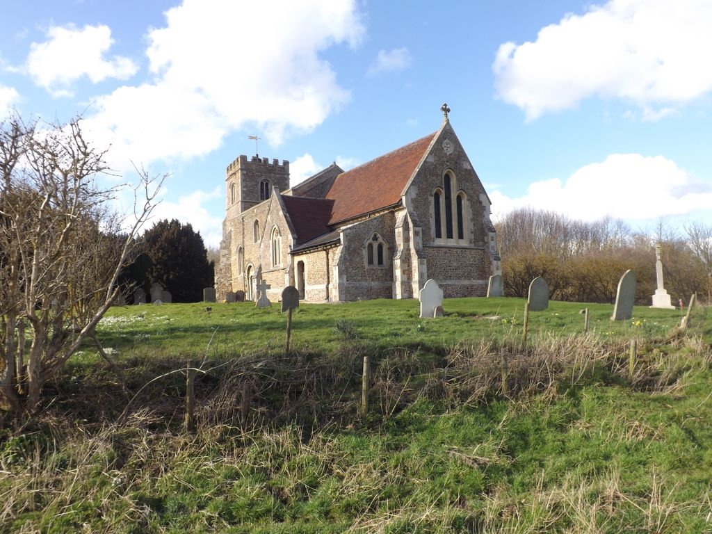
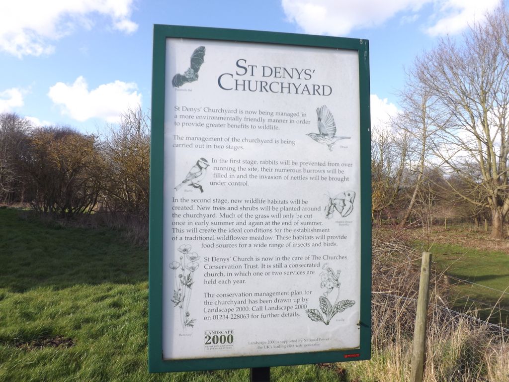
St Deny's Churchyard is located at Little Barford, Bedford Borough ,Bedfordshire , PE19 6YEEngland.
-
St Deny's Churchyard cemetery's updated grave count on graveviews.com?
0 memorials
-
Where are the coordinates of the St Deny's Churchyard?
Latitude: 52.1982210
Longitude: -0.2785350
Nearby Cemetories:
1. St Mary Churchyard
Eaton Socon, Huntingdonshire District, England
Coordinate: 52.2156190, -0.2882830
2. Eynesbury Old Cemetery
Huntingdonshire District, England
Coordinate: 52.2243800, -0.2705300
3. St. Neots Cemetery
St Neots, Huntingdonshire District, England
Coordinate: 52.2253680, -0.2641010
4. Parish Church of St. Mary the Virgin
St Neots, Huntingdonshire District, England
Coordinate: 52.2268700, -0.2671700
5. St. Neots Priory
St Neots, Huntingdonshire District, England
Coordinate: 52.2281710, -0.2705280
6. St. Mary Magdalene Churchyard
Roxton, Bedford Borough, England
Coordinate: 52.1769310, -0.3146280
7. New Street Baptist Church St Neots
St Neots, Huntingdonshire District, England
Coordinate: 52.2290700, -0.2686400
8. Tempsford Village Cemetery
Tempsford, Central Bedfordshire Unitary Authority, England
Coordinate: 52.1639000, -0.3024500
9. St Nicholas Churchyard
Hail Weston, Huntingdonshire District, England
Coordinate: 52.2447100, -0.2945500
10. Little Paxton Cemetery
Little Paxton, Huntingdonshire District, England
Coordinate: 52.2548800, -0.2764600
11. All Saints Churchyard
Great Barford, Bedford Borough, England
Coordinate: 52.1520280, -0.3439850
12. St. Denys Churchyard
Colmworth, Bedford Borough, England
Coordinate: 52.2143200, -0.3785620
13. Bushmead Priory
Bushmead, Bedford Borough, England
Coordinate: 52.2336110, -0.3675000
14. St Leonard Churchyard
Southoe, Huntingdonshire District, England
Coordinate: 52.2654070, -0.2679460
15. St. James the Great New Churchyard
Waresley, Huntingdonshire District, England
Coordinate: 52.1747700, -0.1740900
16. Old Baptist Burial Ground
Sandy, Central Bedfordshire Unitary Authority, England
Coordinate: 52.1299590, -0.2884590
17. St. James Churchyard
Croxton, South Cambridgeshire District, England
Coordinate: 52.2174280, -0.1688510
18. St James the Great Old Churchyard
Waresley, Huntingdonshire District, England
Coordinate: 52.1740400, -0.1710700
19. Holy Trinity Churchyard
Great Paxton, Huntingdonshire District, England
Coordinate: 52.2620300, -0.2291600
20. St Mary the Virgin Churchyard
Gamlingay, South Cambridgeshire District, England
Coordinate: 52.1549840, -0.1872690
21. St Swithun Churchyard
Sandy, Central Bedfordshire Unitary Authority, England
Coordinate: 52.1273583, -0.2862773
22. Sandy Cemetery
Sandy, Central Bedfordshire Unitary Authority, England
Coordinate: 52.1245500, -0.2783300
23. St. John the Evangelist Churchyard
Mogerhanger, Central Bedfordshire Unitary Authority, England
Coordinate: 52.1305000, -0.3325000
24. St. Nicholas Churchyard
Wilden, Bedford Borough, England
Coordinate: 52.1845000, -0.4011000