
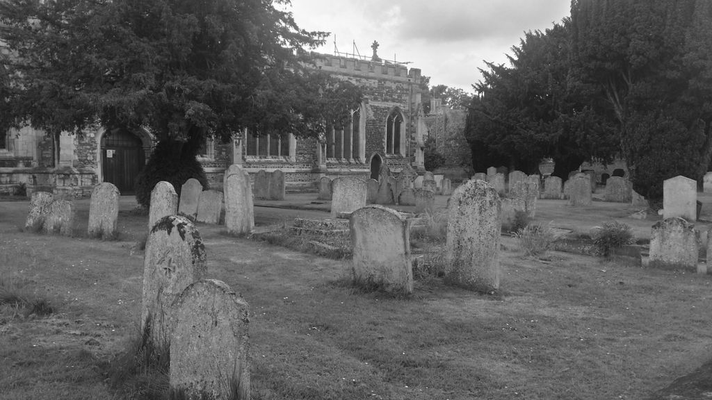
| Memorials | : | 0 |
| Location | : | St Neots, Huntingdonshire District, England |
| Coordinate | : | 52.2268700, -0.2671700 |
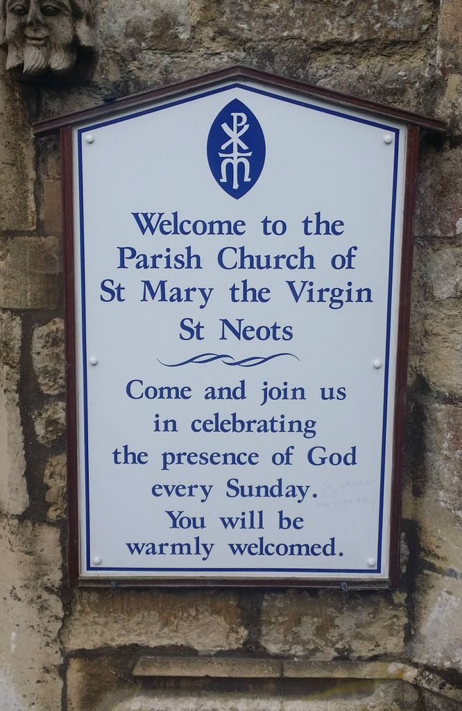
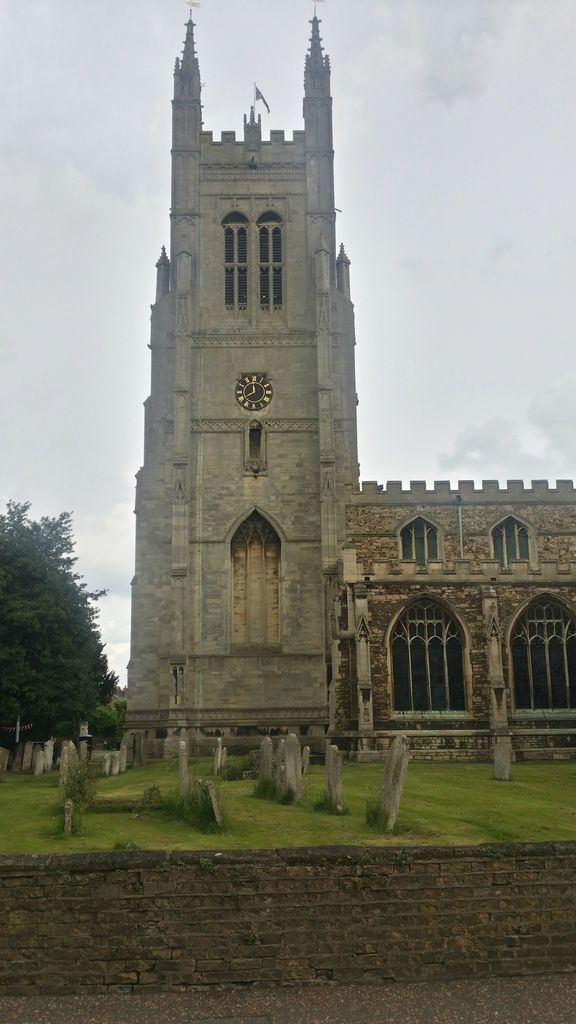
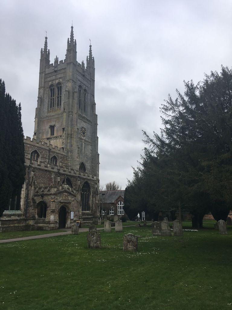
| Description | : | Described as one of the largest most uniform late mediaeval churches in the county. It is sometimes known as the cathedral of Huntingdonshire. The Church dates from the end of the twelfth century. |
frequently asked questions (FAQ):
-
Where is Parish Church of St. Mary the Virgin?
Parish Church of St. Mary the Virgin is located at Church Street St Neots, Huntingdonshire District ,Cambridgeshire , PE19 2BUEngland.
-
Parish Church of St. Mary the Virgin cemetery's updated grave count on graveviews.com?
0 memorials
-
Where are the coordinates of the Parish Church of St. Mary the Virgin?
Latitude: 52.2268700
Longitude: -0.2671700
Nearby Cemetories:
1. New Street Baptist Church St Neots
St Neots, Huntingdonshire District, England
Coordinate: 52.2290700, -0.2686400
2. St. Neots Cemetery
St Neots, Huntingdonshire District, England
Coordinate: 52.2253680, -0.2641010
3. St. Neots Priory
St Neots, Huntingdonshire District, England
Coordinate: 52.2281710, -0.2705280
4. Eynesbury Old Cemetery
Huntingdonshire District, England
Coordinate: 52.2243800, -0.2705300
5. St Mary Churchyard
Eaton Socon, Huntingdonshire District, England
Coordinate: 52.2156190, -0.2882830
6. St Nicholas Churchyard
Hail Weston, Huntingdonshire District, England
Coordinate: 52.2447100, -0.2945500
7. Little Paxton Cemetery
Little Paxton, Huntingdonshire District, England
Coordinate: 52.2548800, -0.2764600
8. St Deny's Churchyard
Little Barford, Bedford Borough, England
Coordinate: 52.1982210, -0.2785350
9. St Leonard Churchyard
Southoe, Huntingdonshire District, England
Coordinate: 52.2654070, -0.2679460
10. Holy Trinity Churchyard
Great Paxton, Huntingdonshire District, England
Coordinate: 52.2620300, -0.2291600
11. St. Lawrence's Churchyard
Diddington, Huntingdonshire District, England
Coordinate: 52.2784800, -0.2578000
12. St. Mary Magdalene Churchyard
Roxton, Bedford Borough, England
Coordinate: 52.1769310, -0.3146280
13. St. James Churchyard
Croxton, South Cambridgeshire District, England
Coordinate: 52.2174280, -0.1688510
14. Bushmead Priory
Bushmead, Bedford Borough, England
Coordinate: 52.2336110, -0.3675000
15. St Peter's Churchyard
Offord d'Arcy, Huntingdonshire District, England
Coordinate: 52.2824000, -0.2178000
16. Lucks Lane Cemetery
Buckden, Huntingdonshire District, England
Coordinate: 52.2910048, -0.2530740
17. St Andrew Churchyard
Great Staughton, Huntingdonshire District, England
Coordinate: 52.2691765, -0.3504967
18. Tempsford Village Cemetery
Tempsford, Central Bedfordshire Unitary Authority, England
Coordinate: 52.1639000, -0.3024500
19. St Mary's Churchyard
Buckden, Huntingdonshire District, England
Coordinate: 52.2941000, -0.2526000
20. St Botolph Churchyard
Graveley, South Cambridgeshire District, England
Coordinate: 52.2605200, -0.1701700
21. Old Cemetery
Great Staughton, Huntingdonshire District, England
Coordinate: 52.2694189, -0.3546817
22. St. Andrew's Church Cemetery
Great Staughton, Huntingdonshire District, England
Coordinate: 52.2677700, -0.3573400
23. All Saints Churchyard
Offord Cluny, Huntingdonshire District, England
Coordinate: 52.2878400, -0.2144120
24. St. Denys Churchyard
Colmworth, Bedford Borough, England
Coordinate: 52.2143200, -0.3785620