
| Memorials | : | 29 |
| Location | : | Buckland, Franklin County, USA |
| Coordinate | : | 42.5926950, -72.7898960 |
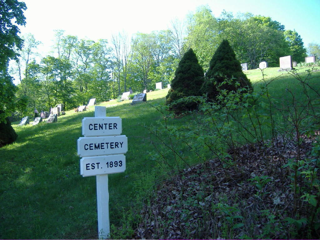
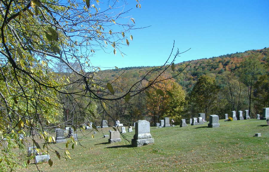
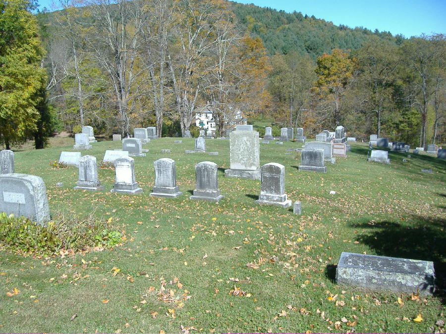
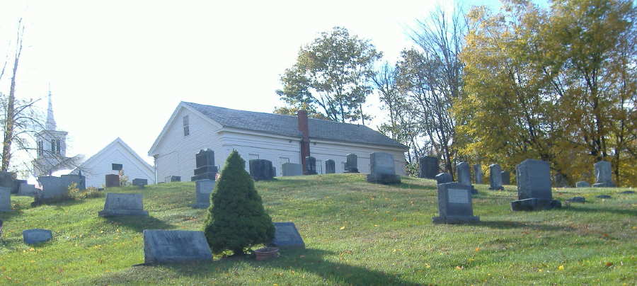
| Description | : | Often referred to as "Center Cemetery" or "New Cemetery" or "Buckland Cemetery." Often confused with Old Cemetery Number One. Often confused with Taylor Cemetery/Number Two. Located on a hillside on the north and east side of a building known as The Buckland Public Hall, formerly the hall of agricultural organization Grange No. 87, now an annex of the First Congregational Church of Buckland (commonly known as the Mary Lyon Church). The rows run in a east/west direction with the stones facing north/south. Access is from the north west corner off Upper Street, where the sign is located, or from the Public... Read More |
frequently asked questions (FAQ):
-
Where is Center Cemetery #03?
Center Cemetery #03 is located at Upper Street Buckland, Franklin County ,Massachusetts , 01338USA.
-
Center Cemetery #03 cemetery's updated grave count on graveviews.com?
29 memorials
-
Where are the coordinates of the Center Cemetery #03?
Latitude: 42.5926950
Longitude: -72.7898960
Nearby Cemetories:
1. Old Cemetery #01
Buckland, Franklin County, USA
Coordinate: 42.5918580, -72.7906890
2. Trow Cemetery #04
Buckland, Franklin County, USA
Coordinate: 42.5932800, -72.7915000
3. Taylor Cemetery #02
Buckland, Franklin County, USA
Coordinate: 42.5932808, -72.7915039
4. Old East Buckland Cemetery
Buckland, Franklin County, USA
Coordinate: 42.5969400, -72.7677900
5. East Buckland Cemetery
Buckland, Franklin County, USA
Coordinate: 42.5962500, -72.7610600
6. East Charlemont Cemetery
Charlemont, Franklin County, USA
Coordinate: 42.6197853, -72.7932739
7. Upper City Cemetery
Buckland, Franklin County, USA
Coordinate: 42.5832640, -72.8355360
8. Leavitt Cemetery
Charlemont, Franklin County, USA
Coordinate: 42.6175003, -72.8332977
9. Old Cemetery #01
Buckland, Franklin County, USA
Coordinate: 42.6175731, -72.8341600
10. Northwest Cemetery
Ashfield, Franklin County, USA
Coordinate: 42.5587500, -72.8250500
11. Old Cemetery
Charlemont, Franklin County, USA
Coordinate: 42.6213111, -72.8333681
12. Baptist Corner Cemetery
Ashfield, Franklin County, USA
Coordinate: 42.5540771, -72.7639313
13. Arms Cemetery
Shelburne Falls, Franklin County, USA
Coordinate: 42.6166992, -72.7332993
14. North Shirkshire Cemetery
Conway, Franklin County, USA
Coordinate: 42.5689011, -72.7210999
15. Beldingville Cemetery
Ashfield, Franklin County, USA
Coordinate: 42.5365562, -72.7638016
16. Doane Cemetery
Hawley, Franklin County, USA
Coordinate: 42.5844002, -72.8739014
17. Plain Cemetery
Ashfield, Franklin County, USA
Coordinate: 42.5292015, -72.7889023
18. Saint John's Church
Ashfield, Franklin County, USA
Coordinate: 42.5258600, -72.7894260
19. South Cemetery
Heath, Franklin County, USA
Coordinate: 42.6542015, -72.8321991
20. Shelburne Center Cemetery
Shelburne, Franklin County, USA
Coordinate: 42.5830000, -72.6969600
21. Village Cemetery
Charlemont, Franklin County, USA
Coordinate: 42.6274185, -72.8711929
22. East Hawley Cemetery
Hawley, Franklin County, USA
Coordinate: 42.5621071, -72.8768005
23. Hill Cemetery
Ashfield, Franklin County, USA
Coordinate: 42.5208015, -72.7992020
24. Bozrah Cemetery
Hawley, Franklin County, USA
Coordinate: 42.6097679, -72.8877258