
| Memorials | : | 11 |
| Location | : | Buckland, Franklin County, USA |
| Coordinate | : | 42.5832640, -72.8355360 |
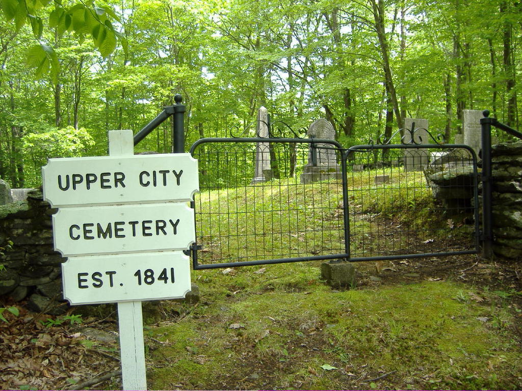
| Description | : | "G.R.5 - Buckland Upper City" in the Mass. Vital Records to 1850 [tan books] Deeded in 1841. Cemetery Road is an abandoned, narrow, dirt way, located off Clesson Brook Road (formerly known as Hawley Rd), approximately 2 miles west of Route 112. From pg 78 of Kendrick's History of Buckland: "A small burying ground in the Upper City is located on an old road to Apple Valley. By a deed…it is evident that in 1841 thirty square rods of land were purchased from Asa Davis, for the sum of ten dollars. This was deeded to those who held lots…It is the... Read More |
frequently asked questions (FAQ):
-
Where is Upper City Cemetery?
Upper City Cemetery is located at Cemetery Road Buckland, Franklin County ,Massachusetts , 01338USA.
-
Upper City Cemetery cemetery's updated grave count on graveviews.com?
11 memorials
-
Where are the coordinates of the Upper City Cemetery?
Latitude: 42.5832640
Longitude: -72.8355360
Nearby Cemetories:
1. Northwest Cemetery
Ashfield, Franklin County, USA
Coordinate: 42.5587500, -72.8250500
2. Doane Cemetery
Hawley, Franklin County, USA
Coordinate: 42.5844002, -72.8739014
3. Taylor Cemetery #02
Buckland, Franklin County, USA
Coordinate: 42.5932808, -72.7915039
4. Trow Cemetery #04
Buckland, Franklin County, USA
Coordinate: 42.5932800, -72.7915000
5. Old Cemetery #01
Buckland, Franklin County, USA
Coordinate: 42.5918580, -72.7906890
6. Leavitt Cemetery
Charlemont, Franklin County, USA
Coordinate: 42.6175003, -72.8332977
7. Old Cemetery #01
Buckland, Franklin County, USA
Coordinate: 42.6175731, -72.8341600
8. Center Cemetery #03
Buckland, Franklin County, USA
Coordinate: 42.5926950, -72.7898960
9. East Hawley Cemetery
Hawley, Franklin County, USA
Coordinate: 42.5621071, -72.8768005
10. Old Cemetery
Charlemont, Franklin County, USA
Coordinate: 42.6213111, -72.8333681
11. Bozrah Cemetery
Hawley, Franklin County, USA
Coordinate: 42.6097679, -72.8877258
12. East Charlemont Cemetery
Charlemont, Franklin County, USA
Coordinate: 42.6197853, -72.7932739
13. Village Cemetery
Charlemont, Franklin County, USA
Coordinate: 42.6274185, -72.8711929
14. Old East Buckland Cemetery
Buckland, Franklin County, USA
Coordinate: 42.5969400, -72.7677900
15. East Buckland Cemetery
Buckland, Franklin County, USA
Coordinate: 42.5962500, -72.7610600
16. Moses Rice Family Cemetery
Charlemont, Franklin County, USA
Coordinate: 42.6279040, -72.8829570
17. Baptist Corner Cemetery
Ashfield, Franklin County, USA
Coordinate: 42.5540771, -72.7639313
18. Pudding Hollow Cemetery
Hawley, Franklin County, USA
Coordinate: 42.6002998, -72.9145966
19. South Hawley Cemetery
Hawley, Franklin County, USA
Coordinate: 42.5654678, -72.9142838
20. North Street Cemetery
Plainfield, Hampshire County, USA
Coordinate: 42.5390700, -72.8969900
21. Plain Cemetery
Ashfield, Franklin County, USA
Coordinate: 42.5292015, -72.7889023
22. Saint John's Church
Ashfield, Franklin County, USA
Coordinate: 42.5258600, -72.7894260
23. Hill Cemetery
Ashfield, Franklin County, USA
Coordinate: 42.5208015, -72.7992020
24. Beldingville Cemetery
Ashfield, Franklin County, USA
Coordinate: 42.5365562, -72.7638016