| Memorials | : | 8 |
| Location | : | Ashfield, Franklin County, USA |
| Coordinate | : | 42.5208015, -72.7992020 |
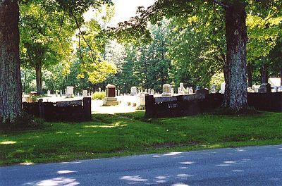
| Description | : | The cemetery on the hill or “Flat” was laid out in 1813 on land bought of Dr. Enos Smith. Its north line was about three rods south of the meeting house which was being built that year. After the removal of the church in 1856, the cemetery was enlarged. There are three entrances from Norton Hill Road through the north stone wall. When the ownership of this cemetery was transferred from the “inhabitants of the town of Ashfield” to the Ashfield Burial Ground Association in 1890 it was called the “Center Cemetery,” because it was “near the geographical center of... Read More |
frequently asked questions (FAQ):
-
Where is Hill Cemetery?
Hill Cemetery is located at Norton Hill Road Ashfield, Franklin County ,Massachusetts ,USA.
-
Hill Cemetery cemetery's updated grave count on graveviews.com?
7 memorials
-
Where are the coordinates of the Hill Cemetery?
Latitude: 42.5208015
Longitude: -72.7992020
Nearby Cemetories:
1. Saint John's Church
Ashfield, Franklin County, USA
Coordinate: 42.5258600, -72.7894260
2. Plain Cemetery
Ashfield, Franklin County, USA
Coordinate: 42.5292015, -72.7889023
3. South Ashfield Cemetery
Ashfield, Franklin County, USA
Coordinate: 42.5077209, -72.7730026
4. Beldingville Cemetery
Ashfield, Franklin County, USA
Coordinate: 42.5365562, -72.7638016
5. Spruce Corner Cemetery
Ashfield, Franklin County, USA
Coordinate: 42.5026817, -72.8481293
6. Baptist Corner Cemetery
Ashfield, Franklin County, USA
Coordinate: 42.5540771, -72.7639313
7. Northwest Cemetery
Ashfield, Franklin County, USA
Coordinate: 42.5587500, -72.8250500
8. Briar Hill Cemetery
Ashfield, Franklin County, USA
Coordinate: 42.4742600, -72.7798300
9. East Street Cemetery
Plainfield, Hampshire County, USA
Coordinate: 42.5136600, -72.8780700
10. Southwest Cemetery
Conway, Franklin County, USA
Coordinate: 42.4660280, -72.7458610
11. Upper City Cemetery
Buckland, Franklin County, USA
Coordinate: 42.5832640, -72.8355360
12. Maynard Cemetery
Conway, Franklin County, USA
Coordinate: 42.4836630, -72.7195800
13. East Hawley Cemetery
Hawley, Franklin County, USA
Coordinate: 42.5621071, -72.8768005
14. Old Cemetery #01
Buckland, Franklin County, USA
Coordinate: 42.5918580, -72.7906890
15. Center Cemetery #03
Buckland, Franklin County, USA
Coordinate: 42.5926950, -72.7898960
16. Goshen Center Cemetery
Goshen, Hampshire County, USA
Coordinate: 42.4483280, -72.8049800
17. Trow Cemetery #04
Buckland, Franklin County, USA
Coordinate: 42.5932800, -72.7915000
18. Taylor Cemetery #02
Buckland, Franklin County, USA
Coordinate: 42.5932808, -72.7915039
19. North Street Cemetery
Plainfield, Hampshire County, USA
Coordinate: 42.5390700, -72.8969900
20. Pleasant Street Cemetery
Plainfield, Hampshire County, USA
Coordinate: 42.5018890, -72.8968620
21. North Shirkshire Cemetery
Conway, Franklin County, USA
Coordinate: 42.5689011, -72.7210999
22. Shaw Cemetery
Cummington, Hampshire County, USA
Coordinate: 42.4591110, -72.8583330
23. Howland Cemetery
Conway, Franklin County, USA
Coordinate: 42.5127983, -72.6967010
24. Harlow Cemetery
Cummington, Hampshire County, USA
Coordinate: 42.4688000, -72.8752200

