
| Memorials | : | 3 |
| Location | : | Ashfield, Franklin County, USA |
| Coordinate | : | 42.5587500, -72.8250500 |
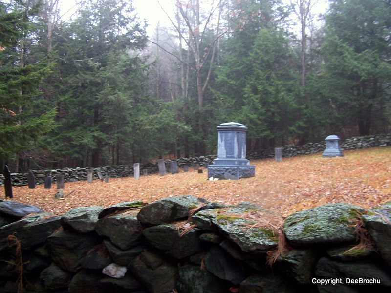
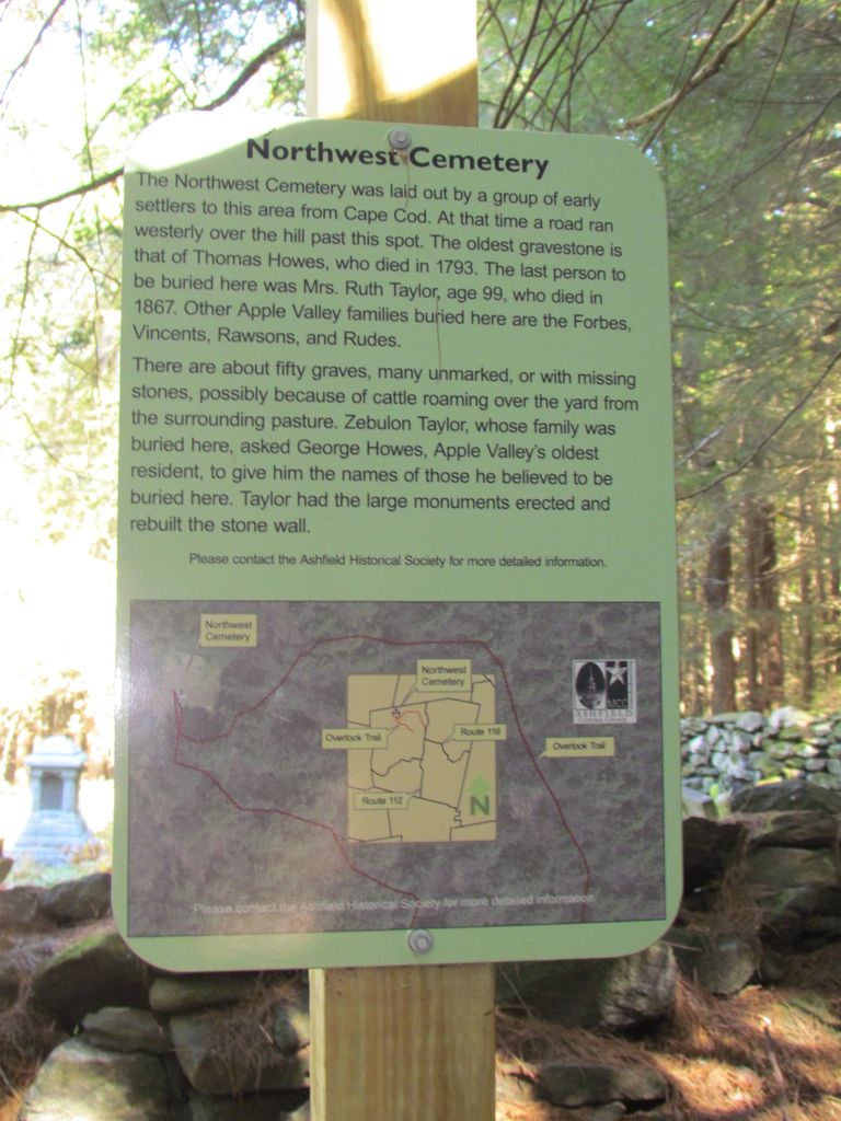
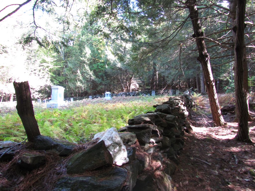
| Description | : | The Northwest Cemetery is located in a lonely spot on Pumpkin HIll in a pasture in the northwest part of the town, know as Apple Valley, in Ashfield, Ma,. Franklin County. The cemetery is owned by Ashfield Burial Association with right of way access. The cemetery was laid out before 1800 and at that time, there was a road running over the hill westerly directly past this spot. The monument was erected in the early 1900's with the engraved names of those who were know to be buried there at that time. The first burial was Thomas Howes... Read More |
frequently asked questions (FAQ):
-
Where is Northwest Cemetery?
Northwest Cemetery is located at Apple Valley Road Ashfield, Franklin County ,Massachusetts , 01330USA.
-
Northwest Cemetery cemetery's updated grave count on graveviews.com?
3 memorials
-
Where are the coordinates of the Northwest Cemetery?
Latitude: 42.5587500
Longitude: -72.8250500
Nearby Cemetories:
1. Upper City Cemetery
Buckland, Franklin County, USA
Coordinate: 42.5832640, -72.8355360
2. East Hawley Cemetery
Hawley, Franklin County, USA
Coordinate: 42.5621071, -72.8768005
3. Plain Cemetery
Ashfield, Franklin County, USA
Coordinate: 42.5292015, -72.7889023
4. Old Cemetery #01
Buckland, Franklin County, USA
Coordinate: 42.5918580, -72.7906890
5. Saint John's Church
Ashfield, Franklin County, USA
Coordinate: 42.5258600, -72.7894260
6. Taylor Cemetery #02
Buckland, Franklin County, USA
Coordinate: 42.5932808, -72.7915039
7. Trow Cemetery #04
Buckland, Franklin County, USA
Coordinate: 42.5932800, -72.7915000
8. Hill Cemetery
Ashfield, Franklin County, USA
Coordinate: 42.5208015, -72.7992020
9. Center Cemetery #03
Buckland, Franklin County, USA
Coordinate: 42.5926950, -72.7898960
10. Doane Cemetery
Hawley, Franklin County, USA
Coordinate: 42.5844002, -72.8739014
11. Baptist Corner Cemetery
Ashfield, Franklin County, USA
Coordinate: 42.5540771, -72.7639313
12. Beldingville Cemetery
Ashfield, Franklin County, USA
Coordinate: 42.5365562, -72.7638016
13. North Street Cemetery
Plainfield, Hampshire County, USA
Coordinate: 42.5390700, -72.8969900
14. Old East Buckland Cemetery
Buckland, Franklin County, USA
Coordinate: 42.5969400, -72.7677900
15. Spruce Corner Cemetery
Ashfield, Franklin County, USA
Coordinate: 42.5026817, -72.8481293
16. Leavitt Cemetery
Charlemont, Franklin County, USA
Coordinate: 42.6175003, -72.8332977
17. Old Cemetery #01
Buckland, Franklin County, USA
Coordinate: 42.6175731, -72.8341600
18. East Street Cemetery
Plainfield, Hampshire County, USA
Coordinate: 42.5136600, -72.8780700
19. East Buckland Cemetery
Buckland, Franklin County, USA
Coordinate: 42.5962500, -72.7610600
20. Old Cemetery
Charlemont, Franklin County, USA
Coordinate: 42.6213111, -72.8333681
21. South Ashfield Cemetery
Ashfield, Franklin County, USA
Coordinate: 42.5077209, -72.7730026
22. East Charlemont Cemetery
Charlemont, Franklin County, USA
Coordinate: 42.6197853, -72.7932739
23. South Hawley Cemetery
Hawley, Franklin County, USA
Coordinate: 42.5654678, -72.9142838
24. Bozrah Cemetery
Hawley, Franklin County, USA
Coordinate: 42.6097679, -72.8877258