
| Memorials | : | 112 |
| Location | : | Ashfield, Franklin County, USA |
| Coordinate | : | 42.5292015, -72.7889023 |
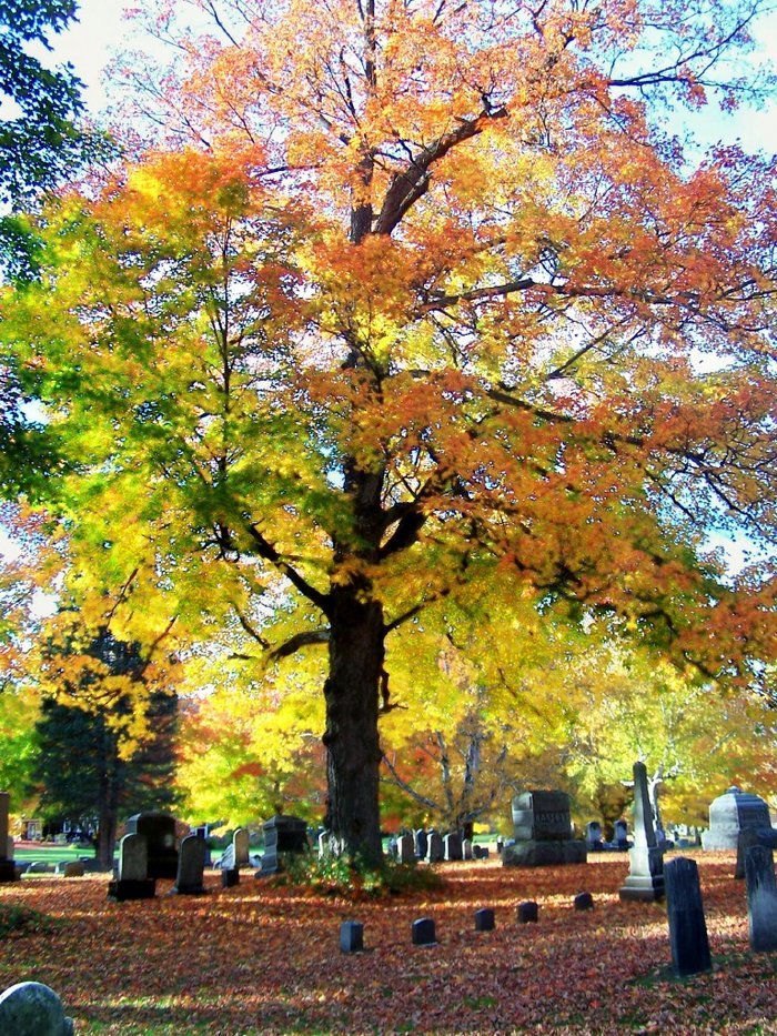
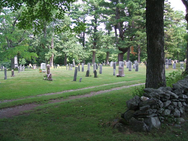
| Description | : | Also known as Ashfield Cemetery and Center Cemetery. Often confused with Baptist Corner Cemetery because of Plain's location on Baptist Corner Road. Located on the site of the First Congregational Church which was built here in 1768. Came under the ownership of the Ashfield Burial Ground Association [ABGA] in 1890. Additional partials of land were added over the years from various owners. [from Ashfield Historical Society research] This cemetery is referred to as G.R.8 in the Vital Records Of Ashfield Massachusetts To The Year 1850 Published By The New England Historic Genealogical Society |
frequently asked questions (FAQ):
-
Where is Plain Cemetery?
Plain Cemetery is located at Baptist Corner Road Ashfield, Franklin County ,Massachusetts ,USA.
-
Plain Cemetery cemetery's updated grave count on graveviews.com?
112 memorials
-
Where are the coordinates of the Plain Cemetery?
Latitude: 42.5292015
Longitude: -72.7889023
Nearby Cemetories:
1. Saint John's Church
Ashfield, Franklin County, USA
Coordinate: 42.5258600, -72.7894260
2. Hill Cemetery
Ashfield, Franklin County, USA
Coordinate: 42.5208015, -72.7992020
3. Beldingville Cemetery
Ashfield, Franklin County, USA
Coordinate: 42.5365562, -72.7638016
4. South Ashfield Cemetery
Ashfield, Franklin County, USA
Coordinate: 42.5077209, -72.7730026
5. Baptist Corner Cemetery
Ashfield, Franklin County, USA
Coordinate: 42.5540771, -72.7639313
6. Northwest Cemetery
Ashfield, Franklin County, USA
Coordinate: 42.5587500, -72.8250500
7. Spruce Corner Cemetery
Ashfield, Franklin County, USA
Coordinate: 42.5026817, -72.8481293
8. Briar Hill Cemetery
Ashfield, Franklin County, USA
Coordinate: 42.4742600, -72.7798300
9. Old Cemetery #01
Buckland, Franklin County, USA
Coordinate: 42.5918580, -72.7906890
10. Center Cemetery #03
Buckland, Franklin County, USA
Coordinate: 42.5926950, -72.7898960
11. North Shirkshire Cemetery
Conway, Franklin County, USA
Coordinate: 42.5689011, -72.7210999
12. Upper City Cemetery
Buckland, Franklin County, USA
Coordinate: 42.5832640, -72.8355360
13. Trow Cemetery #04
Buckland, Franklin County, USA
Coordinate: 42.5932800, -72.7915000
14. Taylor Cemetery #02
Buckland, Franklin County, USA
Coordinate: 42.5932808, -72.7915039
15. East Street Cemetery
Plainfield, Hampshire County, USA
Coordinate: 42.5136600, -72.8780700
16. Maynard Cemetery
Conway, Franklin County, USA
Coordinate: 42.4836630, -72.7195800
17. Old East Buckland Cemetery
Buckland, Franklin County, USA
Coordinate: 42.5969400, -72.7677900
18. Howland Cemetery
Conway, Franklin County, USA
Coordinate: 42.5127983, -72.6967010
19. East Buckland Cemetery
Buckland, Franklin County, USA
Coordinate: 42.5962500, -72.7610600
20. Southwest Cemetery
Conway, Franklin County, USA
Coordinate: 42.4660280, -72.7458610
21. Pine Grove Cemetery
Conway, Franklin County, USA
Coordinate: 42.5222015, -72.6908035
22. East Hawley Cemetery
Hawley, Franklin County, USA
Coordinate: 42.5621071, -72.8768005
23. South Centre Cemetery
Conway, Franklin County, USA
Coordinate: 42.5015940, -72.6973490
24. North Street Cemetery
Plainfield, Hampshire County, USA
Coordinate: 42.5390700, -72.8969900