| Memorials | : | 0 |
| Location | : | Darksville, Randolph County, USA |
| Coordinate | : | 39.5018380, -92.6006240 |
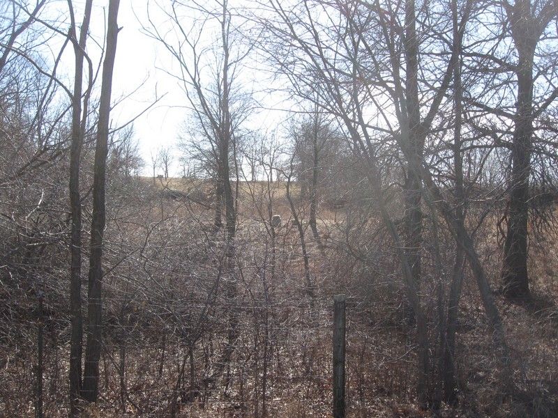
| Description | : | Located in T54 R15 S4 on the north side of Rt Z about 1.57 miles from its junction with Rt C and .13 miles north of Z. The single stone is just northeast of a pond (in January 2018). The stone has fallen off its base but is in very good condition. |
frequently asked questions (FAQ):
-
Where is Cleveland Cemetery?
Cleveland Cemetery is located at Darksville, Randolph County ,Missouri ,USA.
-
Cleveland Cemetery cemetery's updated grave count on graveviews.com?
0 memorials
-
Where are the coordinates of the Cleveland Cemetery?
Latitude: 39.5018380
Longitude: -92.6006240
Nearby Cemetories:
1. Martin Green Cemetery
Randolph County, USA
Coordinate: 39.4972340, -92.6369320
2. McCully-Haines Cemetery
Randolph County, USA
Coordinate: 39.5080870, -92.6410220
3. Terry Cemetery
Huntsville, Randolph County, USA
Coordinate: 39.4985470, -92.5585630
4. Eldad Cumberland Presbyterian Cemetery
Randolph County, USA
Coordinate: 39.5380800, -92.6190800
5. Old Fort Henry Cemetery
Clifton Hill, Randolph County, USA
Coordinate: 39.4636990, -92.6114830
6. David Austin Cemetery
Huntsville, Randolph County, USA
Coordinate: 39.4737420, -92.5649930
7. Hickory Grove Cemetery
Randolph County, USA
Coordinate: 39.5402985, -92.5852966
8. New Fort Henry Cemetery
Fort Henry, Randolph County, USA
Coordinate: 39.4616500, -92.6164990
9. Mount Shiloh Baptist Church Cemetery
Darksville, Randolph County, USA
Coordinate: 39.5534360, -92.5814940
10. Darksville Cemetery
Darksville, Randolph County, USA
Coordinate: 39.5542700, -92.5814900
11. Mason-Payton Cemetery
Randolph County, USA
Coordinate: 39.5067770, -92.5215990
12. Summers Family Cemetery
Huntsville, Randolph County, USA
Coordinate: 39.5439036, -92.5413740
13. Little Union Primitive Baptist Church Cemetery
Randolph County, USA
Coordinate: 39.4528000, -92.5510280
14. Hall Family Cemetery
Darksville, Randolph County, USA
Coordinate: 39.5613890, -92.5769090
15. Phipps-Goodding Cemetery
Randolph County, USA
Coordinate: 39.4897420, -92.5200980
16. Broaddus Cemetery
Darksville, Randolph County, USA
Coordinate: 39.5655550, -92.5902770
17. Johnson Cemetery
Clifton Hill, Randolph County, USA
Coordinate: 39.4728012, -92.6841965
18. Huntsville City Cemetery
Huntsville, Randolph County, USA
Coordinate: 39.4440500, -92.5460000
19. Hardister Cemetery
Randolph County, USA
Coordinate: 39.4799210, -92.5116790
20. Boulware-Morehead Cemetery
Randolph County, USA
Coordinate: 39.4398600, -92.5504750
21. Klink-Lay Cemetery
Randolph County, USA
Coordinate: 39.4474120, -92.5345440
22. Mount Olivette Cemetery
Randolph County, USA
Coordinate: 39.4690780, -92.5131110
23. Barnhart Cemetery
Randolph County, USA
Coordinate: 39.5731010, -92.5671997
24. Henry Austin Cemetery
Huntsville, Randolph County, USA
Coordinate: 39.4365180, -92.5434960


