
| Memorials | : | 0 |
| Location | : | Cincinnati, Hamilton County, USA |
| Coordinate | : | 39.1082510, -84.5175720 |
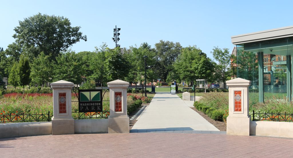
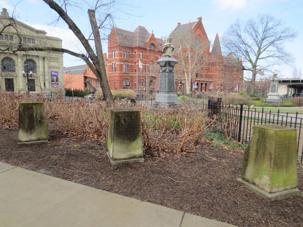
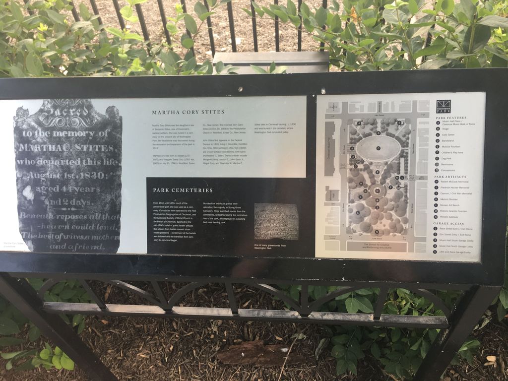
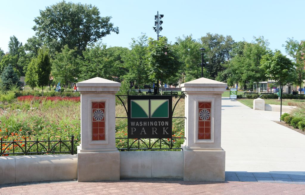
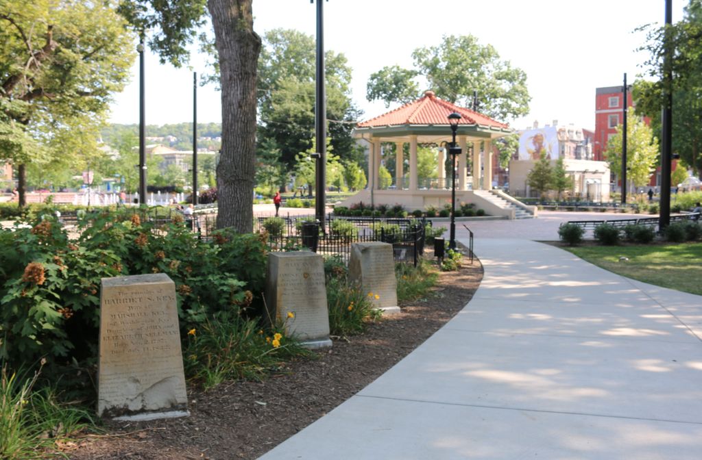
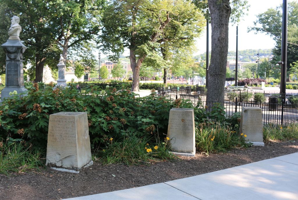
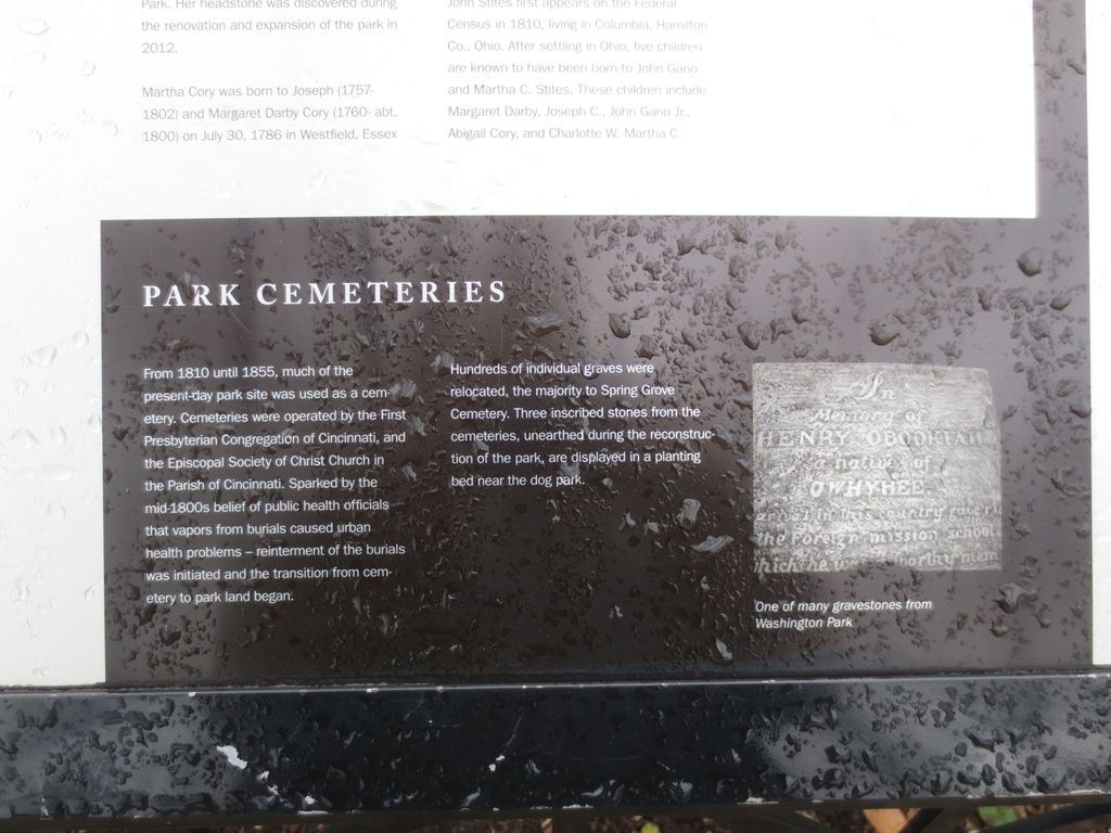
| Description | : | Washington Park exists today on the site that was once used as cemeteries operated by the First Presbyterian Congregation of Cincinnati and the Episcopal Society of Christ Church in the Parish of Cincinnati. The land was used for cemeteries from 1810 to 1855. In 1855, the city of Cincinnati acquired the land and converted it to a park. Most of the burials were relocated to other cemeteries, mainly Spring Grove Cemetery. During the renovation of the park in 2011, three inscribed stones were found and are now displayed in a planting bed near the dog park. The cemetery is located... Read More |
frequently asked questions (FAQ):
-
Where is Presbyterian Burying Ground?
Presbyterian Burying Ground is located at 12th Street and Elm Street Cincinnati, Hamilton County ,Ohio , 45202USA.
-
Presbyterian Burying Ground cemetery's updated grave count on graveviews.com?
0 memorials
-
Where are the coordinates of the Presbyterian Burying Ground?
Latitude: 39.1082510
Longitude: -84.5175720
Nearby Cemetories:
1. Potters Field
Cincinnati, Hamilton County, USA
Coordinate: 39.1094440, -84.5188890
2. Christ Episcopal Churchyard (Defunct)
Cincinnati, Hamilton County, USA
Coordinate: 39.1100520, -84.5177220
3. Thomas Williams Cemetery (Defunct)
Cincinnati, Hamilton County, USA
Coordinate: 39.1085060, -84.5146050
4. Chestnut Street Cemetery
Over-The-Rhine, Hamilton County, USA
Coordinate: 39.1071610, -84.5212210
5. Christ Church Cemetery
Over-The-Rhine, Hamilton County, USA
Coordinate: 39.1126480, -84.5157623
6. Enon Baptist Church Burying Ground (Defunct)
Cincinnati, Hamilton County, USA
Coordinate: 39.1065420, -84.5238110
7. Catherine Street Methodist Cemetery (Defunct)
Cincinnati, Hamilton County, USA
Coordinate: 39.1064840, -84.5243150
8. Catherine Street Burying Ground
Cincinnati, Hamilton County, USA
Coordinate: 39.1067490, -84.5252700
9. First Quaker Cemetery (Defunct)
Cincinnati, Hamilton County, USA
Coordinate: 39.1004360, -84.5201220
10. First Presbyterian Church Cemetery
Cincinnati, Hamilton County, USA
Coordinate: 39.1005310, -84.5102830
11. Wesleyan Chapel Methodist Church Cemetery
Cincinnati, Hamilton County, USA
Coordinate: 39.1022390, -84.5073540
12. Christ Church Cathedral Columbarium
Cincinnati, Hamilton County, USA
Coordinate: 39.1009690, -84.5073790
13. Second Quaker Cemetery (Defunct)
Cincinnati, Hamilton County, USA
Coordinate: 39.1153090, -84.5305240
14. Lincoln Park Potters Field (Defunct)
Cincinnati, Hamilton County, USA
Coordinate: 39.1097710, -84.5346450
15. McCrackin Gravesite
Cincinnati, Hamilton County, USA
Coordinate: 39.0964090, -84.5082230
16. Trinity Episcopal Church Memorial Garden
Covington, Kenton County, USA
Coordinate: 39.0873540, -84.5106140
17. Madison Street Burying Ground
Newport, Campbell County, USA
Coordinate: 39.0922790, -84.4948560
18. Craig Street Burying Ground
Covington, Kenton County, USA
Coordinate: 39.0840890, -84.5151330
19. Mother of God Church
Covington, Kenton County, USA
Coordinate: 39.0839600, -84.5125700
20. Old Newport Cemetery
Newport, Campbell County, USA
Coordinate: 39.0877100, -84.4940800
21. Methodist Protestant Cemetery (Defunct)
Cincinnati, Hamilton County, USA
Coordinate: 39.1324770, -84.4983160
22. Cathedral Basilica of the Assumption
Covington, Kenton County, USA
Coordinate: 39.0781120, -84.5081700
23. Hillside Chapel Crematory and Columbarium
Cincinnati, Hamilton County, USA
Coordinate: 39.1393509, -84.5247192
24. Montague Cemetery
Covington, Kenton County, USA
Coordinate: 39.0805560, -84.5380550