
| Memorials | : | 0 |
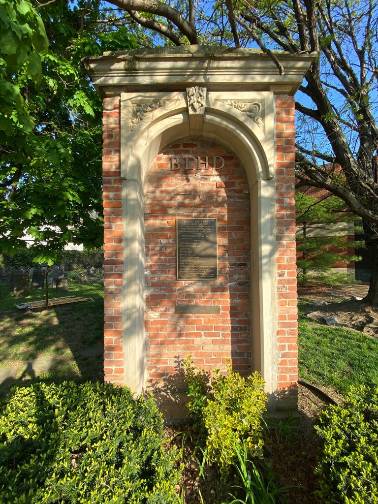
| Location | : | Over-The-Rhine, Hamilton County, USA |
| Phone | : | (513) 961-0178 |
| Website | : | www.jcemcin.org |
| Coordinate | : | 39.1071610, -84.5212210 |
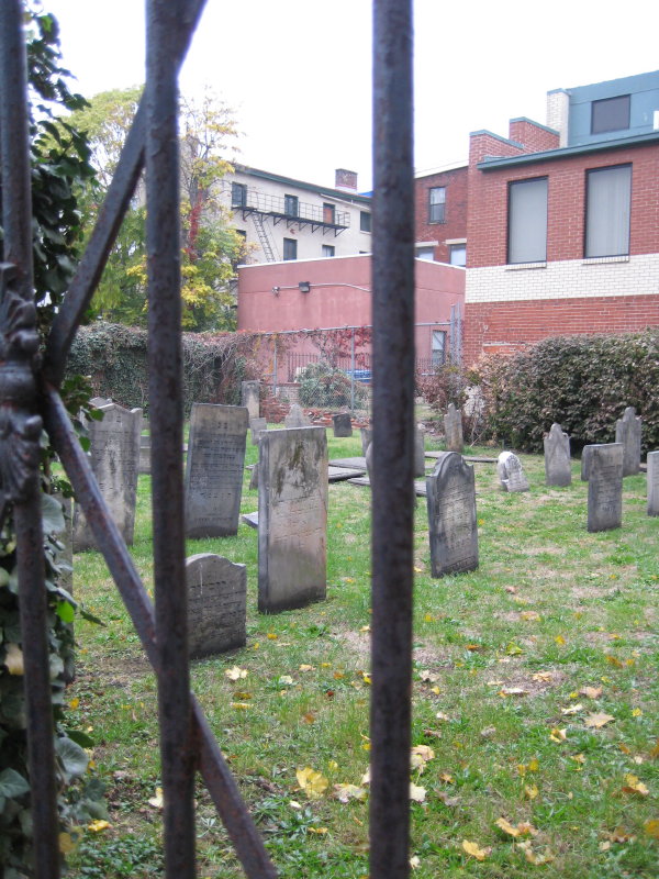
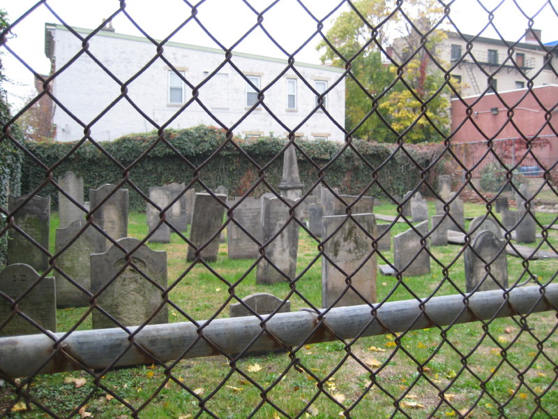
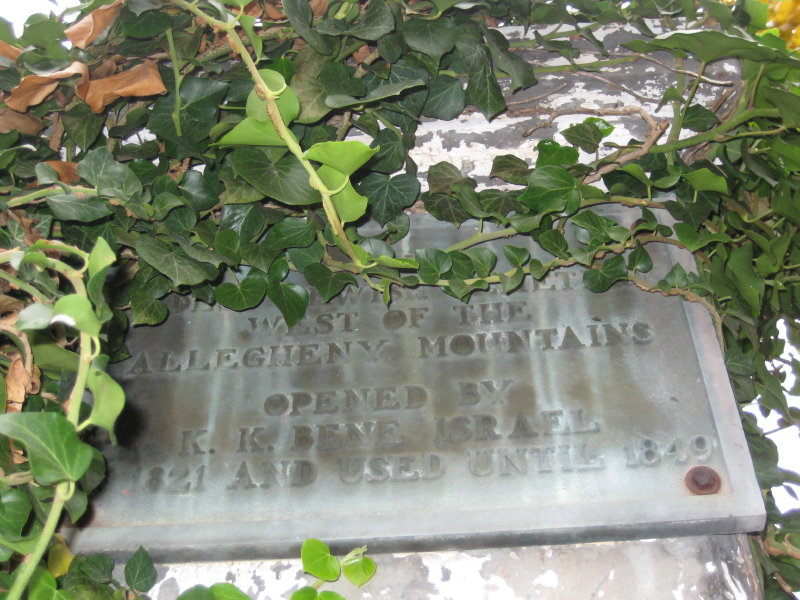
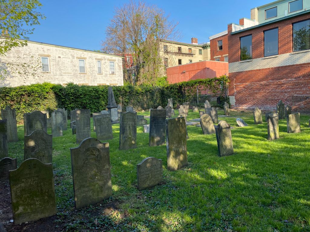
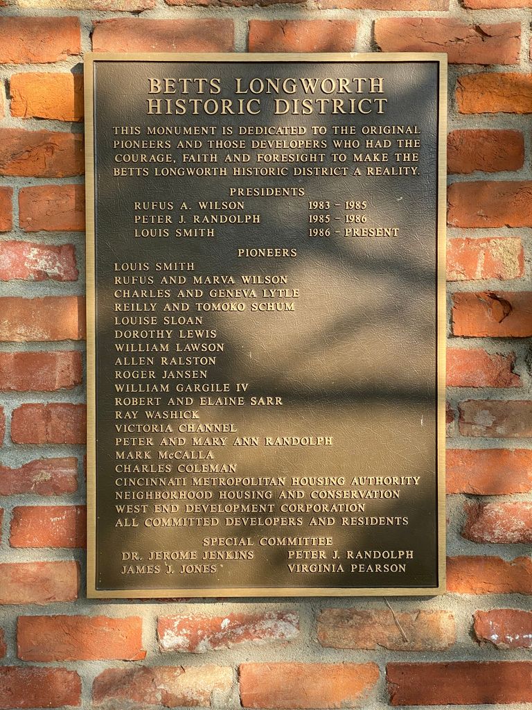
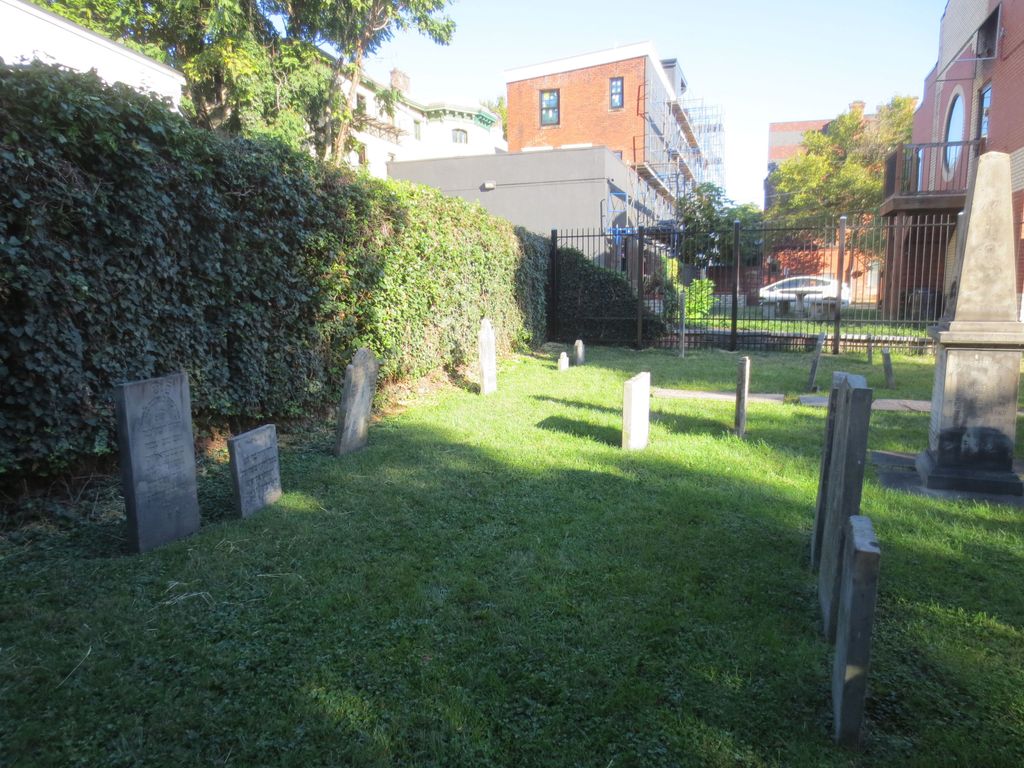
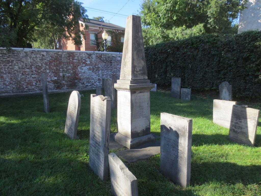
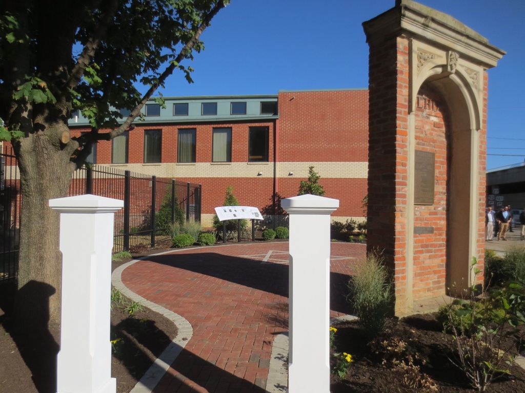
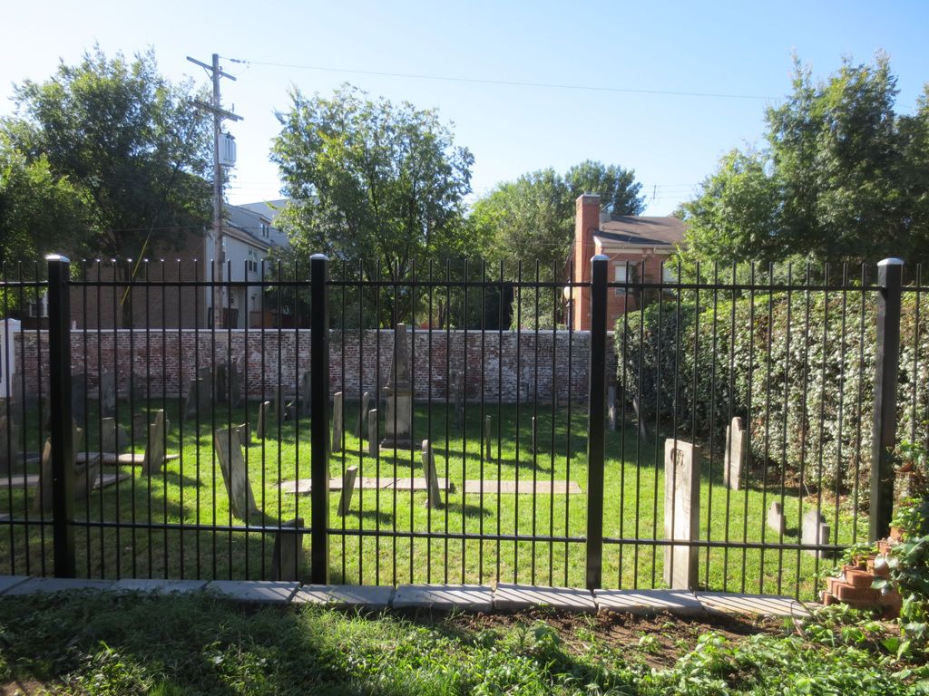
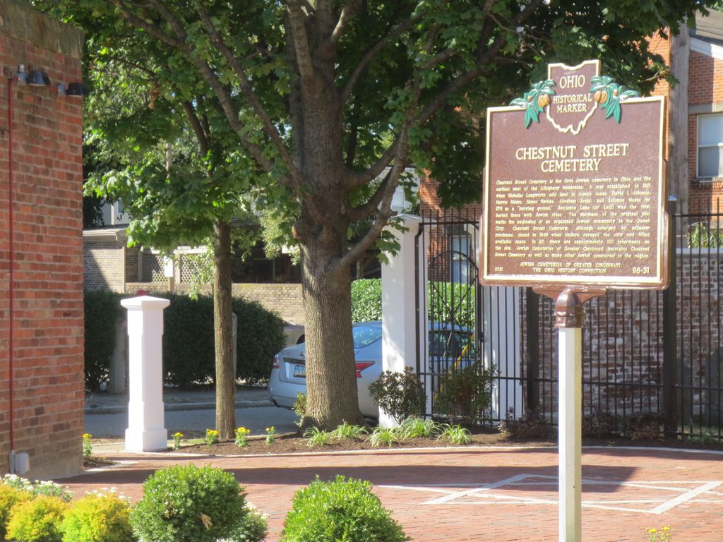
| Description | : | The Old Jewish Cemetery is located just west of Central Avenue on the on the north side of Chestnut Street, in the historic West End. The Cemetery is sited on a tiny plot enclosed by high walls and a locked gate. It was opened by K.K. Bene Israel in 1821 as a result of the Cholera Epidemic and closed in 1849. There are 85 burials total. It is the oldest Jewish Cemetery west of the Allegheny Mountains. The cemetery is now owned and maintained by: Jewish Cemeteries of Greater Cincinnati 3400 Montgomery Road Cincinnati, OH 45027 Phone: 513-961-0178 Fax: 513-961-2021 ... Read More |
frequently asked questions (FAQ):
-
Where is Chestnut Street Cemetery?
Chestnut Street Cemetery is located at Chestnut Street and Central Avenue Over-The-Rhine, Hamilton County ,Ohio , 45203USA.
-
Chestnut Street Cemetery cemetery's updated grave count on graveviews.com?
0 memorials
-
Where are the coordinates of the Chestnut Street Cemetery?
Latitude: 39.1071610
Longitude: -84.5212210
Nearby Cemetories:
1. Enon Baptist Church Burying Ground (Defunct)
Cincinnati, Hamilton County, USA
Coordinate: 39.1065420, -84.5238110
2. Catherine Street Methodist Cemetery (Defunct)
Cincinnati, Hamilton County, USA
Coordinate: 39.1064840, -84.5243150
3. Potters Field
Cincinnati, Hamilton County, USA
Coordinate: 39.1094440, -84.5188890
4. Presbyterian Burying Ground
Cincinnati, Hamilton County, USA
Coordinate: 39.1082510, -84.5175720
5. Catherine Street Burying Ground
Cincinnati, Hamilton County, USA
Coordinate: 39.1067490, -84.5252700
6. Christ Episcopal Churchyard (Defunct)
Cincinnati, Hamilton County, USA
Coordinate: 39.1100520, -84.5177220
7. Thomas Williams Cemetery (Defunct)
Cincinnati, Hamilton County, USA
Coordinate: 39.1085060, -84.5146050
8. First Quaker Cemetery (Defunct)
Cincinnati, Hamilton County, USA
Coordinate: 39.1004360, -84.5201220
9. Christ Church Cemetery
Over-The-Rhine, Hamilton County, USA
Coordinate: 39.1126480, -84.5157623
10. Lincoln Park Potters Field (Defunct)
Cincinnati, Hamilton County, USA
Coordinate: 39.1097710, -84.5346450
11. First Presbyterian Church Cemetery
Cincinnati, Hamilton County, USA
Coordinate: 39.1005310, -84.5102830
12. Second Quaker Cemetery (Defunct)
Cincinnati, Hamilton County, USA
Coordinate: 39.1153090, -84.5305240
13. Wesleyan Chapel Methodist Church Cemetery
Cincinnati, Hamilton County, USA
Coordinate: 39.1022390, -84.5073540
14. Christ Church Cathedral Columbarium
Cincinnati, Hamilton County, USA
Coordinate: 39.1009690, -84.5073790
15. McCrackin Gravesite
Cincinnati, Hamilton County, USA
Coordinate: 39.0964090, -84.5082230
16. Trinity Episcopal Church Memorial Garden
Covington, Kenton County, USA
Coordinate: 39.0873540, -84.5106140
17. Craig Street Burying Ground
Covington, Kenton County, USA
Coordinate: 39.0840890, -84.5151330
18. Mother of God Church
Covington, Kenton County, USA
Coordinate: 39.0839600, -84.5125700
19. Madison Street Burying Ground
Newport, Campbell County, USA
Coordinate: 39.0922790, -84.4948560
20. Old Newport Cemetery
Newport, Campbell County, USA
Coordinate: 39.0877100, -84.4940800
21. Montague Cemetery
Covington, Kenton County, USA
Coordinate: 39.0805560, -84.5380550
22. Cathedral Basilica of the Assumption
Covington, Kenton County, USA
Coordinate: 39.0781120, -84.5081700
23. Methodist Protestant Cemetery (Defunct)
Cincinnati, Hamilton County, USA
Coordinate: 39.1324770, -84.4983160
24. Hillside Chapel Crematory and Columbarium
Cincinnati, Hamilton County, USA
Coordinate: 39.1393509, -84.5247192