
| Memorials | : | 0 |
| Location | : | Callow End, Malvern Hills District, England |
| Coordinate | : | 52.1389670, -2.2398380 |
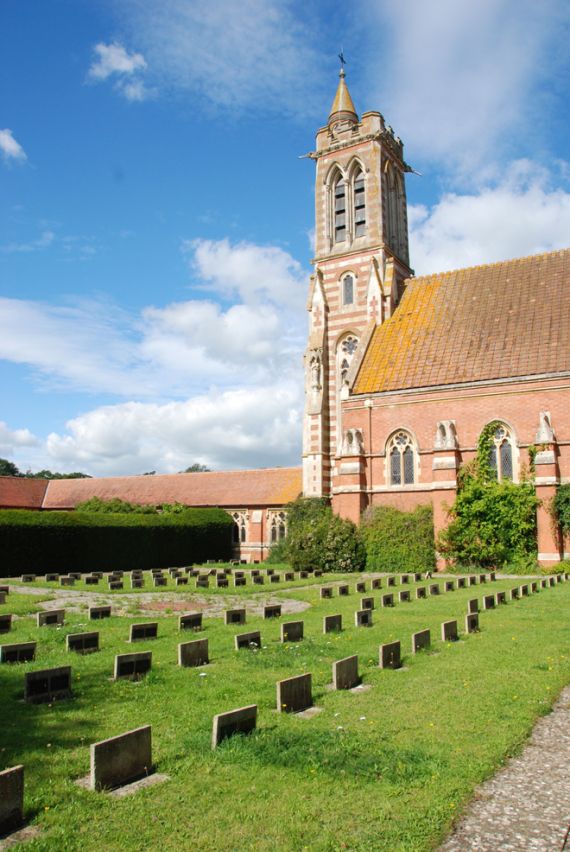
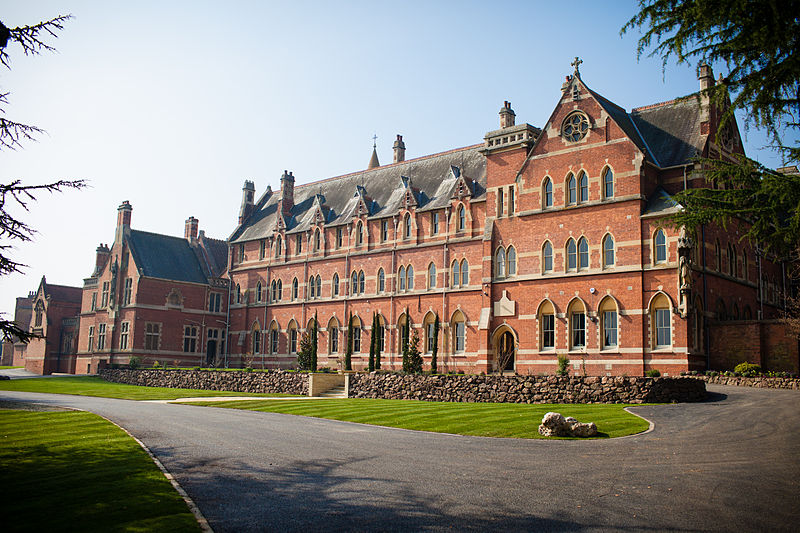
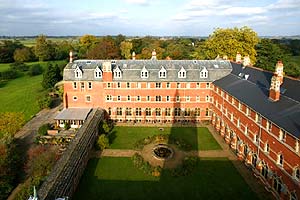
| Description | : | Stanbrook Abbey is an abbey originally built as a contemplative house for Benedictine nuns. It was founded in 1625 in Cambrai, Flanders, then part of the Spanish Netherlands, under the auspices of the English Benedictine Congregation. The English Benedictine Congregation have now re-located to Wass in the North York Moors National Park. The property is currently operational as an events venue, and is owned by Clarenco LLP. The chief foundress was 17-year-old Helen More, professed as Sister Gertrude More, who was great-great-granddaughter of St Thomas More; her father, Cresacre More, provided the original endowment for the foundation of the monastery. She... Read More |
frequently asked questions (FAQ):
-
Where is Stanbrook Abbey?
Stanbrook Abbey is located at Callow End, Malvern Hills District ,Worcestershire ,England.
-
Stanbrook Abbey cemetery's updated grave count on graveviews.com?
0 memorials
-
Where are the coordinates of the Stanbrook Abbey?
Latitude: 52.1389670
Longitude: -2.2398380
Nearby Cemetories:
1. St. Mary the Virgin Churchyard
Kempsey, Malvern Hills District, England
Coordinate: 52.1396580, -2.2231290
2. Worcester County Pauper and Lunatic Asylum Cemetery
Powick, Malvern Hills District, England
Coordinate: 52.1530276, -2.2599550
3. St Peter's Church Burial Ground
Powick, Malvern Hills District, England
Coordinate: 52.1613890, -2.2432490
4. St Mary the Virgin Churchyard
Madresfield, Malvern Hills District, England
Coordinate: 52.1252800, -2.2864800
5. Newland Cemetery
Newland, Malvern Hills District, England
Coordinate: 52.1342764, -2.2988052
6. St. Mary's Churchyard
Guarlford, Malvern Hills District, England
Coordinate: 52.1061887, -2.2738220
7. St. James the Great Churchyard
Norton, Wychavon District, England
Coordinate: 52.1586493, -2.1795272
8. Convent of the Holy Name, Chapel and Cloister
Malvern Link, Malvern Hills District, England
Coordinate: 52.1304500, -2.3068900
9. St. John the Baptist Churchyard
Bransford, Malvern Hills District, England
Coordinate: 52.1616486, -2.2981676
10. St. Peter's Churchyard
Pirton, Wychavon District, England
Coordinate: 52.1196530, -2.1687410
11. St. Deny's Chyrchyard
Severn Stoke, Malvern Hills District, England
Coordinate: 52.0940600, -2.2116400
12. St. Matthias Churchyard
Malvern Link, Malvern Hills District, England
Coordinate: 52.1290490, -2.3178900
13. St Johns Bedwardine
Worcester, City of Worcester, England
Coordinate: 52.1882200, -2.2352000
14. St. Philip and James Churchyard
Whittington, Wychavon District, England
Coordinate: 52.1741600, -2.1821800
15. Saint John's Cemetery
Worcester, City of Worcester, England
Coordinate: 52.1894670, -2.2436270
16. St. Peter the Great Churchyard
Worcester, City of Worcester, England
Coordinate: 52.1878260, -2.2185430
17. Worcester Cathedral
Worcester, City of Worcester, England
Coordinate: 52.1887270, -2.2208070
18. St. Clement's Churchyard
Worcester, City of Worcester, England
Coordinate: 52.1906579, -2.2341371
19. Great Malvern Cemetery
Great Malvern, Malvern Hills District, England
Coordinate: 52.1133010, -2.3135120
20. St Helen's Church
Worcester, City of Worcester, England
Coordinate: 52.1903000, -2.2209900
21. Saint Alban Church
Worcester, City of Worcester, England
Coordinate: 52.1904262, -2.2218995
22. Our Lady & St Alphonsus Catholic Churchyard
Hanley Swan, Malvern Hills District, England
Coordinate: 52.0907960, -2.2753160
23. Greyfriars
Worcester, City of Worcester, England
Coordinate: 52.1905400, -2.2187800
24. Saint Andrew Churchyard
Worcester, City of Worcester, England
Coordinate: 52.1911300, -2.2224300