| Memorials | : | 0 |
| Location | : | Newland, Malvern Hills District, England |
| Coordinate | : | 52.1342764, -2.2988052 |
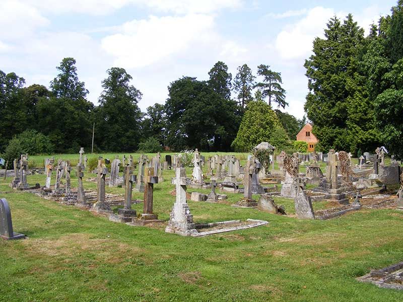
| Description | : | The small rural burial ground at Newland lies east of St Leonards church and the Beauchamp Community almshouses. It is approached by a footpath running down the east side of the modern housing development known as Pyndar Court. The burial ground was created on the site of the old wooden church, and adjoining land given by Lord Beauchamp, and consecrated on 22nd October 1862 by the Bishop of Worcester. |
frequently asked questions (FAQ):
-
Where is Newland Cemetery?
Newland Cemetery is located at Newland, Malvern Link, Worcestershire, England Newland, Malvern Hills District ,Worcestershire , WR13 4AXEngland.
-
Newland Cemetery cemetery's updated grave count on graveviews.com?
0 memorials
-
Where are the coordinates of the Newland Cemetery?
Latitude: 52.1342764
Longitude: -2.2988052
Nearby Cemetories:
1. Convent of the Holy Name, Chapel and Cloister
Malvern Link, Malvern Hills District, England
Coordinate: 52.1304500, -2.3068900
2. St Mary the Virgin Churchyard
Madresfield, Malvern Hills District, England
Coordinate: 52.1252800, -2.2864800
3. St. Matthias Churchyard
Malvern Link, Malvern Hills District, England
Coordinate: 52.1290490, -2.3178900
4. Great Malvern Cemetery
Great Malvern, Malvern Hills District, England
Coordinate: 52.1133010, -2.3135120
5. St James Churchyard
Great Malvern, Malvern Hills District, England
Coordinate: 52.1197650, -2.3316900
6. St. Peter's Churchyard
Malvern Link, Malvern Hills District, England
Coordinate: 52.1259530, -2.3380280
7. St. John the Baptist Churchyard
Bransford, Malvern Hills District, England
Coordinate: 52.1616486, -2.2981676
8. Great Malvern Priory Churchyard
Great Malvern, Malvern Hills District, England
Coordinate: 52.1106750, -2.3284660
9. Worcester County Pauper and Lunatic Asylum Cemetery
Powick, Malvern Hills District, England
Coordinate: 52.1530276, -2.2599550
10. St. Mary's Churchyard
Guarlford, Malvern Hills District, England
Coordinate: 52.1061887, -2.2738220
11. Stanbrook Abbey
Callow End, Malvern Hills District, England
Coordinate: 52.1389670, -2.2398380
12. St. James's Churchyard
West Malvern, Malvern Hills District, England
Coordinate: 52.1127220, -2.3469830
13. St Peter's Church Burial Ground
Powick, Malvern Hills District, England
Coordinate: 52.1613890, -2.2432490
14. Our Lady & St Alphonsus Catholic Churchyard
Hanley Swan, Malvern Hills District, England
Coordinate: 52.0907960, -2.2753160
15. St. Eadburga Churchyard
Leigh, Malvern Hills District, England
Coordinate: 52.1789500, -2.3169500
16. St. Mary the Virgin Churchyard
Kempsey, Malvern Hills District, England
Coordinate: 52.1396580, -2.2231290
17. St. Gabriel's Churchyard
Hanley Swan, Malvern Hills District, England
Coordinate: 52.0829420, -2.2784110
18. St. James' the Great Churchyard
Cradley, Herefordshire Unitary Authority, England
Coordinate: 52.1218440, -2.3870920
19. St Leonard Churchyard
Cotheridge, Malvern Hills District, England
Coordinate: 52.1903100, -2.3139500
20. St Thomas Churchyard
Rushwick, Malvern Hills District, England
Coordinate: 52.1903870, -2.2751750
21. St Mary Magdalene Churchyard
Alfrick, Malvern Hills District, England
Coordinate: 52.1744230, -2.3693070
22. Malvern Wells Cemetery
Malvern Wells, Malvern Hills District, England
Coordinate: 52.0779911, -2.3286663
23. St Peter's Churchyard
Malvern Wells, Malvern Hills District, England
Coordinate: 52.0783528, -2.3322165
24. Cradley Chapel
Cradley, Herefordshire Unitary Authority, England
Coordinate: 52.1215478, -2.4001078

