
| Memorials | : | 0 |
| Location | : | Bransford, Malvern Hills District, England |
| Phone | : | 01886 832355 |
| Coordinate | : | 52.1616486, -2.2981676 |
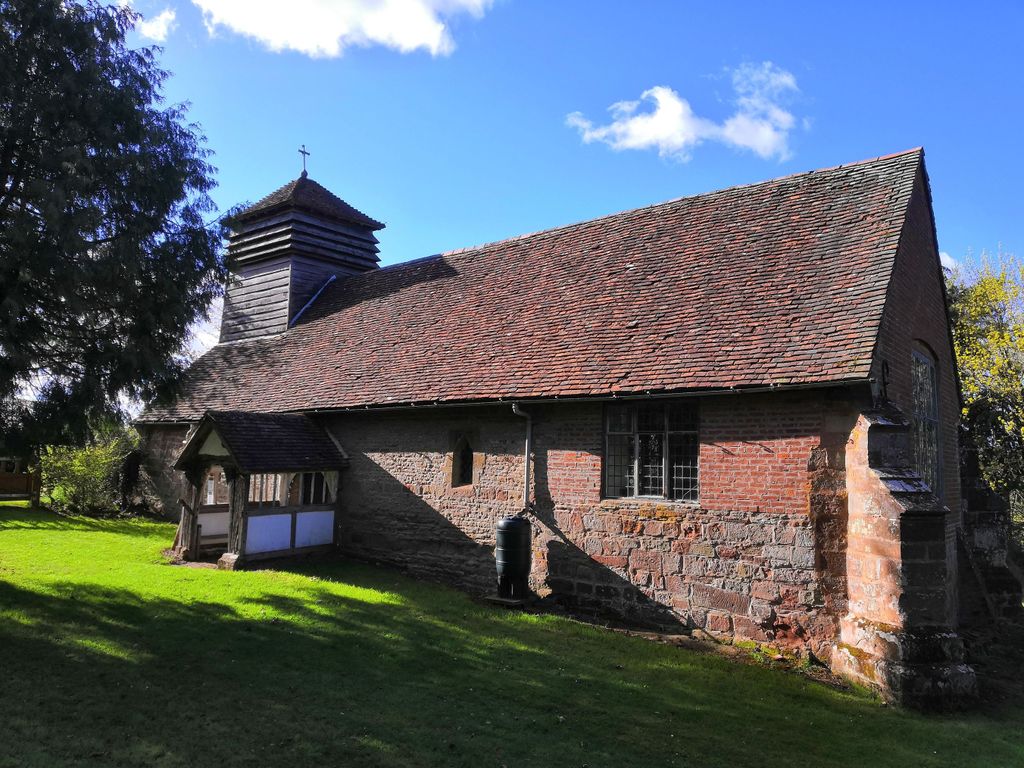
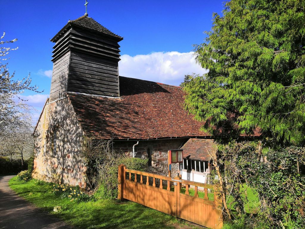
| Description | : | A simple church, the earliest part is from the 13th century. There are additions from later periods. Lighting is by candlelight. The church is in a quiet lane away from the main part of the village and is not normally open other than for services. Graveyard is over the road split in to 2 sections 'new' and 'old' Old section is quite overgrown, with a majority of gravestones now completely covered. |
frequently asked questions (FAQ):
-
Where is St. John the Baptist Churchyard?
St. John the Baptist Churchyard is located at 1 Chapel Ln Bransford, Malvern Hills District ,Worcestershire , WR6 5JGEngland.
-
St. John the Baptist Churchyard cemetery's updated grave count on graveviews.com?
0 memorials
-
Where are the coordinates of the St. John the Baptist Churchyard?
Latitude: 52.1616486
Longitude: -2.2981676
Nearby Cemetories:
1. St. Eadburga Churchyard
Leigh, Malvern Hills District, England
Coordinate: 52.1789500, -2.3169500
2. Worcester County Pauper and Lunatic Asylum Cemetery
Powick, Malvern Hills District, England
Coordinate: 52.1530276, -2.2599550
3. Newland Cemetery
Newland, Malvern Hills District, England
Coordinate: 52.1342764, -2.2988052
4. St Leonard Churchyard
Cotheridge, Malvern Hills District, England
Coordinate: 52.1903100, -2.3139500
5. Convent of the Holy Name, Chapel and Cloister
Malvern Link, Malvern Hills District, England
Coordinate: 52.1304500, -2.3068900
6. St Thomas Churchyard
Rushwick, Malvern Hills District, England
Coordinate: 52.1903870, -2.2751750
7. St Peter's Church Burial Ground
Powick, Malvern Hills District, England
Coordinate: 52.1613890, -2.2432490
8. St. Matthias Churchyard
Malvern Link, Malvern Hills District, England
Coordinate: 52.1290490, -2.3178900
9. St Mary the Virgin Churchyard
Madresfield, Malvern Hills District, England
Coordinate: 52.1252800, -2.2864800
10. Elgar Birthplace Museum
Lower Broadheath, Malvern Hills District, England
Coordinate: 52.1989600, -2.2827000
11. Stanbrook Abbey
Callow End, Malvern Hills District, England
Coordinate: 52.1389670, -2.2398380
12. St. Peter's Churchyard
Malvern Link, Malvern Hills District, England
Coordinate: 52.1259530, -2.3380280
13. Saint John's Cemetery
Worcester, City of Worcester, England
Coordinate: 52.1894670, -2.2436270
14. St Mary Magdalene Churchyard
Alfrick, Malvern Hills District, England
Coordinate: 52.1744230, -2.3693070
15. St James Churchyard
Great Malvern, Malvern Hills District, England
Coordinate: 52.1197650, -2.3316900
16. St Johns Bedwardine
Worcester, City of Worcester, England
Coordinate: 52.1882200, -2.2352000
17. St. Clement's Churchyard
Worcester, City of Worcester, England
Coordinate: 52.1906579, -2.2341371
18. Great Malvern Cemetery
Great Malvern, Malvern Hills District, England
Coordinate: 52.1133010, -2.3135120
19. St. Mary Magdalene Churchyard
Broadwas, Malvern Hills District, England
Coordinate: 52.1938300, -2.3598200
20. St. Mary the Virgin Churchyard
Kempsey, Malvern Hills District, England
Coordinate: 52.1396580, -2.2231290
21. Christ Church Churchyard
Lower Broadheath, Malvern Hills District, England
Coordinate: 52.2131500, -2.2786300
22. Great Malvern Priory Churchyard
Great Malvern, Malvern Hills District, England
Coordinate: 52.1106750, -2.3284660
23. Worcester Cathedral
Worcester, City of Worcester, England
Coordinate: 52.1887270, -2.2208070
24. All Saints Churchyard
Worcester, City of Worcester, England
Coordinate: 52.1919400, -2.2240200