
| Memorials | : | 0 |
| Location | : | Cotherstone, Durham Unitary Authority, England |
| Coordinate | : | 54.5722230, -1.9824740 |
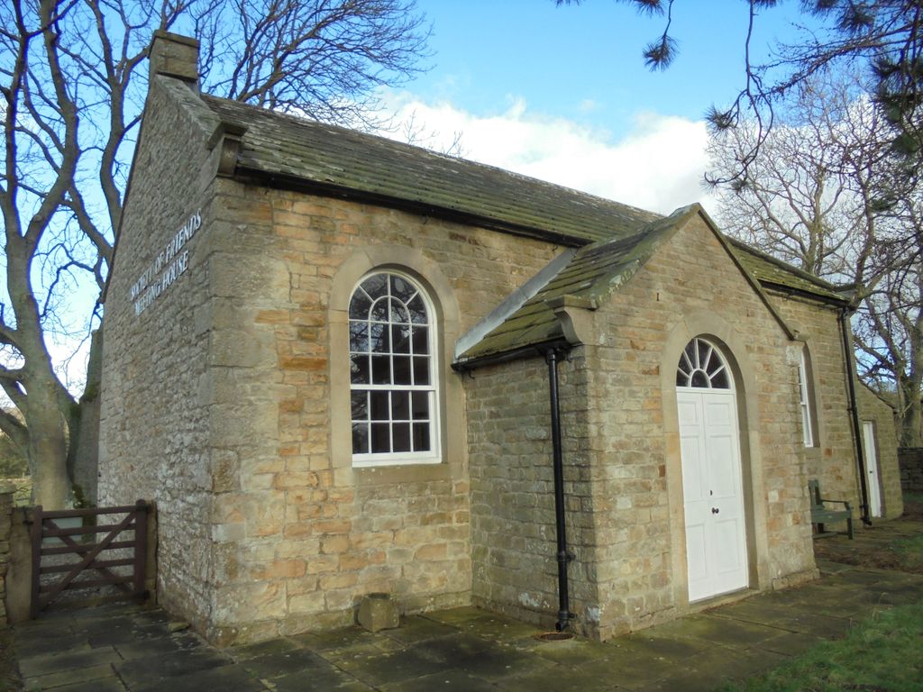
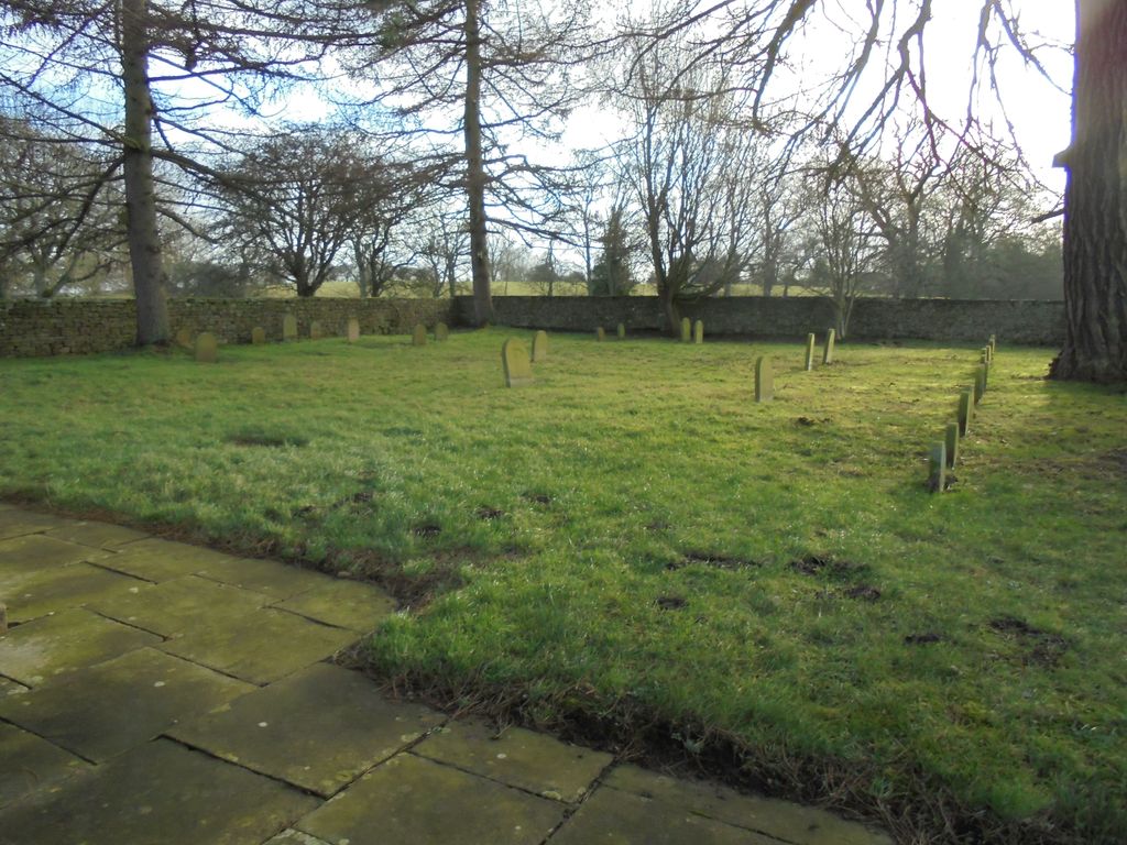
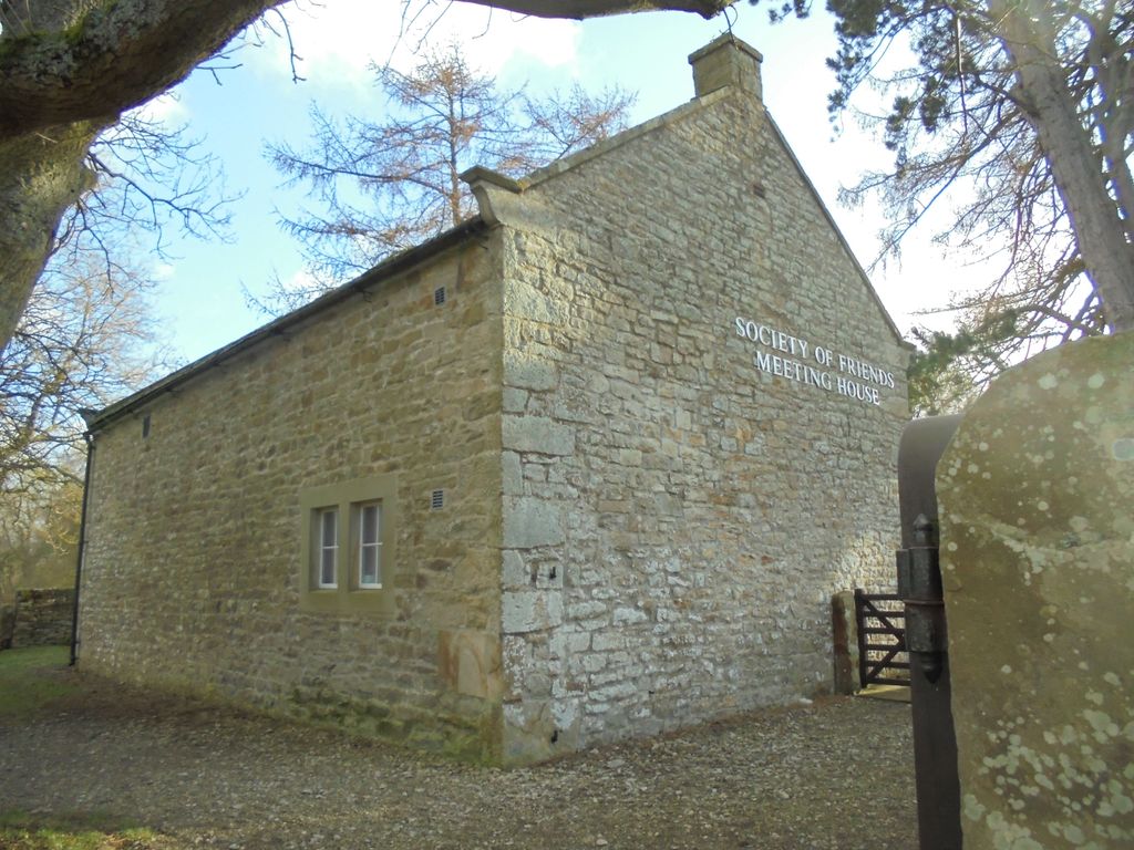
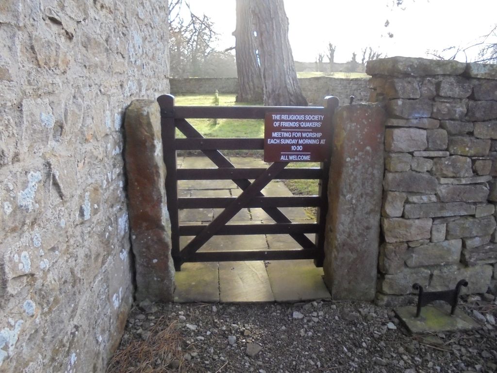
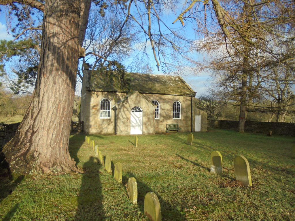
| Description | : | Society of Friends (Quakers) Meeting House is sited in quiet corner of Cotherstone in County Durham.It is still in use and can only be approached down a path leading off northeast corner of East Green and across field opposite. Cars may be parked by the Green. The meeting house was original built by the Quakers in 1796,the porch was added about 1837. |
frequently asked questions (FAQ):
-
Where is Cotherstone Friends Burial Ground?
Cotherstone Friends Burial Ground is located at Demesne Lane Cotherstone, Durham Unitary Authority ,County Durham , DL12 9PGEngland.
-
Cotherstone Friends Burial Ground cemetery's updated grave count on graveviews.com?
0 memorials
-
Where are the coordinates of the Cotherstone Friends Burial Ground?
Latitude: 54.5722230
Longitude: -1.9824740
Nearby Cemetories:
1. Cotherstone Cemetery
Cotherstone, Durham Unitary Authority, England
Coordinate: 54.5680830, -1.9804850
2. St. Romald Churchyard
Romaldkirk, Durham Unitary Authority, England
Coordinate: 54.5941550, -2.0089636
3. Romaldkirk Cemetery
Romaldkirk, Durham Unitary Authority, England
Coordinate: 54.5977800, -2.0083200
4. Chapel of Ease
Eggleston, Durham Unitary Authority, England
Coordinate: 54.6058000, -2.0050000
5. Holy Trinity Churchyard
Eggleston, Durham Unitary Authority, England
Coordinate: 54.6082390, -2.0037610
6. Victoria Road Cemetery
Barnard Castle, Durham Unitary Authority, England
Coordinate: 54.5456000, -1.9183000
7. St. Mary's Churchyard
Barnard Castle, Durham Unitary Authority, England
Coordinate: 54.5416950, -1.9230780
8. Barnard Castle Dissenters Cemetery
Barnard Castle, Durham Unitary Authority, England
Coordinate: 54.5451000, -1.9182900
9. Roman Catholic Cemetery
Barnard Castle, Durham Unitary Authority, England
Coordinate: 54.5442300, -1.9184500
10. St Mary's Roman Catholic Church
Barnard Castle, Durham Unitary Authority, England
Coordinate: 54.5414010, -1.9183080
11. St Giles Churchyard
Bowes, Durham Unitary Authority, England
Coordinate: 54.5169000, -2.0124000
12. Bowes and Gilmonby Cemetery
Bowes, Durham Unitary Authority, England
Coordinate: 54.5164600, -2.0124100
13. Eggleston Abbey
Barnard Castle, Durham Unitary Authority, England
Coordinate: 54.5311600, -1.9049600
14. Lune Chapel Churchyard
Laithkirk, Durham Unitary Authority, England
Coordinate: 54.6115800, -2.0717400
15. Saint Mary's Churchyard
Rokeby, Durham Unitary Authority, England
Coordinate: 54.5193100, -1.8894300
16. Middleton On Teesdale Churchyard
Middleton-in-Teesdale, Durham Unitary Authority, England
Coordinate: 54.6257980, -2.0825420
17. St Mary's Churchyard
Brignall, Durham Unitary Authority, England
Coordinate: 54.5061090, -1.8896890
18. Brignall Old Churchyard
Brignall, Durham Unitary Authority, England
Coordinate: 54.5051000, -1.8826400
19. St. John the Evangelist Churchyard
Lynesack, Durham Unitary Authority, England
Coordinate: 54.6299000, -1.8607870
20. Lynesack Cemetery
Lynesack, Durham Unitary Authority, England
Coordinate: 54.6301930, -1.8601710
21. St Michael and All Angels Churchyard
Barningham, Durham Unitary Authority, England
Coordinate: 54.4895190, -1.8691942
22. St Mary the Virgin Churchyard
Cockfield, Durham Unitary Authority, England
Coordinate: 54.6131690, -1.8017530
23. Cockfield Cemetery
Cockfield, Durham Unitary Authority, England
Coordinate: 54.6156200, -1.8004200
24. Rey Cross
Eden District, England
Coordinate: 54.5057950, -2.1486260