
| Memorials | : | 0 |
| Location | : | Oare, West Somerset District, England |
| Coordinate | : | 51.2124350, -3.7164290 |
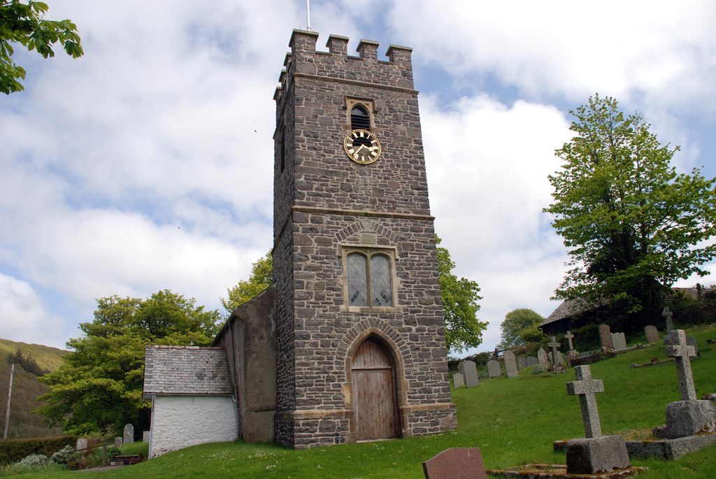
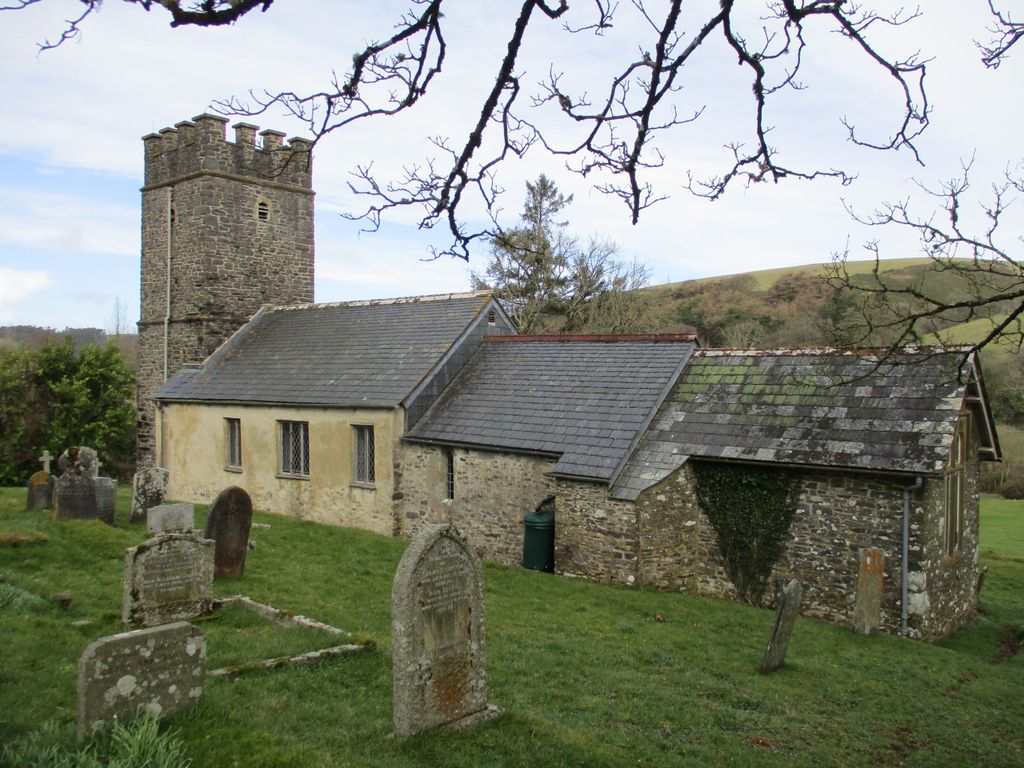
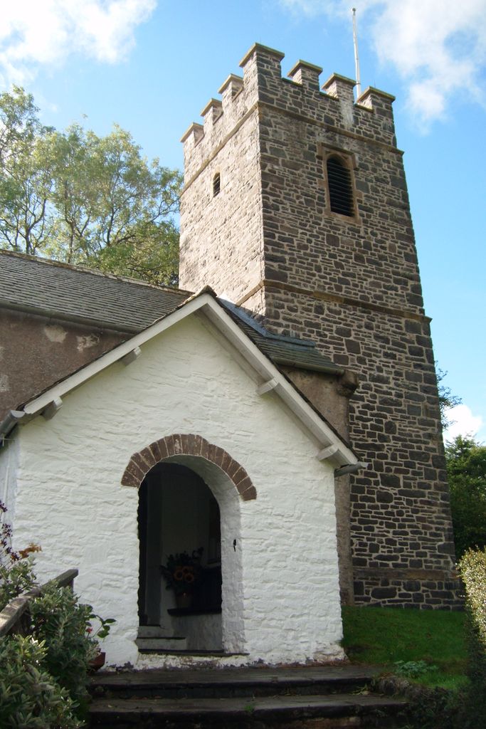
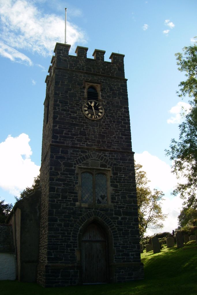
| Description | : | Referred to as Are in the Domesday Book of 1086, the hamlet of Oare is home to the Church of St.Mary's. This Grade II listed building was immortalised in the novel 'Lorna Doone' by R.D.Blackmore whose Grandfather was the Rector between 1809-42. St. Mary's is easily found at the T junction of New road and Hookway Hill, 1 mile off the A39 Lynton to Porlock road. The Church has an inner(possibly 15th century) and outer chancel, nave, 18th century box pews, readers desk, Norman font, pulpit, roof bosses and three separate slate roofs. It's mainly of Medieval origin but much... Read More |
frequently asked questions (FAQ):
-
Where is St. Mary the Virgin Churchyard?
St. Mary the Virgin Churchyard is located at Oare, West Somerset District ,Somerset ,England.
-
St. Mary the Virgin Churchyard cemetery's updated grave count on graveviews.com?
0 memorials
-
Where are the coordinates of the St. Mary the Virgin Churchyard?
Latitude: 51.2124350
Longitude: -3.7164290
Nearby Cemetories:
1. Culbone St. Bueno's Churchyard
Oare, West Somerset District, England
Coordinate: 51.2213640, -3.6594820
2. St. Brendon's Churchyard
Brendon, North Devon District, England
Coordinate: 51.2149390, -3.7910490
3. St.Luke's Churchyard
Simonsbath, West Somerset District, England
Coordinate: 51.1408600, -3.7514560
4. St. Mary the Virgin Churchyard
Lynton, North Devon District, England
Coordinate: 51.2298700, -3.8339800
5. St Dubricius Churchyard
Porlock, West Somerset District, England
Coordinate: 51.2083000, -3.5955000
6. Porlock Cemetery
Porlock, West Somerset District, England
Coordinate: 51.2033790, -3.5954070
7. Stoke Pero Churchyard
Porlock, West Somerset District, England
Coordinate: 51.1796510, -3.6060674
8. Lynton New Cemetery
Lynton, North Devon District, England
Coordinate: 51.2293000, -3.8453100
9. St. Mary Magdalene Churchyard
Exford, West Somerset District, England
Coordinate: 51.1341450, -3.6342160
10. Luccombe Extension Cemetery
Luccombe, West Somerset District, England
Coordinate: 51.1897360, -3.5609100
11. St. Mary's Churchyard
Luccombe, West Somerset District, England
Coordinate: 51.1895770, -3.5596880
12. Selworthy Extension Cemeteries
Selworthy, West Somerset District, England
Coordinate: 51.2098330, -3.5481240
13. All Saints Churchyard
Selworthy, West Somerset District, England
Coordinate: 51.2101800, -3.5475440
14. Saint Andrew's Churchyard
Withypool, West Somerset District, England
Coordinate: 51.1078060, -3.6492700
15. St Petrock Graveyard
Parracombe, North Devon District, England
Coordinate: 51.1883600, -3.8977900
16. All Saints Churchyard
Wootton Courtenay, West Somerset District, England
Coordinate: 51.1801840, -3.5203550
17. St. John the Evangelist Churchyard
Cutcombe, West Somerset District, England
Coordinate: 51.1424576, -3.5295319
18. Minehead Cemetery
Minehead, West Somerset District, England
Coordinate: 51.2050650, -3.4982030
19. Winsford Churchyard
Winsford, West Somerset District, England
Coordinate: 51.1038000, -3.5665000
20. St. Petrock's Churchyard
Timberscombe, West Somerset District, England
Coordinate: 51.1680950, -3.4948210
21. St. Michael's Anglican Church Cemetery
Minehead, West Somerset District, England
Coordinate: 51.2110390, -3.4808250
22. All Saints Churchyard
Brayford, North Devon District, England
Coordinate: 51.0931990, -3.8724700
23. St Giles Churchyard
Hawkridge, West Somerset District, England
Coordinate: 51.0638000, -3.6266000
24. St. John The Baptist Churchyard
Charles, North Devon District, England
Coordinate: 51.0809305, -3.8751413