| Memorials | : | 3 |
| Location | : | Simonsbath, West Somerset District, England |
| Coordinate | : | 51.1408600, -3.7514560 |
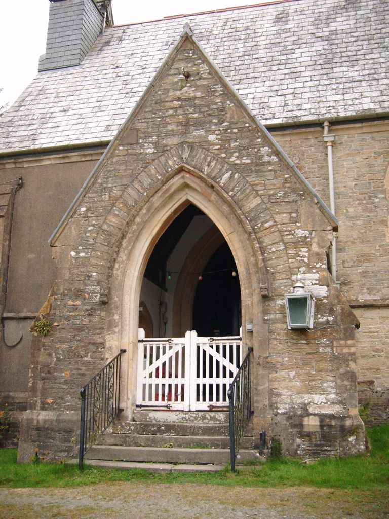
| Description | : | Constructed in 1856 of grey stone with big lancet windows. A listed building of II , consisting of south porch, nave and chancel, plain glass windows for light, font, and slate roofs. Stained glass windows are dedicated to St.Mary, St. Luke, and W.W.1 Simonsbath is found on the B3223 road. The first vicar being the Rev William Henry Thornton. ~ J.D |
frequently asked questions (FAQ):
-
Where is St.Luke's Churchyard?
St.Luke's Churchyard is located at Simonsbath, West Somerset District ,Somerset ,England.
-
St.Luke's Churchyard cemetery's updated grave count on graveviews.com?
3 memorials
-
Where are the coordinates of the St.Luke's Churchyard?
Latitude: 51.1408600
Longitude: -3.7514560
Nearby Cemetories:
1. Saint Andrew's Churchyard
Withypool, West Somerset District, England
Coordinate: 51.1078060, -3.6492700
2. St. Mary Magdalene Churchyard
Exford, West Somerset District, England
Coordinate: 51.1341450, -3.6342160
3. St. Mary the Virgin Churchyard
Oare, West Somerset District, England
Coordinate: 51.2124350, -3.7164290
4. St. Brendon's Churchyard
Brendon, North Devon District, England
Coordinate: 51.2149390, -3.7910490
5. All Saints Churchyard
Brayford, North Devon District, England
Coordinate: 51.0931990, -3.8724700
6. All Saints Churchyard
North Molton, North Devon District, England
Coordinate: 51.0549970, -3.8039230
7. St. John The Baptist Churchyard
Charles, North Devon District, England
Coordinate: 51.0809305, -3.8751413
8. Culbone St. Bueno's Churchyard
Oare, West Somerset District, England
Coordinate: 51.2213640, -3.6594820
9. Stoke Pero Churchyard
Porlock, West Somerset District, England
Coordinate: 51.1796510, -3.6060674
10. St. Mary the Virgin Churchyard
Lynton, North Devon District, England
Coordinate: 51.2298700, -3.8339800
11. St Petrock Graveyard
Parracombe, North Devon District, England
Coordinate: 51.1883600, -3.8977900
12. Lynton New Cemetery
Lynton, North Devon District, England
Coordinate: 51.2293000, -3.8453100
13. St Giles Churchyard
Hawkridge, West Somerset District, England
Coordinate: 51.0638000, -3.6266000
14. Porlock Cemetery
Porlock, West Somerset District, England
Coordinate: 51.2033790, -3.5954070
15. St Dubricius Churchyard
Porlock, West Somerset District, England
Coordinate: 51.2083000, -3.5955000
16. Winsford Churchyard
Winsford, West Somerset District, England
Coordinate: 51.1038000, -3.5665000
17. St. Petrock's Churchyard
West Anstey, North Devon District, England
Coordinate: 51.0352740, -3.6385530
18. Luccombe Extension Cemetery
Luccombe, West Somerset District, England
Coordinate: 51.1897360, -3.5609100
19. St. Mary's Churchyard
Luccombe, West Somerset District, England
Coordinate: 51.1895770, -3.5596880
20. St Mary Magdalene Churchyard
South Molton, North Devon District, England
Coordinate: 51.0186400, -3.8349800
21. South Molton Cemetery
South Molton, North Devon District, England
Coordinate: 51.0127000, -3.8317400
22. St. John the Evangelist Churchyard
Cutcombe, West Somerset District, England
Coordinate: 51.1424576, -3.5295319
23. St Peter's Church Exton
Exton, West Somerset District, England
Coordinate: 51.0925840, -3.5352300
24. Selworthy Extension Cemeteries
Selworthy, West Somerset District, England
Coordinate: 51.2098330, -3.5481240

