
| Memorials | : | 0 |
| Location | : | Eyam, Derbyshire Dales District, England |
| Coordinate | : | 53.2839200, -1.6586665 |
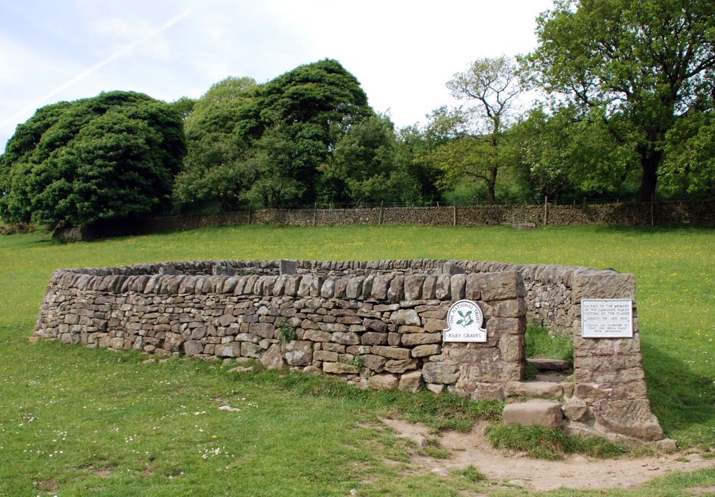
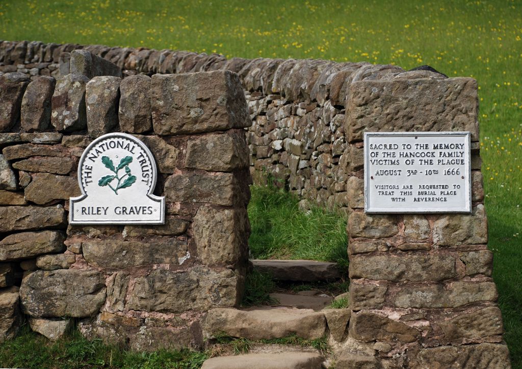
| Description | : | National Trust Site In a field on the E side of Eyam village is an egg-shaped enclosure surrounded by a drystone wall and containing seven graves. They belong to those members of the Hancock family who died from the plague within seven days of each other in August 1666. Six of the graves are marked by simply inscribed sandstone slabs set upright, with no grave mounds visible. The seventh, belonging to John Hancock senior, is a table tomb. The family lived in a house within the field, which is called Riley Field, hence the name given to the burials. The Talbot... Read More |
frequently asked questions (FAQ):
-
Where is Riley Graves?
Riley Graves is located at Eyam, Derbyshire Dales District ,Derbyshire ,England.
-
Riley Graves cemetery's updated grave count on graveviews.com?
0 memorials
-
Where are the coordinates of the Riley Graves?
Latitude: 53.2839200
Longitude: -1.6586665
Nearby Cemetories:
1. Riley Farm
Eyam, Derbyshire Dales District, England
Coordinate: 53.2857957, -1.6636787
2. Eyam Village
Eyam, Derbyshire Dales District, England
Coordinate: 53.2843748, -1.6717200
3. St Martin
Stoney Middleton, Derbyshire Dales District, England
Coordinate: 53.2758020, -1.6542840
4. St. Lawrence's Churchyard
Eyam, Derbyshire Dales District, England
Coordinate: 53.2842751, -1.6749160
5. St. Helen's Churchyard
Grindleford, Derbyshire Dales District, England
Coordinate: 53.2975200, -1.6322900
6. All Saints Churchyard
Calver, Derbyshire Dales District, England
Coordinate: 53.2660740, -1.6303850
7. Hamlet of Bretton
Eyam, Derbyshire Dales District, England
Coordinate: 53.2979962, -1.7008309
8. St. Anne Churchyard
Baslow, Derbyshire Dales District, England
Coordinate: 53.2473740, -1.6241110
9. The Good Shepherd Churchyard
Wardlow, Derbyshire Dales District, England
Coordinate: 53.2693970, -1.7294140
10. Methodist Churchyard
Great Hucklow, Derbyshire Dales District, England
Coordinate: 53.2970009, -1.7330000
11. Saint Giles Churchyard
Great Longstone, Derbyshire Dales District, England
Coordinate: 53.2432100, -1.7009100
12. St Michael and All Angels Churchyard
Hathersage, Derbyshire Dales District, England
Coordinate: 53.3330570, -1.6501020
13. Trot Lane Private Cemetery
Foolow, Derbyshire Dales District, England
Coordinate: 53.2872651, -1.7434660
14. Little Longstone Chapel
Little Longstone, Derbyshire Dales District, England
Coordinate: 53.2413241, -1.7203296
15. St. Peter's Churchyard
Edensor, Derbyshire Dales District, England
Coordinate: 53.2255530, -1.6260190
16. Litton Cemetery
Litton, Derbyshire Dales District, England
Coordinate: 53.2654380, -1.7573610
17. Tideswell Parish Council Cemetery
Tideswell, Derbyshire Dales District, England
Coordinate: 53.2846630, -1.7639730
18. St Barnabas Churchyard
Bradwell, Derbyshire Dales District, England
Coordinate: 53.3263560, -1.7387040
19. Methodist Chapel Graveyard
Bradwell, Derbyshire Dales District, England
Coordinate: 53.3264690, -1.7417860
20. St. John the Baptist Churchyard
Bamford, High Peak Borough, England
Coordinate: 53.3468590, -1.6896950
21. Bethlehem Churchyard
Bradwell, Derbyshire Dales District, England
Coordinate: 53.3277120, -1.7417070
22. Holy Trinity Churchyard
Ashford-in-the-Water, Derbyshire Dales District, England
Coordinate: 53.2241640, -1.7093610
23. St John the Baptist Tideswell
Tideswell, Derbyshire Dales District, England
Coordinate: 53.2785640, -1.7728500
24. Immaculate Heart of Mary, Roman Catholic Chapel
Tideswell, Derbyshire Dales District, England
Coordinate: 53.2761640, -1.7741580