
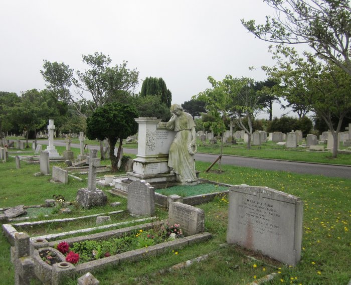
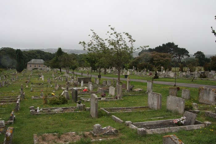
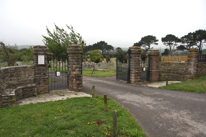
| Memorials | : | 0 |
| Location | : | Swanage, Purbeck District, England |
| Coordinate | : | 50.6217400, -1.9749200 |
frequently asked questions (FAQ):
-
Where is Godlingston Cemetery?
Godlingston Cemetery is located at Swanage, Purbeck District ,Dorset ,England.
-
Godlingston Cemetery cemetery's updated grave count on graveviews.com?
0 memorials
-
Where are the coordinates of the Godlingston Cemetery?
Latitude: 50.6217400
Longitude: -1.9749200
Nearby Cemetories:
1. Northbrook Cemetery
Swanage, Purbeck District, England
Coordinate: 50.6106750, -1.9631520
2. St Mary the Virgin Churchyard
Swanage, Purbeck District, England
Coordinate: 50.6087180, -1.9630010
3. St. Mary the Virgin Churchyard
Swanage, Purbeck District, England
Coordinate: 50.6086280, -1.9631060
4. Langton Matravers Church Cemetery
Langton Matravers, Purbeck District, England
Coordinate: 50.6096300, -2.0025700
5. St George Churchyard
Langton Matravers, Purbeck District, England
Coordinate: 50.6096640, -2.0039300
6. Saint Nicholas Churchyard
Studland, Purbeck District, England
Coordinate: 50.6425800, -1.9498100
7. St Nicholas Churchyard
Worth Matravers, Purbeck District, England
Coordinate: 50.5967650, -2.0397410
8. Old Church Cemetery
Corfe Castle, Purbeck District, England
Coordinate: 50.6367499, -2.0549142
9. Kingston Chapel
Kingston, Purbeck District, England
Coordinate: 50.6159590, -2.0600790
10. St Edward King and Martyr
Corfe Castle, Purbeck District, England
Coordinate: 50.6383980, -2.0573030
11. God's Acre Cemetery
Corfe Castle, Purbeck District, England
Coordinate: 50.6366100, -2.0591320
12. St James Churchyard
Kingston, Purbeck District, England
Coordinate: 50.6156390, -2.0641100
13. St. Mary's Church
Brownsea Island, Poole Unitary Authority, England
Coordinate: 50.6895400, -1.9615340
14. St Peter's Churchyard Church Knowle
Church Knowle, Purbeck District, England
Coordinate: 50.6370800, -2.0851140
15. Swyre Head
Chaldon Herring, Purbeck District, England
Coordinate: 50.6058320, -2.0944380
16. Kimmeridge Churchyard
Kimmeridge, Purbeck District, England
Coordinate: 50.6192291, -2.1187155
17. St James Churchyard
Poole, Poole Unitary Authority, England
Coordinate: 50.7134850, -1.9897060
18. Parkstone Cemetery
Poole, Poole Unitary Authority, England
Coordinate: 50.7147430, -1.9492790
19. Hunger Hill Burial Ground
Poole, Poole Unitary Authority, England
Coordinate: 50.7169428, -1.9852496
20. St. Michael's and All Angels Churchyard
Steeple, Purbeck District, England
Coordinate: 50.6277090, -2.1267040
21. All Saints Churchyard
Poole, Poole Unitary Authority, England
Coordinate: 50.7134060, -1.9165840
22. St. Michael's Churchyard
Hamworthy, Poole Unitary Authority, England
Coordinate: 50.7199660, -2.0099190
23. St. Mary's Churchyard
Poole, Poole Unitary Authority, England
Coordinate: 50.7226400, -1.9716790
24. St. Peter's Church
Parkstone, Poole Unitary Authority, England
Coordinate: 50.7245590, -1.9533390