
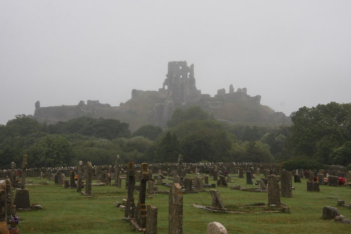
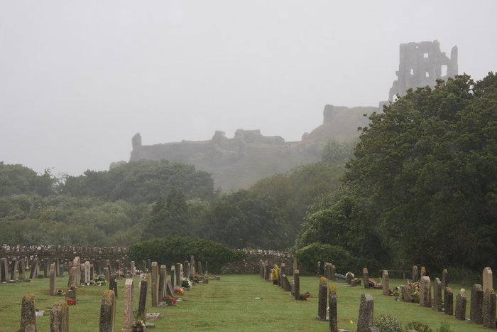
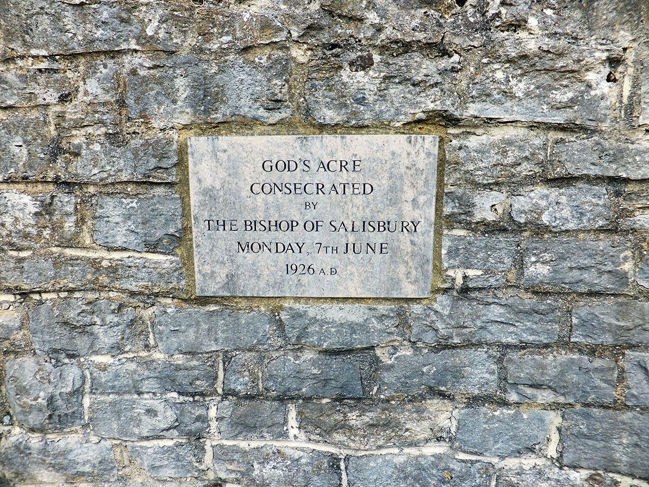
| Memorials | : | 25 |
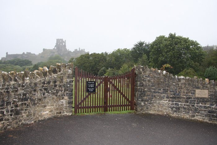
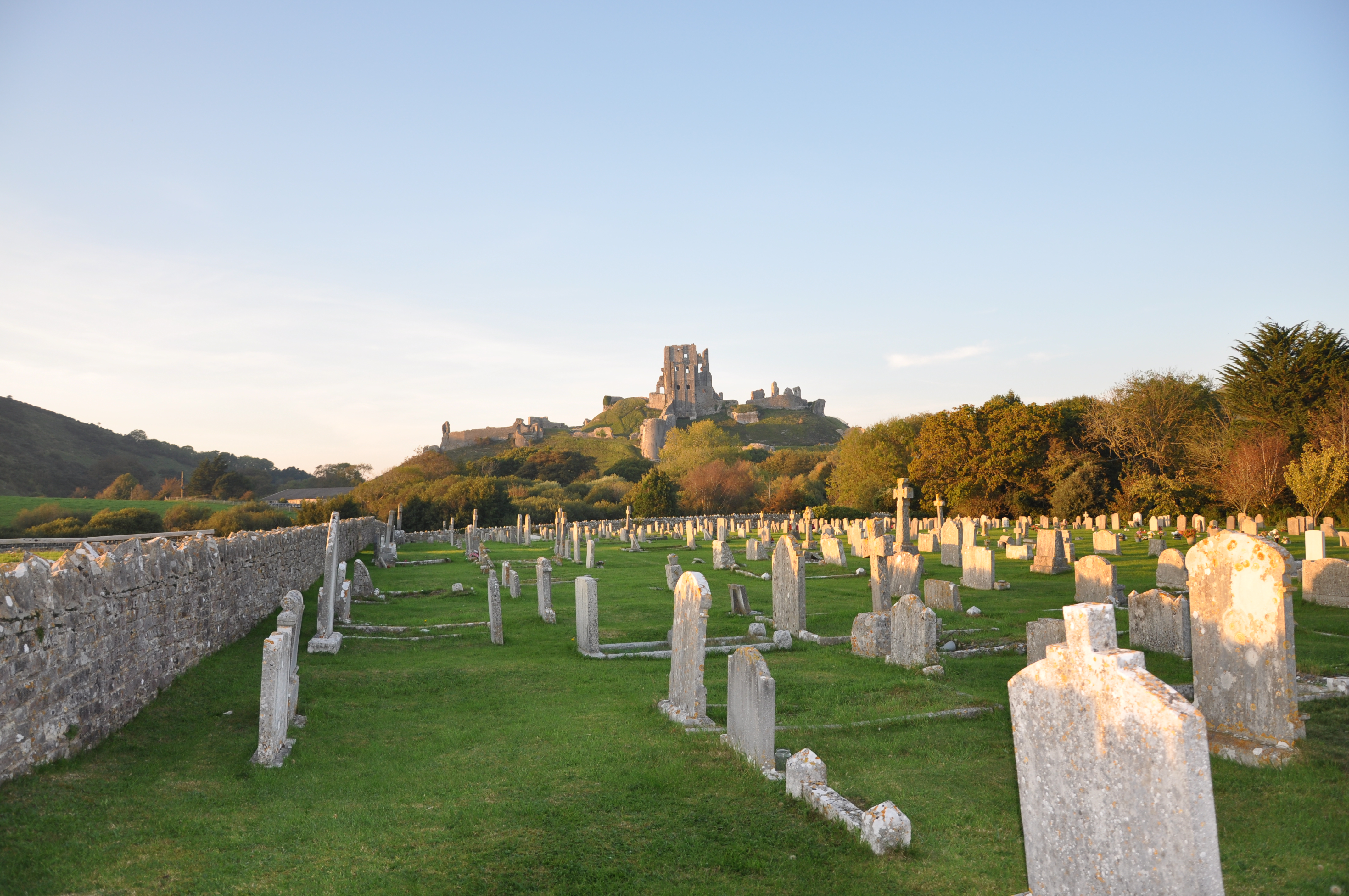
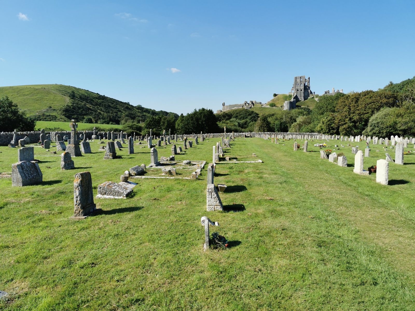
| Location | : | Corfe Castle, Purbeck District, England |
| Coordinate | : | 50.6366100, -2.0591320 |
| Description | : | The village of Corfe Castle in Dorset surrounds the ruin of a castle which dates back to the 11th century. The castle stands on top of a 55m high hill and can be seen for miles around. The keep was built in the early 12th century for King Henry I, William the Conqueror's son. After six centuries of keeping enemies at bay, an Act of Parliament was passed at Wareham to destroy the castle. Soldiers used gunpowder to bring the towers and ramparts crashing down, resulting in the yawning gaps and crazy angles that can be seen today. After a... Read More |
frequently asked questions (FAQ):
-
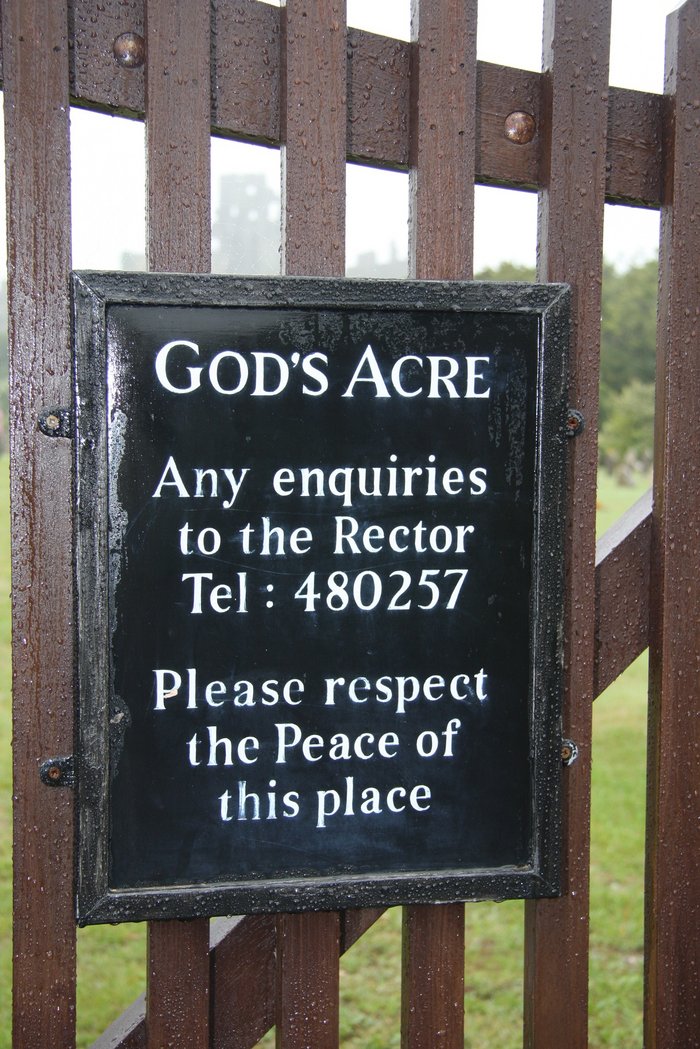
Where is God's Acre Cemetery?
God's Acre Cemetery is located at Next to West Street Corfe Castle, Purbeck District ,Dorset , BH20 5HHEngland.
-
God's Acre Cemetery cemetery's updated grave count on graveviews.com?
25 memorials
-
Where are the coordinates of the God's Acre Cemetery?
Latitude: 50.6366100
Longitude: -2.0591320
Nearby Cemetories:
1. St Edward King and Martyr
Corfe Castle, Purbeck District, England
Coordinate: 50.6383980, -2.0573030
2. Old Church Cemetery
Corfe Castle, Purbeck District, England
Coordinate: 50.6367499, -2.0549142
3. St Peter's Churchyard Church Knowle
Church Knowle, Purbeck District, England
Coordinate: 50.6370800, -2.0851140
4. Kingston Chapel
Kingston, Purbeck District, England
Coordinate: 50.6159590, -2.0600790
5. St James Churchyard
Kingston, Purbeck District, England
Coordinate: 50.6156390, -2.0641100
6. Swyre Head
Chaldon Herring, Purbeck District, England
Coordinate: 50.6058320, -2.0944380
7. Kimmeridge Churchyard
Kimmeridge, Purbeck District, England
Coordinate: 50.6192291, -2.1187155
8. St Nicholas Churchyard
Worth Matravers, Purbeck District, England
Coordinate: 50.5967650, -2.0397410
9. St. Michael's and All Angels Churchyard
Steeple, Purbeck District, England
Coordinate: 50.6277090, -2.1267040
10. St George Churchyard
Langton Matravers, Purbeck District, England
Coordinate: 50.6096640, -2.0039300
11. Langton Matravers Church Cemetery
Langton Matravers, Purbeck District, England
Coordinate: 50.6096300, -2.0025700
12. Godlingston Cemetery
Swanage, Purbeck District, England
Coordinate: 50.6217400, -1.9749200
13. Lady St Mary Churchyard
Wareham, Purbeck District, England
Coordinate: 50.6843130, -2.1077420
14. Wareham Cemetery
Wareham, Purbeck District, England
Coordinate: 50.6848600, -2.1066320
15. United Reformed Churchyard
Wareham, Purbeck District, England
Coordinate: 50.6860338, -2.1078591
16. St Martin-on-the-Walls
Wareham, Purbeck District, England
Coordinate: 50.6888000, -2.1115000
17. Hill View Cemetery
Wareham, Purbeck District, England
Coordinate: 50.6828550, -2.1266310
18. St. John the Evangelist
East Holme, Purbeck District, England
Coordinate: 50.6730910, -2.1440880
19. Northbrook Cemetery
Swanage, Purbeck District, England
Coordinate: 50.6106750, -1.9631520
20. St. Mary the Virgin Churchyard
Swanage, Purbeck District, England
Coordinate: 50.6086280, -1.9631060
21. St Mary the Virgin Churchyard
Swanage, Purbeck District, England
Coordinate: 50.6087180, -1.9630010
22. Saint Nicholas Churchyard
Studland, Purbeck District, England
Coordinate: 50.6425800, -1.9498100
23. St Mary's Churchyard
Tyneham, Purbeck District, England
Coordinate: 50.6230090, -2.1689980
24. St. Mary's Church
Brownsea Island, Poole Unitary Authority, England
Coordinate: 50.6895400, -1.9615340