
| Memorials | : | 0 |
| Location | : | Burghfield, West Berkshire Unitary Authority, England |
| Coordinate | : | 51.4110000, -1.0420000 |
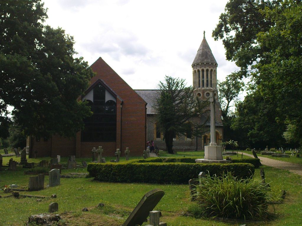
| Description | : | The Church of England parish church of St Mary in Church Lane, Burghfield village, was originally built in the 12th century, but early in the Victorian era it was completely demolished and replaced by a Norman revival building designed by J.B. Clacy of Reading and completed in 1843. The original church had a stepped wooden tower, and the building is depicted in one of the stained glass windows. The parish church contains a number of church monuments from the old St. Mary's, including the alabaster effigy of an important historic figure, Richard Neville, 5th Earl of Salisbury the father of... Read More |
frequently asked questions (FAQ):
-
Where is St. Mary's Churchyard?
St. Mary's Churchyard is located at Church Lane Burghfield, West Berkshire Unitary Authority ,Berkshire , RG30 3TGEngland.
-
St. Mary's Churchyard cemetery's updated grave count on graveviews.com?
0 memorials
-
Where are the coordinates of the St. Mary's Churchyard?
Latitude: 51.4110000
Longitude: -1.0420000
Nearby Cemetories:
1. St Michaels Churchyard
Sulhamstead, West Berkshire Unitary Authority, England
Coordinate: 51.4119700, -1.0825800
2. Holy Trinity Churchyard
Grazeley, Wokingham Borough, England
Coordinate: 51.3972008, -0.9965683
3. Holy Trinity Churchyard
Theale, West Berkshire Unitary Authority, England
Coordinate: 51.4367420, -1.0825640
4. Saint Mark's Church
Englefield, West Berkshire Unitary Authority, England
Coordinate: 51.4435960, -1.1036540
5. St John the Baptist
Padworth, West Berkshire Unitary Authority, England
Coordinate: 51.3911075, -1.1198134
6. St Saviour Churchyard
Mortimer West End, Basingstoke and Deane Borough, England
Coordinate: 51.3682600, -1.0912800
7. Saint Nicholas Churchyard
Sulham, West Berkshire Unitary Authority, England
Coordinate: 51.4632900, -1.0729000
8. St. Mary Churchyard
Shinfield, Wokingham Borough, England
Coordinate: 51.4081180, -0.9524620
9. St Mary the Virgin Churchyard
Silchester, Basingstoke and Deane Borough, England
Coordinate: 51.3564000, -1.0775700
10. St Giles Churchyard
Reading, Reading Borough, England
Coordinate: 51.4509510, -0.9704450
11. St. Mary's Churchyard
Reading, Reading Borough, England
Coordinate: 51.4544953, -0.9735278
12. Greyfriars Churchyard
Reading, Reading Borough, England
Coordinate: 51.4567920, -0.9764880
13. St. Laurence Churchyard
Tidmarsh, West Berkshire Unitary Authority, England
Coordinate: 51.4663800, -1.0873800
14. Stratfield Saye House
Stratfield Saye, Basingstoke and Deane Borough, England
Coordinate: 51.3522220, -1.0058200
15. St. Laurence Churchyard
Reading, Reading Borough, England
Coordinate: 51.4567474, -0.9686236
16. Reading Abbey Ruins
Reading, Reading Borough, England
Coordinate: 51.4563710, -0.9651130
17. All Saints Churchyard
Swallowfield, Wokingham Borough, England
Coordinate: 51.3775140, -0.9500010
18. Reading Prison Cemetery
Reading, Reading Borough, England
Coordinate: 51.4564910, -0.9641120
19. St Mary Churchyard
Stratfield Saye, Basingstoke and Deane Borough, England
Coordinate: 51.3474200, -1.0023700
20. St Mary the Virgin Cemetery
Purley on Thames, West Berkshire Unitary Authority, England
Coordinate: 51.4797100, -1.0402200
21. St. Peter's Churchyard
Caversham, Reading Borough, England
Coordinate: 51.4686597, -0.9807669
22. Reading Cemetery
Reading, Reading Borough, England
Coordinate: 51.4529450, -0.9480160
23. Nutbean Lane Cemetery
Swallowfield, Wokingham Borough, England
Coordinate: 51.3730630, -0.9430220
24. Chapel of St Michael the Archangel
Mapledurham, South Oxfordshire District, England
Coordinate: 51.4849140, -1.0355910