
| Memorials | : | 0 |
| Location | : | Coventry, Metropolitan Borough of Coventry, England |
| Coordinate | : | 52.4059400, -1.5114400 |
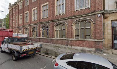
| Description | : | Franciscan Greyfriars church, originally built at Sir Ranuld de Blondeville's manor about 1234 founded by Ralph, the Earl of Chester, and enlarged in 1298 by a land grant from Roger de Montalt. The Hastings chapel was added in the 1500's. Located between New Union Street and Warwick Lane in the centre of Coventry, fell victim to the dissolution, dissolved 05 Oct 1538, then rebuilt 1830 to 1833, falling again to despair April 1944 in World War II. Only the church spire remains. |
frequently asked questions (FAQ):
-
Where is Greyfriars Coventry?
Greyfriars Coventry is located at Greyfriars Lane Coventry, Metropolitan Borough of Coventry ,West Midlands ,England.
-
Greyfriars Coventry cemetery's updated grave count on graveviews.com?
0 memorials
-
Where are the coordinates of the Greyfriars Coventry?
Latitude: 52.4059400
Longitude: -1.5114400
Nearby Cemetories:
1. Holy Trinity Churchyard
Coventry, Metropolitan Borough of Coventry, England
Coordinate: 52.4085450, -1.5093060
2. St Michael's Cathedral
Coventry, Metropolitan Borough of Coventry, England
Coordinate: 52.4080000, -1.5071840
3. Saint Mary's Priory and Cathedral Coventry
Coventry, Metropolitan Borough of Coventry, England
Coordinate: 52.4089000, -1.5085000
4. Coventry Cathedral
Coventry, Metropolitan Borough of Coventry, England
Coordinate: 52.4083290, -1.5067360
5. White Friars
Coventry, Metropolitan Borough of Coventry, England
Coordinate: 52.4050100, -1.5014800
6. London Road Cemetery
Coventry, Metropolitan Borough of Coventry, England
Coordinate: 52.3975420, -1.4966730
7. St Mary Magdalen
Chapelfields, Metropolitan Borough of Coventry, England
Coordinate: 52.4078970, -1.5316060
8. St Michael Churchyard
Coventry, Metropolitan Borough of Coventry, England
Coordinate: 52.4115820, -1.4747430
9. Canley Garden Cemetery and Crematorium
Canley, Metropolitan Borough of Coventry, England
Coordinate: 52.3890370, -1.5475700
10. All Saints Churchyard
Allesley, Metropolitan Borough of Coventry, England
Coordinate: 52.4230817, -1.5563453
11. St. Paul's Cemetery
Coventry, Metropolitan Borough of Coventry, England
Coordinate: 52.4383200, -1.5047500
12. Foleshill Road United Reformed Churchyard
Foleshill, Metropolitan Borough of Coventry, England
Coordinate: 52.4373320, -1.4919190
13. St Mary Magdalen
Coventry, Metropolitan Borough of Coventry, England
Coordinate: 52.4236750, -1.4621960
14. St Mary Magdalene Wyken
Coventry, Metropolitan Borough of Coventry, England
Coordinate: 52.4236580, -1.4620770
15. St. Thomas Churchyard
Keresley, Metropolitan Borough of Coventry, England
Coordinate: 52.4395700, -1.5358000
16. Saint John the Baptist Church
Baginton, Warwick District, England
Coordinate: 52.3698000, -1.4969000
17. St Bartholomew Churchyard
Binley, Metropolitan Borough of Coventry, England
Coordinate: 52.4031820, -1.4468110
18. Westwood Churchyard
Coventry, Metropolitan Borough of Coventry, England
Coordinate: 52.3840345, -1.5717602
19. Walsgrave-on Sowe Cemetery
Walsgrave on Sowe, Metropolitan Borough of Coventry, England
Coordinate: 52.4420000, -1.4498100
20. St Mary's Churchyard
Stoneleigh, Warwick District, England
Coordinate: 52.3504620, -1.5161400
21. St Giles Churchyard
Exhall, Nuneaton and Bedworth Borough, England
Coordinate: 52.4623930, -1.5003010
22. Lentons Lane Cemetery
Coventry, Metropolitan Borough of Coventry, England
Coordinate: 52.4476000, -1.4469500
23. St Giles Churchyard
Bubbenhall, Warwick District, England
Coordinate: 52.3501940, -1.4730830
24. St Leonard's Churchyard
Ryton-on-Dunsmore, Rugby Borough, England
Coordinate: 52.3674940, -1.4338580