
| Memorials | : | 0 |
| Location | : | Hei- en Boeicop, Zederik Municipality, Netherlands |
| Coordinate | : | 51.9478600, 5.0672500 |
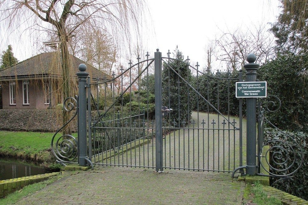
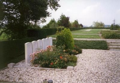
| Description | : | Heicop, a village in the commune of Hei-en-Boeicop, is 24 kilometres south of Utrecht and 49 kilometres east of Rotterdam. The cemetery is in the centre of the village, on the north side of the road to Leerdam. |
frequently asked questions (FAQ):
-
Where is Heicop General Cemetery?
Heicop General Cemetery is located at Hei- en Boeicop, Zederik Municipality ,Zuid-Holland ,Netherlands.
-
Heicop General Cemetery cemetery's updated grave count on graveviews.com?
0 memorials
-
Where are the coordinates of the Heicop General Cemetery?
Latitude: 51.9478600
Longitude: 5.0672500
Nearby Cemetories:
1. Joodse Begraafplaats
Vianen Municipality, Netherlands
Coordinate: 51.9862400, 5.0874000
2. Vianen Protestant Cemetery
Vianen, Vianen Municipality, Netherlands
Coordinate: 51.9867800, 5.0891100
3. Vreeswijk Protestant Cemetery
Vreeswijk, Nieuwegein Municipality, Netherlands
Coordinate: 52.0048700, 5.0974600
4. Rooms Katholieke Begraafplaats St. Barbera
Leerdam Municipality, Netherlands
Coordinate: 51.8934994, 5.1083541
5. Algemene Begraafplaats
Leerdam, Leerdam Municipality, Netherlands
Coordinate: 51.8865484, 5.0789400
6. Ameide Nieuwe Begraafplaats
Ameide, Zederik Municipality, Netherlands
Coordinate: 51.9493470, 4.9665220
7. Joodse Begraafplaats Asperen
Asperen, Lingewaal Municipality, Netherlands
Coordinate: 51.8870200, 5.1013500
8. Tull En 't Waal Protestant Cemetery
Tull en 't Waal, Houten Municipality, Netherlands
Coordinate: 52.0017900, 5.1330300
9. Sint Nicolaas Kerk
IJsselstein, IJsselstein Municipality, Netherlands
Coordinate: 52.0206960, 5.0449240
10. Benschop General Cemetery
Benschop, Lopik Municipality, Netherlands
Coordinate: 52.0097300, 4.9784100
11. Schalkwijk Roman Catholic Cemetery
Schalkwijk, Houten Municipality, Netherlands
Coordinate: 51.9949500, 5.1845200
12. Begraafplaats Noordeloos
Noordeloos, Giessenlanden Municipality, Netherlands
Coordinate: 51.9050436, 4.9412288
13. Schalkwijk Protestant Churchyard
Schalkwijk, Houten Municipality, Netherlands
Coordinate: 51.9910100, 5.1933300
14. Hoge Akker Begraafplaats
IJsselstein, IJsselstein Municipality, Netherlands
Coordinate: 52.0357500, 5.0380900
15. Kerkveld Algemene Begraafplaats
Nieuwegein, Nieuwegein Municipality, Netherlands
Coordinate: 52.0371800, 5.0857400
16. Joodse Begraafplaats Beesd
Beesd, Geldermalsen Municipality, Netherlands
Coordinate: 51.8986210, 5.1895010
17. Noorderveld
Nieuwegein, Nieuwegein Municipality, Netherlands
Coordinate: 52.0421660, 5.1026720
18. Culemborg General Cemetery
Culemborg, Culemborg Municipality, Netherlands
Coordinate: 51.9632800, 5.2311300
19. Joodse begraafplaats Culemborg
Culemborg Municipality, Netherlands
Coordinate: 51.9626100, 5.2322500
20. Utrecht Sint-Barbara Roman Catholic Cemetery
Utrecht, Utrecht Municipality, Netherlands
Coordinate: 52.0539430, 5.0832590
21. Willige-Langerak Churchyard
Willige Langerak, Krimpenerwaard Municipality, Netherlands
Coordinate: 51.9355100, 4.8829800
22. Goudriaan Algemene Begraafplaats
Goudriaan, Molenwaard Municipality, Netherlands
Coordinate: 51.9036512, 4.8883253
23. Montfoort General Cemetery
Montfoort, Montfoort Municipality, Netherlands
Coordinate: 52.0434800, 4.9451700
24. Gorinchem Old General Cemetery
Gorinchem, Gorinchem Municipality, Netherlands
Coordinate: 51.8379600, 4.9786700