
| Memorials | : | 0 |
| Location | : | Asperen, Lingewaal Municipality, Netherlands |
| Coordinate | : | 51.8870200, 5.1013500 |
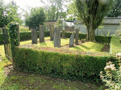
| Description | : | This cemetery is believed to be private property of the Nieuwendijk family. Burials occurred from 1870-1911. The cemetery is maintained by the municipality of Lingewaal. |
frequently asked questions (FAQ):
-
Where is Joodse Begraafplaats Asperen?
Joodse Begraafplaats Asperen is located at Oude Zuiderlingedijk Asperen, Lingewaal Municipality ,Gelderland , 4147 BPNetherlands.
-
Joodse Begraafplaats Asperen cemetery's updated grave count on graveviews.com?
0 memorials
-
Where are the coordinates of the Joodse Begraafplaats Asperen?
Latitude: 51.8870200
Longitude: 5.1013500
Nearby Cemetories:
1. Rooms Katholieke Begraafplaats St. Barbera
Leerdam Municipality, Netherlands
Coordinate: 51.8934994, 5.1083541
2. Algemene Begraafplaats
Leerdam, Leerdam Municipality, Netherlands
Coordinate: 51.8865484, 5.0789400
3. Joodse Begraafplaats Beesd
Beesd, Geldermalsen Municipality, Netherlands
Coordinate: 51.8986210, 5.1895010
4. Heicop General Cemetery
Hei- en Boeicop, Zederik Municipality, Netherlands
Coordinate: 51.9478600, 5.0672500
5. Zuilichem General Cemetery
Zuilichem, Zaltbommel Municipality, Netherlands
Coordinate: 51.8060400, 5.1354500
6. Gorinchem Old General Cemetery
Gorinchem, Gorinchem Municipality, Netherlands
Coordinate: 51.8379600, 4.9786700
7. Begraafplaats woudrichem
Woudrichem Municipality, Netherlands
Coordinate: 51.8142805, 4.9994250
8. Algemene Begraafplaats Haaften
Haaften, Neerijnen Municipality, Netherlands
Coordinate: 51.8186100, 5.2134100
9. Joodse Begraafplaats
Vianen Municipality, Netherlands
Coordinate: 51.9862400, 5.0874000
10. Vianen Protestant Cemetery
Vianen, Vianen Municipality, Netherlands
Coordinate: 51.9867800, 5.0891100
11. Begraafplaats Noordeloos
Noordeloos, Giessenlanden Municipality, Netherlands
Coordinate: 51.9050436, 4.9412288
12. Poederoijen Protestant Churchyard
Poederoijen, Zaltbommel Municipality, Netherlands
Coordinate: 51.7861200, 5.0784600
13. Giessen Nederlands Hervormd Cemetery
Giessen, Woudrichem Municipality, Netherlands
Coordinate: 51.7924700, 5.0370100
14. Ameide Nieuwe Begraafplaats
Ameide, Zederik Municipality, Netherlands
Coordinate: 51.9493470, 4.9665220
15. Andel oude Nederlands Hervormde begraafplaats
Andel, Woudrichem Municipality, Netherlands
Coordinate: 51.7838700, 5.0537100
16. Veen Nederlands Hervormd Cemetery
Veen, Aalburg Municipality, Netherlands
Coordinate: 51.7797400, 5.1072100
17. Begraafplaats Meteren
Meteren, Geldermalsen Municipality, Netherlands
Coordinate: 51.8686615, 5.2737818
18. Culemborg General Cemetery
Culemborg, Culemborg Municipality, Netherlands
Coordinate: 51.9632800, 5.2311300
19. Joodse begraafplaats Culemborg
Culemborg Municipality, Netherlands
Coordinate: 51.9626100, 5.2322500
20. Buurmalsen General Cemetery
Buurmalsen, Geldermalsen Municipality, Netherlands
Coordinate: 51.8873500, 5.2817100
21. Algemene Begraafplaats Waardenburg
Waardenburg, Neerijnen Municipality, Netherlands
Coordinate: 51.8359820, 5.2699709
22. Tull En 't Waal Protestant Cemetery
Tull en 't Waal, Houten Municipality, Netherlands
Coordinate: 52.0017900, 5.1330300
23. Vreeswijk Protestant Cemetery
Vreeswijk, Nieuwegein Municipality, Netherlands
Coordinate: 52.0048700, 5.0974600
24. Schalkwijk Protestant Churchyard
Schalkwijk, Houten Municipality, Netherlands
Coordinate: 51.9910100, 5.1933300