| Memorials | : | 0 |
| Location | : | Heradsbygd, Elverum kommune, Norway |
| Coordinate | : | 60.8228625, 11.6344067 |
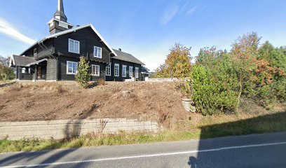
| Description | : | Heradsbygd cemetery was planned and talked about for many years before it finally became a reality. The cemetery was consecrated Sunday, August 27, 1995; it has since been extended. Heradsbygd church was in its time built as a house, to give Heradsbygd population a meeting place. The house was built by raised funds and is still owned by the local parish. It was taken into use as an assembly house (forsamlingshus) on December 28, 1895, but Heradsbygd parish wanted more. Later, the house was rebuilt /extended and consecrated to chapel December 28, 1911. In the... Read More |
frequently asked questions (FAQ):
-
Where is Heradsbygd kirkegård?
Heradsbygd kirkegård is located at Solørvegen 834 Heradsbygd, Elverum kommune ,Hedmark fylke , 2415Norway.
-
Heradsbygd kirkegård cemetery's updated grave count on graveviews.com?
0 memorials
-
Where are the coordinates of the Heradsbygd kirkegård?
Latitude: 60.8228625
Longitude: 11.6344067
Nearby Cemetories:
1. Elverum Churchyard
Elverum, Elverum kommune, Norway
Coordinate: 60.8776090, 11.5655730
2. Sørskogbygda Kirke Cemetery
Elverum, Elverum kommune, Norway
Coordinate: 60.9427210, 11.7735460
3. Løten Kirke Cemetery
Loten, Løten kommune, Norway
Coordinate: 60.8268950, 11.3172070
4. Nordskogbygda kirkegård
Elverum, Elverum kommune, Norway
Coordinate: 60.9925100, 11.6967500
5. Våler Cemetery
Våler i Solor, Våler kommune, Norway
Coordinate: 60.6726000, 11.8354300
6. Vallset kirkegård
Stange, Stange kommune, Norway
Coordinate: 60.7012600, 11.3286000
7. Romedal Kirkegård
Romedal, Stange kommune, Norway
Coordinate: 60.7517000, 11.2614400
8. Øvre Vang kirkegård
Hamar, Hamar kommune, Norway
Coordinate: 60.8458900, 11.2043400
9. Ottestad kirkegård
Ottestad, Stange kommune, Norway
Coordinate: 60.7573100, 11.1447300
10. Stange Church Cemetery
Stange, Stange kommune, Norway
Coordinate: 60.7098210, 11.1373780
11. Åsnes kirkegård
Kjellmyra, Åsnes kommune, Norway
Coordinate: 60.6100000, 11.9762940
12. Tangen kirkegård
Stange, Stange kommune, Norway
Coordinate: 60.6167300, 11.2653600
13. Hamar Kirkegaard
Hamar, Hamar kommune, Norway
Coordinate: 60.7991950, 11.0698420
14. Hol Cemetery
Hamar, Hamar kommune, Norway
Coordinate: 60.8154900, 11.0450600
15. Furnes kirkegård
Furnes, Ringsaker kommune, Norway
Coordinate: 60.8406000, 11.0217000
16. Hof Church Cemetery
Åsnes kommune, Norway
Coordinate: 60.5510204, 12.0178858
17. Åmot kirkegård
Rena, Åmot kommune, Norway
Coordinate: 61.1338610, 11.3726110
18. Brumunddal kirkegård
Brumunddal, Ringsaker kommune, Norway
Coordinate: 60.8845300, 10.9528000
19. Helgøya kirkegård
Nes, Ringsaker kommune, Norway
Coordinate: 60.7446645, 10.9585367
20. Nes kirkegård
Nes, Ringsaker kommune, Norway
Coordinate: 60.7625700, 10.9429500
21. Strandlykkja cemetery
Strandlykkja, Stange kommune, Norway
Coordinate: 60.5138100, 11.2472333
22. Balke Kirkegaard
Skreia, Østre Toten kommune, Norway
Coordinate: 60.6681415, 10.9499695
23. Nordre Gravplass Åsnes Finnskog
Velta, Åsnes kommune, Norway
Coordinate: 60.7082200, 12.3621400
24. Veldre kirkegård
Veldre, Ringsaker kommune, Norway
Coordinate: 60.9172800, 10.8907600

