
| Memorials | : | 0 |
| Location | : | St Albans, St Albans District, England |
| Coordinate | : | 51.7526990, -0.3405156 |
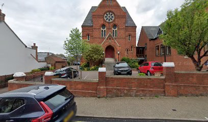
| Description | : | The church fellowship traces its beginnings back to about 1640, to the village of Kensworth, 11 miles distant. Dissenters from the established church met in private houses. By 1720 the St Albans congregation acquired a permanent home on Dagnall Lane, St Albans. The current Dagnall Street Baptist Church was built in 1885 on the same site, now called Upper Dagnall Street. There are records of 106 burials between 1822 and 1837. |
frequently asked questions (FAQ):
-
Where is Dagnall Lane Baptist Chapel?
Dagnall Lane Baptist Chapel is located at 1 Cross Street, St Albans, Herts St Albans, St Albans District ,Hertfordshire , AL3 5EEEngland.
-
Dagnall Lane Baptist Chapel cemetery's updated grave count on graveviews.com?
0 memorials
-
Where are the coordinates of the Dagnall Lane Baptist Chapel?
Latitude: 51.7526990
Longitude: -0.3405156
Nearby Cemetories:
1. Spicer Street Chapel Burial Ground
St Albans, St Albans District, England
Coordinate: 51.7523288, -0.3423231
2. Romeland Hill Garden of Rest
St Albans, St Albans District, England
Coordinate: 51.7514540, -0.3438830
3. Saint Alban's Cathedral
St Albans, St Albans District, England
Coordinate: 51.7504425, -0.3423680
4. St Peter's Churchyard
St Albans, St Albans District, England
Coordinate: 51.7555400, -0.3350270
5. St Michael’s Churchyard
St Albans, St Albans District, England
Coordinate: 51.7529540, -0.3560640
6. St. Stephen's Churchyard
St Albans, St Albans District, England
Coordinate: 51.7417450, -0.3483370
7. Hatfield Road Cemetery
St Albans, St Albans District, England
Coordinate: 51.7523003, -0.3192620
8. London Road Cemetery
St Albans, St Albans District, England
Coordinate: 51.7333610, -0.3066110
9. Childwickbury Manor
Childwickbury, St Albans District, England
Coordinate: 51.7809460, -0.3499100
10. St Mary Churchyard
Childwickbury, St Albans District, England
Coordinate: 51.7836980, -0.3473020
11. Frogmore Holy Trinity Burial Ground
St Albans District, England
Coordinate: 51.7197598, -0.3365342
12. Holy Trinity Churchyard
St Albans, St Albans District, England
Coordinate: 51.7170354, -0.3334244
13. St Leonard Churchyard & Extension
Sandridge, St Albans District, England
Coordinate: 51.7813690, -0.3036580
14. Sir David Yule Mausoleum
St Albans, St Albans District, England
Coordinate: 51.7024660, -0.3505190
15. Woodwells Cemetery
Hemel Hempstead, Dacorum Borough, England
Coordinate: 51.7576500, -0.4280300
16. Holy Trinity Churchyard
Leverstock Green, Dacorum Borough, England
Coordinate: 51.7466800, -0.4295770
17. St. Mary's Churchyard
Redbourn, St Albans District, England
Coordinate: 51.7916200, -0.4066100
18. East Lane Cemetery
Leavesden, Three Rivers District, England
Coordinate: 51.7084796, -0.4036263
19. Saint Bololph's Churchyard
Shenley, Hertsmere Borough, England
Coordinate: 51.7030296, -0.2890460
20. West Herts Crematorium
Watford, Watford Borough, England
Coordinate: 51.7004195, -0.3847509
21. Hill End Hospital Cemetery
St Albans, St Albans District, England
Coordinate: 51.6982051, -0.2901128
22. Wheathampstead United Churchyard
Wheathampstead, St Albans District, England
Coordinate: 51.8108170, -0.2972210
23. All Saints Churchyard
Watford Borough, England
Coordinate: 51.6954810, -0.3885560
24. St Nicholas Churchyard
Harpenden, St Albans District, England
Coordinate: 51.8169470, -0.3583300