
| Memorials | : | 0 |
| Location | : | Taylorsville, Smith County, USA |
| Coordinate | : | 31.9635580, -89.4432700 |
| Description | : | From Raleigh, Mississippi proceed South on Highway 35 (Hwy 35) for 2.75 miles to the intersection of Highway 37 (Hwy 37) and turn left (East.) Continue on Hwy 37 3.25 miles to the intersection of Smith County Road 97 (SCR 97) turn left on SCR 97 and continue 2.8 miles to the intersection of Smith County Road 93 (SCR 93) and turn right ((SouthEast.) Proceed three tenths of a mile on SCR 93 which places you at the driveway of a private residence. After obtaining permission to be on the property from the owner, proceed down the driveway 250 feet... Read More |
frequently asked questions (FAQ):
-
Where is Jefcoats-Farnham Cemetery?
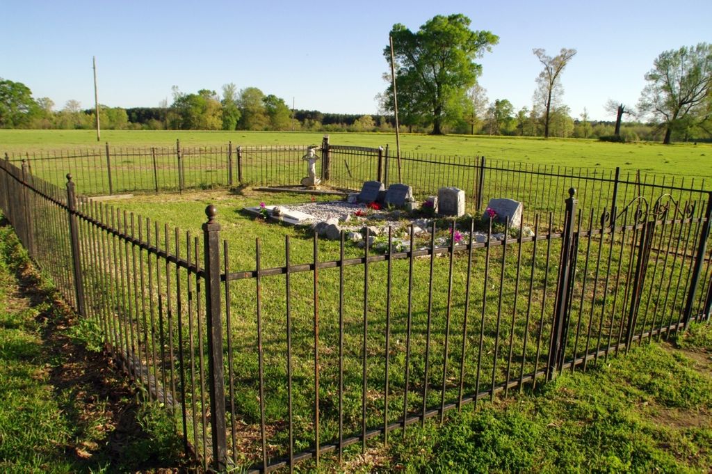
Jefcoats-Farnham Cemetery is located at 3754 Smith County Road 93 Taylorsville, Smith County ,Mississippi , 39168USA.
-
Jefcoats-Farnham Cemetery cemetery's updated grave count on graveviews.com?
0 memorials
-
Where are the coordinates of the Jefcoats-Farnham Cemetery?
Latitude: 31.9635580
Longitude: -89.4432700
Nearby Cemetories:
1. Beaver Dam Baptist Church Cemetery
Raleigh, Smith County, USA
Coordinate: 31.9677410, -89.4485110
2. New Bethel Baptist Church Cemetery
Taylorsville, Smith County, USA
Coordinate: 31.9504300, -89.4398900
3. Mineral Springs Missionary Baptist Cemetery
Taylorsville, Smith County, USA
Coordinate: 31.9522400, -89.4261900
4. Center Ridge Cemetery
Taylorsville, Smith County, USA
Coordinate: 31.9456710, -89.4705320
5. Unity Methodist Church Cemetery
Taylorsville, Smith County, USA
Coordinate: 31.9456500, -89.4735300
6. Walnut Grove Cemetery
Taylorsville, Smith County, USA
Coordinate: 31.9759370, -89.4069210
7. Bezer Cemetery
Raleigh, Smith County, USA
Coordinate: 31.9699993, -89.4894028
8. Hancock Cemetery
Mize, Smith County, USA
Coordinate: 31.9387610, -89.4847580
9. Bezer Cemetery West
Bezer, Smith County, USA
Coordinate: 31.9746170, -89.4928284
10. Hartley Cemetery
Raleigh, Smith County, USA
Coordinate: 32.0087250, -89.4264670
11. Jesus Name House of Prayer Cemetery
Raleigh, Smith County, USA
Coordinate: 32.0116790, -89.4280510
12. Moore Cemetery
Raleigh, Smith County, USA
Coordinate: 32.0132190, -89.4658840
13. Johnson Cemetery
Raleigh, Smith County, USA
Coordinate: 32.0146900, -89.4217500
14. Hancock Family Cemetery
Sylvarena, Smith County, USA
Coordinate: 31.9585680, -89.3775183
15. Speir Cemetery
Mize, Smith County, USA
Coordinate: 31.9158800, -89.4784100
16. McAlpin Cemetery
Raleigh, Smith County, USA
Coordinate: 31.9644900, -89.5182000
17. Tillson Cemetery
Mize, Smith County, USA
Coordinate: 31.9655800, -89.5187300
18. South Raleigh Christian Cemetery
Mize, Smith County, USA
Coordinate: 31.9650100, -89.5195300
19. Mount Pleasant Baptist Church Cemetery
Raleigh, Smith County, USA
Coordinate: 32.0228859, -89.4116950
20. Union Baptist Church Cemetery
Raleigh, Smith County, USA
Coordinate: 31.9799600, -89.5219900
21. Sylvarena Cemetery
Sylvarena, Smith County, USA
Coordinate: 32.0137200, -89.3793800
22. McCraw Cemetery
Taylorsville, Smith County, USA
Coordinate: 31.9390300, -89.3606500
23. Mount Zion Baptist Church Cemetery
Taylorsville, Smith County, USA
Coordinate: 31.8816700, -89.4463196
24. Double Church Cemetery
Raleigh, Smith County, USA
Coordinate: 32.0460420, -89.4574910