
| Memorials | : | 0 |
| Location | : | Raleigh, Smith County, USA |
| Coordinate | : | 32.0132190, -89.4658840 |
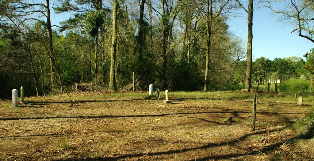
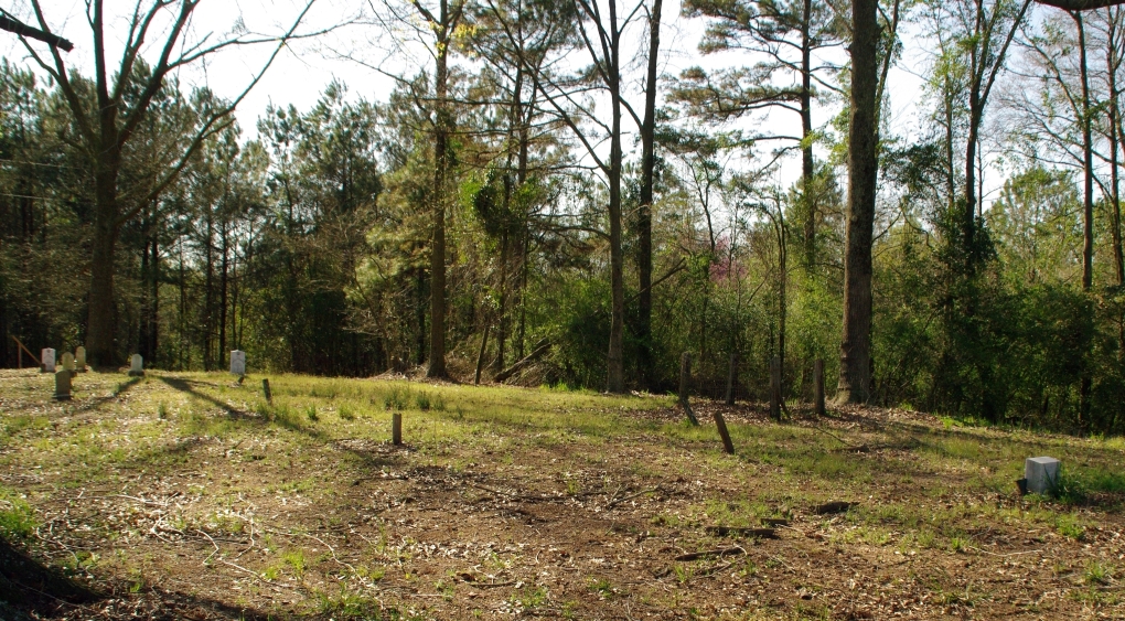
| Description | : | From Raleigh, MS proceed East on Mississippi Highway 18 (MS 18 aka Sylvarena Avenue) 3.9 miles to a dirt road on the Right (South) side of MS 18. The dirt road will be after you pass the intersection of Smith County Road 18-3 (SCR 18-3) and prior to passing the intersection of Smith County Road 93 (SCR 93.) There are no markings for this dirt road. Turn Right (South) onto the dirt toad and continue two tenths of a mile, cemetery will be on the Left (East) side of the road behind several chicken houses, specifically SE1/4 NW1/4, S15, T2N-R8E,... Read More |
frequently asked questions (FAQ):
-
Where is Moore Cemetery?
Moore Cemetery is located at Raleigh, Smith County ,Mississippi , 39153USA.
-
Moore Cemetery cemetery's updated grave count on graveviews.com?
0 memorials
-
Where are the coordinates of the Moore Cemetery?
Latitude: 32.0132190
Longitude: -89.4658840
Nearby Cemetories:
1. Jesus Name House of Prayer Cemetery
Raleigh, Smith County, USA
Coordinate: 32.0116790, -89.4280510
2. Double Church Cemetery
Raleigh, Smith County, USA
Coordinate: 32.0460420, -89.4574910
3. Hartley Cemetery
Raleigh, Smith County, USA
Coordinate: 32.0087250, -89.4264670
4. Johnson Cemetery
Raleigh, Smith County, USA
Coordinate: 32.0146900, -89.4217500
5. Eastside Baptist Church Cemetery
Raleigh, Smith County, USA
Coordinate: 32.0360600, -89.5063500
6. Bezer Cemetery West
Bezer, Smith County, USA
Coordinate: 31.9746170, -89.4928284
7. Lewis Harper Cemetery
Raleigh, Smith County, USA
Coordinate: 32.0396800, -89.5115600
8. Mount Pleasant Baptist Church Cemetery
Raleigh, Smith County, USA
Coordinate: 32.0228859, -89.4116950
9. Bezer Cemetery
Raleigh, Smith County, USA
Coordinate: 31.9699993, -89.4894028
10. Beaver Dam Baptist Church Cemetery
Raleigh, Smith County, USA
Coordinate: 31.9677410, -89.4485110
11. Turner Chapel Cemetery
Raleigh, Smith County, USA
Coordinate: 32.0474700, -89.5075300
12. Raleigh Cemetery
Raleigh, Smith County, USA
Coordinate: 32.0308500, -89.5229600
13. Jefcoats-Farnham Cemetery
Taylorsville, Smith County, USA
Coordinate: 31.9635580, -89.4432700
14. North Raleigh Cemetery
Raleigh, Smith County, USA
Coordinate: 32.0432140, -89.5222230
15. Union Baptist Church Cemetery
Raleigh, Smith County, USA
Coordinate: 31.9799600, -89.5219900
16. Walnut Grove Cemetery
Taylorsville, Smith County, USA
Coordinate: 31.9759370, -89.4069210
17. Tillson Cemetery
Mize, Smith County, USA
Coordinate: 31.9655800, -89.5187300
18. McAlpin Cemetery
Raleigh, Smith County, USA
Coordinate: 31.9644900, -89.5182000
19. South Raleigh Christian Cemetery
Mize, Smith County, USA
Coordinate: 31.9650100, -89.5195300
20. New Bethel Baptist Church Cemetery
Taylorsville, Smith County, USA
Coordinate: 31.9504300, -89.4398900
21. Center Ridge Cemetery
Taylorsville, Smith County, USA
Coordinate: 31.9456710, -89.4705320
22. Unity Methodist Church Cemetery
Taylorsville, Smith County, USA
Coordinate: 31.9456500, -89.4735300
23. Mount Pisgah Cemetery
Raleigh, Smith County, USA
Coordinate: 32.0589300, -89.5261100
24. Cedar Grove Methodist Church Cemetery
Raleigh, Smith County, USA
Coordinate: 32.0664100, -89.4145800