
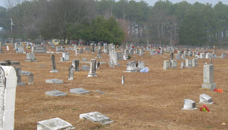
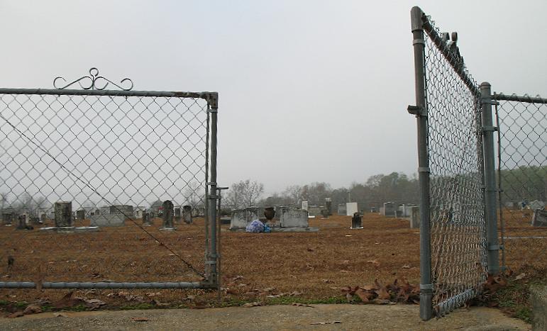
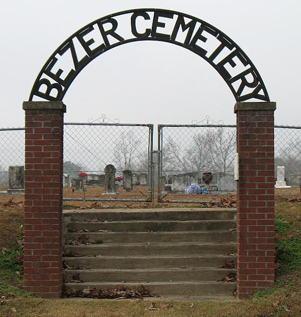
| Memorials | : | 0 |
| Location | : | Bezer, Smith County, USA |
| Coordinate | : | 31.9746170, -89.4928284 |
| Description | : | From Raleigh Mississippi proceed South on Highway 35 (Magnolia Drive,) for a distance of approximately two and three fourths miles to the intersection of Highway 37. Turn left (East) and proceed 2.6 miles on Hwy 37 to the intersection of Smith County Road 90 (SCR 90.) Turn right (West) and cemetery will be on your left (South,) specifically; NE1/4 NE1/4, S32, T2N-R8E, Smith, Center Ridge Quadrangle map, USNG: 16R BA 64441 40337. |
frequently asked questions (FAQ):
-
Where is Bezer Cemetery West?
Bezer Cemetery West is located at 2216 Smith County Road 90 Bezer, Smith County ,Mississippi , 39153USA.
-
Bezer Cemetery West cemetery's updated grave count on graveviews.com?
0 memorials
-
Where are the coordinates of the Bezer Cemetery West?
Latitude: 31.9746170
Longitude: -89.4928284
Nearby Cemetories:
1. Bezer Cemetery
Raleigh, Smith County, USA
Coordinate: 31.9699993, -89.4894028
2. Tillson Cemetery
Mize, Smith County, USA
Coordinate: 31.9655800, -89.5187300
3. McAlpin Cemetery
Raleigh, Smith County, USA
Coordinate: 31.9644900, -89.5182000
4. South Raleigh Christian Cemetery
Mize, Smith County, USA
Coordinate: 31.9650100, -89.5195300
5. Union Baptist Church Cemetery
Raleigh, Smith County, USA
Coordinate: 31.9799600, -89.5219900
6. Unity Methodist Church Cemetery
Taylorsville, Smith County, USA
Coordinate: 31.9456500, -89.4735300
7. Center Ridge Cemetery
Taylorsville, Smith County, USA
Coordinate: 31.9456710, -89.4705320
8. Hancock Cemetery
Mize, Smith County, USA
Coordinate: 31.9387610, -89.4847580
9. Beaver Dam Baptist Church Cemetery
Raleigh, Smith County, USA
Coordinate: 31.9677410, -89.4485110
10. Jefcoats-Farnham Cemetery
Taylorsville, Smith County, USA
Coordinate: 31.9635580, -89.4432700
11. Moore Cemetery
Raleigh, Smith County, USA
Coordinate: 32.0132190, -89.4658840
12. New Bethel Baptist Church Cemetery
Taylorsville, Smith County, USA
Coordinate: 31.9504300, -89.4398900
13. Easterling Cemetery
Raleigh, Smith County, USA
Coordinate: 32.0045300, -89.5485500
14. Speir Cemetery
Mize, Smith County, USA
Coordinate: 31.9158800, -89.4784100
15. Mineral Springs Missionary Baptist Cemetery
Taylorsville, Smith County, USA
Coordinate: 31.9522400, -89.4261900
16. Raleigh Cemetery
Raleigh, Smith County, USA
Coordinate: 32.0308500, -89.5229600
17. Wilkinson Memorial Baptist Cemetery
Raleigh, Smith County, USA
Coordinate: 31.9817700, -89.5653800
18. Eastside Baptist Church Cemetery
Raleigh, Smith County, USA
Coordinate: 32.0360600, -89.5063500
19. Hartley Cemetery
Raleigh, Smith County, USA
Coordinate: 32.0087250, -89.4264670
20. Jesus Name House of Prayer Cemetery
Raleigh, Smith County, USA
Coordinate: 32.0116790, -89.4280510
21. Lewis Harper Cemetery
Raleigh, Smith County, USA
Coordinate: 32.0396800, -89.5115600
22. Harmony Baptist Church Cemetery
Mize, Smith County, USA
Coordinate: 31.9184190, -89.5370930
23. Dry Ridge Church Cemetery
Mize, Smith County, USA
Coordinate: 31.9099860, -89.5295840
24. Johnson Cemetery
Raleigh, Smith County, USA
Coordinate: 32.0146900, -89.4217500