
| Memorials | : | 0 |
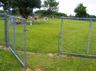
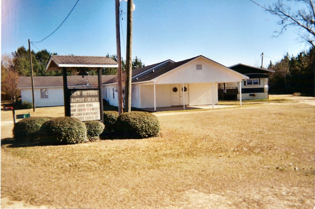
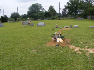
| Location | : | Taylorsville, Smith County, USA |
| Coordinate | : | 31.9504300, -89.4398900 |
| Description | : | From Taylorsville, MS proceed North on Misissippi Highway 37 (MS 37) 9.8 miles to the intersection of Smith County Road 82 (SCR 82 aka Mineral Springs Road.) Turn Right (East) onto SCR 82 and continue 2.6 miles, cemetery will be on Left (North) side of road, specifically NW1/4 SW1/4, S1, T1N-R8E, Smith, Center Ridge Quadrangle map, USNG 16R BA 69376 37519. |
frequently asked questions (FAQ):
-
Where is New Bethel Baptist Church Cemetery?
New Bethel Baptist Church Cemetery is located at 2624 Smith County Road 82 Taylorsville, Smith County ,Mississippi , 39168USA.
-
New Bethel Baptist Church Cemetery cemetery's updated grave count on graveviews.com?
0 memorials
-
Where are the coordinates of the New Bethel Baptist Church Cemetery?
Latitude: 31.9504300
Longitude: -89.4398900
Nearby Cemetories:
1. Mineral Springs Missionary Baptist Cemetery
Taylorsville, Smith County, USA
Coordinate: 31.9522400, -89.4261900
2. Jefcoats-Farnham Cemetery
Taylorsville, Smith County, USA
Coordinate: 31.9635580, -89.4432700
3. Beaver Dam Baptist Church Cemetery
Raleigh, Smith County, USA
Coordinate: 31.9677410, -89.4485110
4. Center Ridge Cemetery
Taylorsville, Smith County, USA
Coordinate: 31.9456710, -89.4705320
5. Unity Methodist Church Cemetery
Taylorsville, Smith County, USA
Coordinate: 31.9456500, -89.4735300
6. Walnut Grove Cemetery
Taylorsville, Smith County, USA
Coordinate: 31.9759370, -89.4069210
7. Hancock Cemetery
Mize, Smith County, USA
Coordinate: 31.9387610, -89.4847580
8. Bezer Cemetery
Raleigh, Smith County, USA
Coordinate: 31.9699993, -89.4894028
9. Speir Cemetery
Mize, Smith County, USA
Coordinate: 31.9158800, -89.4784100
10. Bezer Cemetery West
Bezer, Smith County, USA
Coordinate: 31.9746170, -89.4928284
11. Hancock Family Cemetery
Sylvarena, Smith County, USA
Coordinate: 31.9585680, -89.3775183
12. Hartley Cemetery
Raleigh, Smith County, USA
Coordinate: 32.0087250, -89.4264670
13. Jesus Name House of Prayer Cemetery
Raleigh, Smith County, USA
Coordinate: 32.0116790, -89.4280510
14. Johnson Cemetery
Raleigh, Smith County, USA
Coordinate: 32.0146900, -89.4217500
15. Moore Cemetery
Raleigh, Smith County, USA
Coordinate: 32.0132190, -89.4658840
16. McAlpin Cemetery
Raleigh, Smith County, USA
Coordinate: 31.9644900, -89.5182000
17. McCraw Cemetery
Taylorsville, Smith County, USA
Coordinate: 31.9390300, -89.3606500
18. Tillson Cemetery
Mize, Smith County, USA
Coordinate: 31.9655800, -89.5187300
19. Mount Zion Baptist Church Cemetery
Taylorsville, Smith County, USA
Coordinate: 31.8816700, -89.4463196
20. South Raleigh Christian Cemetery
Mize, Smith County, USA
Coordinate: 31.9650100, -89.5195300
21. Union Baptist Church Cemetery
Raleigh, Smith County, USA
Coordinate: 31.9799600, -89.5219900
22. Mount Pleasant Baptist Church Cemetery
Raleigh, Smith County, USA
Coordinate: 32.0228859, -89.4116950
23. Shady Grove Missionary Baptist Church Cemetery
Taylorsville, Smith County, USA
Coordinate: 31.9184100, -89.3563900
24. Sylvarena Cemetery
Sylvarena, Smith County, USA
Coordinate: 32.0137200, -89.3793800