
| Memorials | : | 0 |
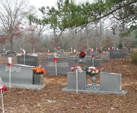
| Location | : | Taylorsville, Smith County, USA |
| Coordinate | : | 31.9456500, -89.4735300 |
| Description | : | From Taylorsville, MS proceed North on Mississippi Highway 37 (MS 37 aka Welcome street) 9 miles to the intersection of Smith County Road 80 (SCR 80.) Turn Right (East) onto SCR 80 and proceed 350 feet, Cemetery will be on the Left (North) side of the road specifically NW1/4 NW1/4, S10, T1N-R8E, Smith, Center Ridge Quadrangle map, 16R BA 66179 37061. Cemetery is well maintained. |
frequently asked questions (FAQ):
-
Where is Unity Methodist Church Cemetery?
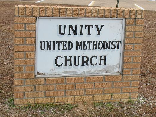
Unity Methodist Church Cemetery is located at 5113 Mississippi Highway 37 Taylorsville, Smith County ,Mississippi , 39168USA.
-
Unity Methodist Church Cemetery cemetery's updated grave count on graveviews.com?
0 memorials
-
Where are the coordinates of the Unity Methodist Church Cemetery?
Latitude: 31.9456500
Longitude: -89.4735300
Nearby Cemetories:
1. Center Ridge Cemetery
Taylorsville, Smith County, USA
Coordinate: 31.9456710, -89.4705320
2. Hancock Cemetery
Mize, Smith County, USA
Coordinate: 31.9387610, -89.4847580
3. Bezer Cemetery
Raleigh, Smith County, USA
Coordinate: 31.9699993, -89.4894028
4. New Bethel Baptist Church Cemetery
Taylorsville, Smith County, USA
Coordinate: 31.9504300, -89.4398900
5. Speir Cemetery
Mize, Smith County, USA
Coordinate: 31.9158800, -89.4784100
6. Beaver Dam Baptist Church Cemetery
Raleigh, Smith County, USA
Coordinate: 31.9677410, -89.4485110
7. Jefcoats-Farnham Cemetery
Taylorsville, Smith County, USA
Coordinate: 31.9635580, -89.4432700
8. Bezer Cemetery West
Bezer, Smith County, USA
Coordinate: 31.9746170, -89.4928284
9. Mineral Springs Missionary Baptist Cemetery
Taylorsville, Smith County, USA
Coordinate: 31.9522400, -89.4261900
10. McAlpin Cemetery
Raleigh, Smith County, USA
Coordinate: 31.9644900, -89.5182000
11. Tillson Cemetery
Mize, Smith County, USA
Coordinate: 31.9655800, -89.5187300
12. South Raleigh Christian Cemetery
Mize, Smith County, USA
Coordinate: 31.9650100, -89.5195300
13. Union Baptist Church Cemetery
Raleigh, Smith County, USA
Coordinate: 31.9799600, -89.5219900
14. Mozingo Cemetery
Smith County, USA
Coordinate: 31.9065342, -89.5250702
15. Dry Ridge Church Cemetery
Mize, Smith County, USA
Coordinate: 31.9099860, -89.5295840
16. Harmony Baptist Church Cemetery
Mize, Smith County, USA
Coordinate: 31.9184190, -89.5370930
17. Walnut Grove Cemetery
Taylorsville, Smith County, USA
Coordinate: 31.9759370, -89.4069210
18. Pleasant Home Primitive Baptist Church Cemetery
Mize, Smith County, USA
Coordinate: 31.8905300, -89.5131000
19. Moore Cemetery
Raleigh, Smith County, USA
Coordinate: 32.0132190, -89.4658840
20. Mount Zion Baptist Church Cemetery
Taylorsville, Smith County, USA
Coordinate: 31.8816700, -89.4463196
21. Fairmount Waco Cemetery
Mize, Smith County, USA
Coordinate: 31.9001100, -89.5419200
22. Hartley Cemetery
Raleigh, Smith County, USA
Coordinate: 32.0087250, -89.4264670
23. Jesus Name House of Prayer Cemetery
Raleigh, Smith County, USA
Coordinate: 32.0116790, -89.4280510
24. Johnson Cemetery
Raleigh, Smith County, USA
Coordinate: 32.0146900, -89.4217500