
| Memorials | : | 0 |
| Location | : | Raleigh, Smith County, USA |
| Coordinate | : | 32.0891991, -89.5432968 |
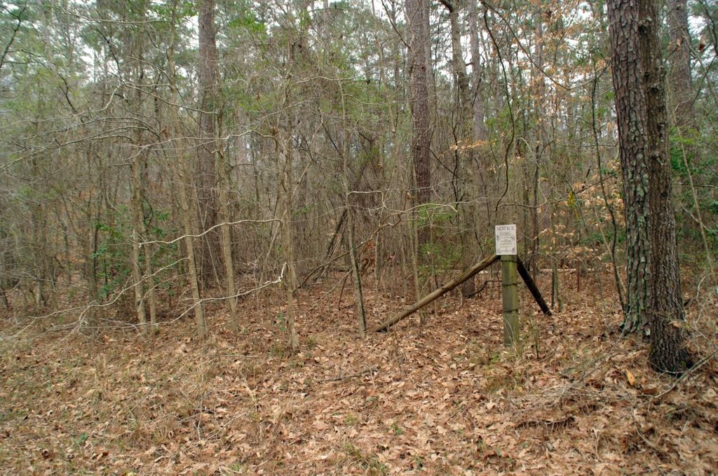
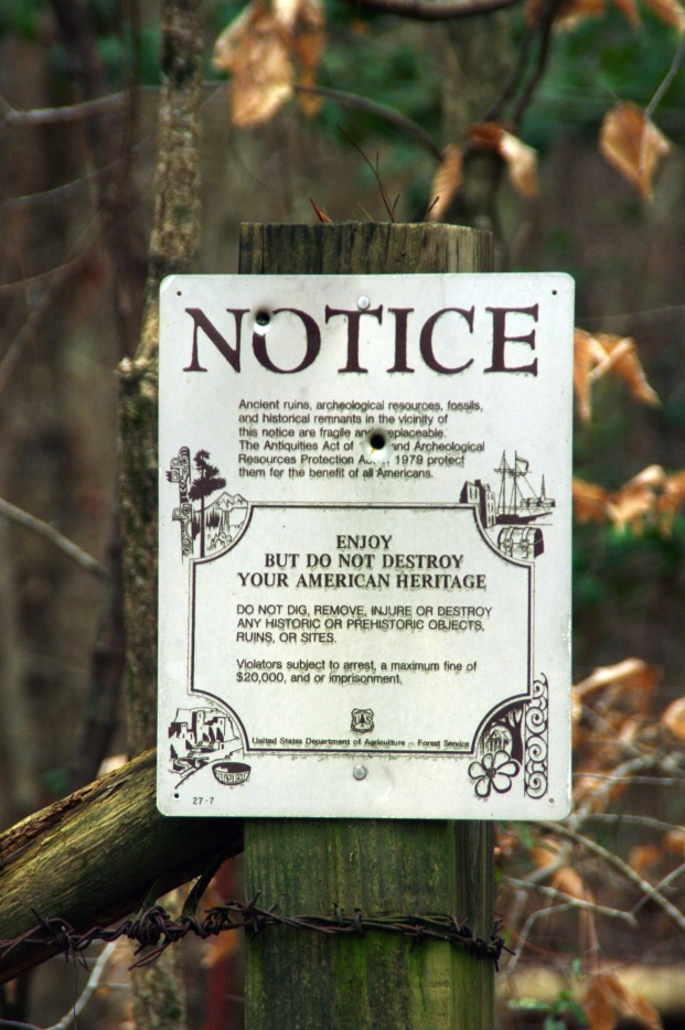
| Description | : | From Raleigh, Mississippi proceed North on Highway 35 approximately 5.6 miles to the intersection of US Forest Service Road 527 (FSR 527.) Turn left (West) and continue on FSR 527 fpr 4.2 miles, Page cemetery will be on the left (South) side of FSR 527. The cemetery area is surrounded by a barb wire fence and four corner markers proclaiming the area is protected by the Archeological Resources Protection Act of 1979. The actaul graves (only three remained as of 16 March, 2014) are approximately 80 feet South of the fence, specifically: NE1/4 NE1/4. S23, T3N-R7E, Smith, Raleigh Quadrangle map,... Read More |
frequently asked questions (FAQ):
-
Where is Page Cemetery?
Page Cemetery is located at US Forest Service Road 527 Raleigh, Smith County ,Mississippi , 39153USA.
-
Page Cemetery cemetery's updated grave count on graveviews.com?
0 memorials
-
Where are the coordinates of the Page Cemetery?
Latitude: 32.0891991
Longitude: -89.5432968
Nearby Cemetories:
1. Craft Cemetery
Smith County, USA
Coordinate: 32.0774994, -89.5460968
2. Austin Cemetery
Shongelo, Smith County, USA
Coordinate: 32.0875015, -89.5233002
3. Myers Cemetery
Raleigh, Smith County, USA
Coordinate: 32.0950012, -89.5730972
4. Sharon Baptist Church Cemetery
Raleigh, Smith County, USA
Coordinate: 32.0909100, -89.5740800
5. Barnes Cemetery
Raleigh, Smith County, USA
Coordinate: 32.0946999, -89.5068970
6. Mount Pisgah Cemetery
Raleigh, Smith County, USA
Coordinate: 32.0589300, -89.5261100
7. Henderson Family Cemetery
Smith County, USA
Coordinate: 32.1207008, -89.5181122
8. Boykin Church Cemetery
Raleigh, Smith County, USA
Coordinate: 32.0985177, -89.5898151
9. Burns United Methodist Church Cemetery
Burns, Smith County, USA
Coordinate: 32.1310501, -89.5399399
10. Gordan Cemetery
Raleigh, Smith County, USA
Coordinate: 32.0950012, -89.5935974
11. Barber Cemetery
Raleigh, Smith County, USA
Coordinate: 32.1321810, -89.5385960
12. Burns Baptist Church Cemetery
Raleigh, Smith County, USA
Coordinate: 32.1321880, -89.5384430
13. Moss Cemetery
Smith County, USA
Coordinate: 32.1063995, -89.5919037
14. Providence Cemetery
Burns, Smith County, USA
Coordinate: 32.1357400, -89.5528600
15. North Raleigh Cemetery
Raleigh, Smith County, USA
Coordinate: 32.0432140, -89.5222230
16. Turner Chapel Cemetery
Raleigh, Smith County, USA
Coordinate: 32.0474700, -89.5075300
17. Old Henderson Cemetery
Smith County, USA
Coordinate: 32.1199100, -89.4919700
18. High Hill Baptist Church Cemetery
Raleigh, Smith County, USA
Coordinate: 32.0860100, -89.4780800
19. Lewis Harper Cemetery
Raleigh, Smith County, USA
Coordinate: 32.0396800, -89.5115600
20. Trinity Methodist Cemetery
Raleigh, Smith County, USA
Coordinate: 32.0920600, -89.4753300
21. Moulder Cemetery
Smith County, USA
Coordinate: 32.1239014, -89.6007996
22. Raleigh Cemetery
Raleigh, Smith County, USA
Coordinate: 32.0308500, -89.5229600
23. Eastside Baptist Church Cemetery
Raleigh, Smith County, USA
Coordinate: 32.0360600, -89.5063500
24. Goodwater Baptist Church Cemetery
Smith County, USA
Coordinate: 32.1415200, -89.5027900