
| Memorials | : | 0 |
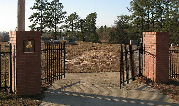
| Location | : | Raleigh, Smith County, USA |
| Coordinate | : | 32.0920600, -89.4753300 |
| Description | : | From Raleigh, MS proceed North on Mississippi Highway 35 (MS 35 aka Mimosa Drive) 4.9 miles to the intersection of Smith County Road 120 (SCR 120.) Turn Right onto SCR 120 and continue 2.6 miles, cemetery will be on Left (North) side of road specifically SE1/4 SE1/4, S16, T3N-R8E, Smith, Louin Southwest Quadrangle map USNG 16S BA 66383 53330. |
frequently asked questions (FAQ):
-
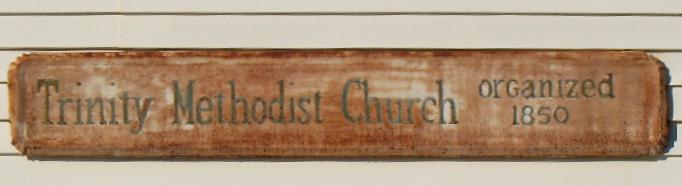
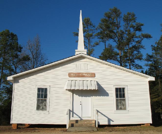
Where is Trinity Methodist Cemetery?
Trinity Methodist Cemetery is located at Smith County Road 120 Raleigh, Smith County ,Mississippi , 39152USA.
-
Trinity Methodist Cemetery cemetery's updated grave count on graveviews.com?
0 memorials
-
Where are the coordinates of the Trinity Methodist Cemetery?
Latitude: 32.0920600
Longitude: -89.4753300
Nearby Cemetories:
1. High Hill Baptist Church Cemetery
Raleigh, Smith County, USA
Coordinate: 32.0860100, -89.4780800
2. Mount Nebo Cemetery
Smith County, USA
Coordinate: 32.0951900, -89.4677200
3. Barnes Cemetery
Raleigh, Smith County, USA
Coordinate: 32.0946999, -89.5068970
4. Sylvan Grove Cemetery
Smith County, USA
Coordinate: 32.1137310, -89.4530439
5. Lemon Christian Cemetery
Raleigh, Smith County, USA
Coordinate: 32.1225570, -89.4748020
6. Old Henderson Cemetery
Smith County, USA
Coordinate: 32.1199100, -89.4919700
7. Mount Nebo Baptist Cemetery
Raleigh, Smith County, USA
Coordinate: 32.0981000, -89.4317400
8. Austin Cemetery
Shongelo, Smith County, USA
Coordinate: 32.0875015, -89.5233002
9. Henderson Family Cemetery
Smith County, USA
Coordinate: 32.1207008, -89.5181122
10. Double Church Cemetery
Raleigh, Smith County, USA
Coordinate: 32.0460420, -89.4574910
11. Turner Chapel Cemetery
Raleigh, Smith County, USA
Coordinate: 32.0474700, -89.5075300
12. Mount Pisgah Cemetery
Raleigh, Smith County, USA
Coordinate: 32.0589300, -89.5261100
13. Goodwater Baptist Church Cemetery
Smith County, USA
Coordinate: 32.1415200, -89.5027900
14. Royals & Webb Cemetery
Raleigh, Smith County, USA
Coordinate: 32.0932999, -89.4096985
15. Cedar Grove Methodist Church Cemetery
Raleigh, Smith County, USA
Coordinate: 32.0664100, -89.4145800
16. Page Cemetery
Raleigh, Smith County, USA
Coordinate: 32.0891991, -89.5432968
17. Lewis Harper Cemetery
Raleigh, Smith County, USA
Coordinate: 32.0396800, -89.5115600
18. Craft Cemetery
Smith County, USA
Coordinate: 32.0774994, -89.5460968
19. Eastside Baptist Church Cemetery
Raleigh, Smith County, USA
Coordinate: 32.0360600, -89.5063500
20. North Raleigh Cemetery
Raleigh, Smith County, USA
Coordinate: 32.0432140, -89.5222230
21. Russell - Boykin Cemetery
Smith County, USA
Coordinate: 32.1066472, -89.3997402
22. Burns Baptist Church Cemetery
Raleigh, Smith County, USA
Coordinate: 32.1321880, -89.5384430
23. Barber Cemetery
Raleigh, Smith County, USA
Coordinate: 32.1321810, -89.5385960
24. Burns United Methodist Church Cemetery
Burns, Smith County, USA
Coordinate: 32.1310501, -89.5399399