
| Memorials | : | 240 |
| Location | : | Marske, Richmondshire District, England |
| Coordinate | : | 54.3997500, -1.8403700 |
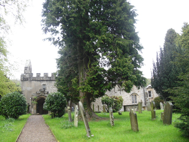
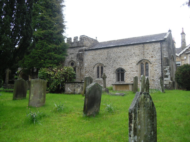
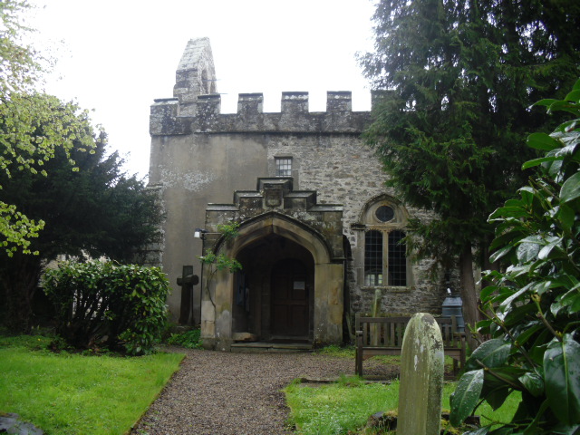
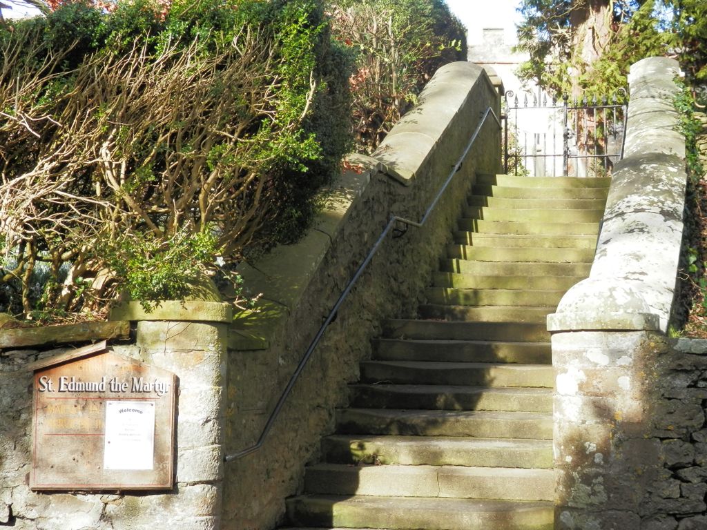
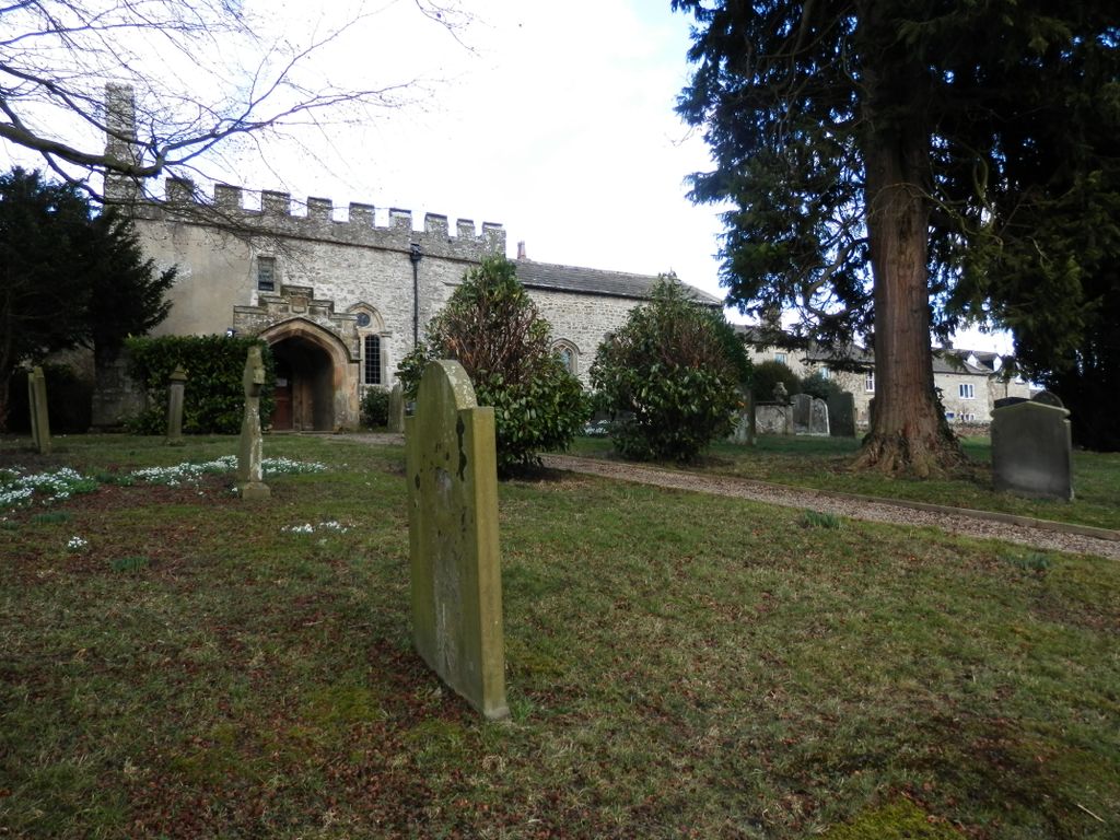
| Description | : | The Norman church was restored in the 17th century. The patronage of this church was in the family of Hutton since 1598 when Matthew Hutton, archbishop of York, purchased the estate. The parish registers, which began in 1578, are held at the North Yorkshire County Records Office , Northallerton The village of Marske is in the wapentake of Gilling West. It is approximately 5 miles due west of Richmond on the main road (A6108) from Richmond to Leyburn following the valley of the River Swale.Alternatively, there is a ' B ' road from Richmond which crosses the moor and drops down... Read More |
frequently asked questions (FAQ):
-
Where is St Edmund the Martyr Churchyard?
St Edmund the Martyr Churchyard is located at Marske, Richmondshire District ,North Yorkshire ,England.
-
St Edmund the Martyr Churchyard cemetery's updated grave count on graveviews.com?
3 memorials
-
Where are the coordinates of the St Edmund the Martyr Churchyard?
Latitude: 54.3997500
Longitude: -1.8403700
Nearby Cemetories:
1. St Michael and All Angels Churchyard
Downholme, Richmondshire District, England
Coordinate: 54.3799700, -1.8313400
2. St Michael and All Angels Churchyard
Hudswell, Richmondshire District, England
Coordinate: 54.3990300, -1.7846500
3. Marrick Priory Churchyard
Marrick, Richmondshire District, England
Coordinate: 54.3758830, -1.8977990
4. Richmond Cemetery
Richmond, Richmondshire District, England
Coordinate: 54.4053750, -1.7572010
5. Reeth and Grinton Cemetery
Grinton, Richmondshire District, England
Coordinate: 54.3800400, -1.9246700
6. St. Andrew's Churchyard
Grinton, Richmondshire District, England
Coordinate: 54.3812610, -1.9305740
7. Reeth Congregational Chapelyard
Reeth, Richmondshire District, England
Coordinate: 54.3878600, -1.9422700
8. St Mary the Virgin Churchyard
Richmond, Richmondshire District, England
Coordinate: 54.4046600, -1.7333700
9. St. Peter and St. Felix Churchyard
Kirby Hill, Richmondshire District, England
Coordinate: 54.4546050, -1.7851500
10. St John the Evangelist Churchyard
Bellerby, Richmondshire District, England
Coordinate: 54.3303200, -1.8239000
11. St Agatha Churchyard
Easby, Richmondshire District, England
Coordinate: 54.3976010, -1.7158320
12. Catterick Garrison Military Cemetery
Hipswell, Richmondshire District, England
Coordinate: 54.3803100, -1.7138300
13. St John The Evangelist Churchyard
Hipswell, Richmondshire District, England
Coordinate: 54.3798700, -1.7130100
14. St. Agatha and St. Oswin Churchyard
Gilling West, Richmondshire District, England
Coordinate: 54.4414840, -1.7209980
15. Leyburn Cemetery
Leyburn, Richmondshire District, England
Coordinate: 54.3093030, -1.8348630
16. St Oswald Churchyard
Hauxwell, Richmondshire District, England
Coordinate: 54.3333300, -1.7333300
17. St Michael and All Angels Churchyard
Barningham, Durham Unitary Authority, England
Coordinate: 54.4895190, -1.8691942
18. Langthwaite Wesleyan Methodist Chapelyard
Langthwaite, Richmondshire District, England
Coordinate: 54.4181000, -1.9958500
19. Preston Under Scar Cemetery
Preston-under-Scar, Richmondshire District, England
Coordinate: 54.3133800, -1.8964000
20. St. Mary the Virgin Churchyard
Langthwaite, Richmondshire District, England
Coordinate: 54.4195260, -1.9967580
21. Church of Saint Mary the Virgin Graveyard
Arkengarthdale, Richmondshire District, England
Coordinate: 54.4225063, -2.0013365
22. Wensley Cemetery
Wensley, Richmondshire District, England
Coordinate: 54.3013320, -1.8568169
23. Holy Trinity Churchyard
Wensley, Richmondshire District, England
Coordinate: 54.3014000, -1.8600000
24. St Mary Churchyard
Redmire, Richmondshire District, England
Coordinate: 54.3126200, -1.9227400