
| Memorials | : | 315 |
| Location | : | El Dorado Hills, El Dorado County, USA |
| Coordinate | : | 38.6986084, -121.1093521 |
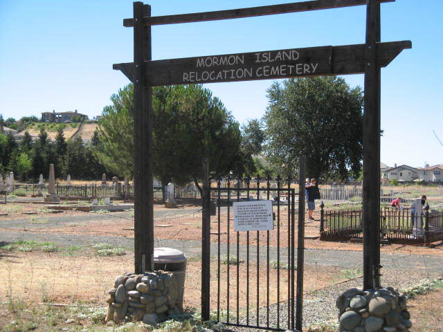
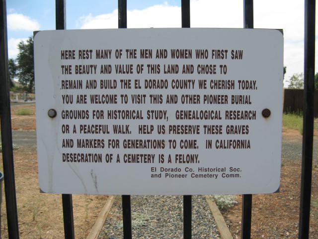
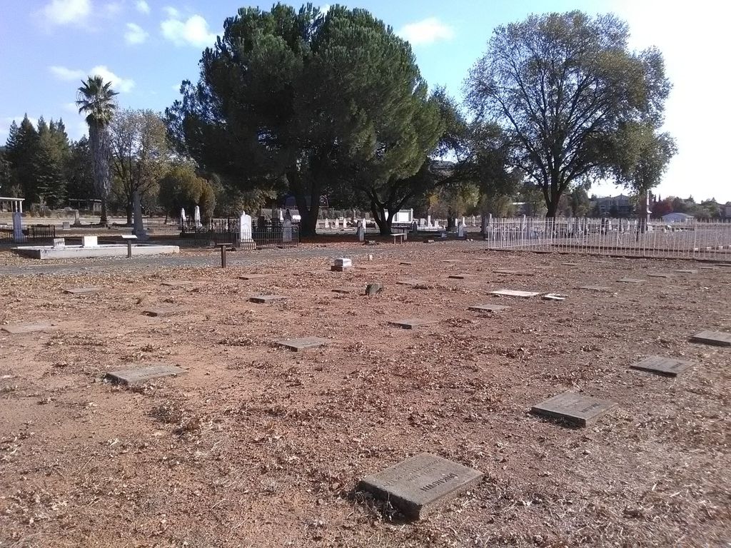
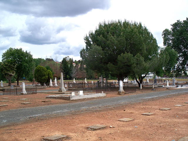
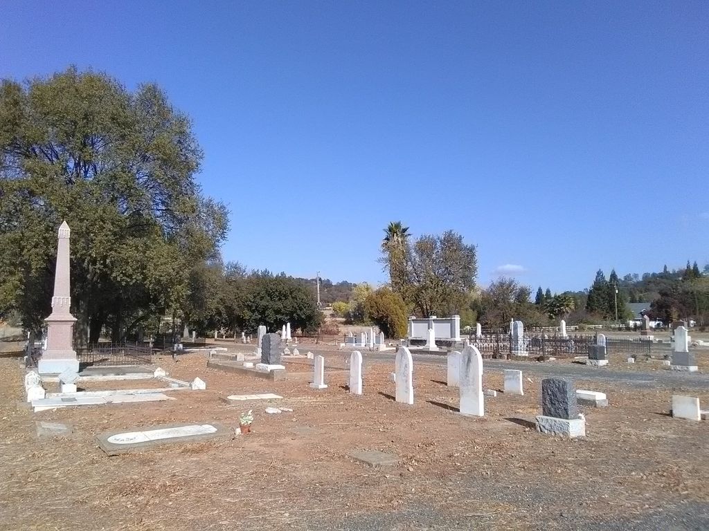
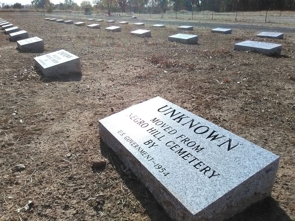
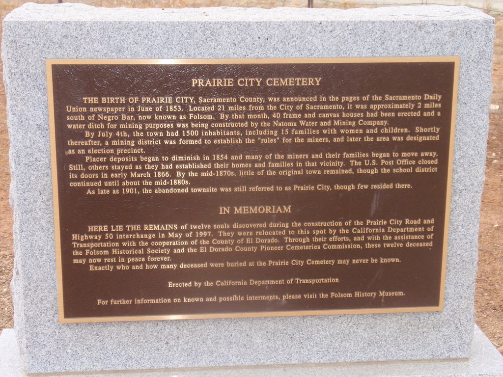
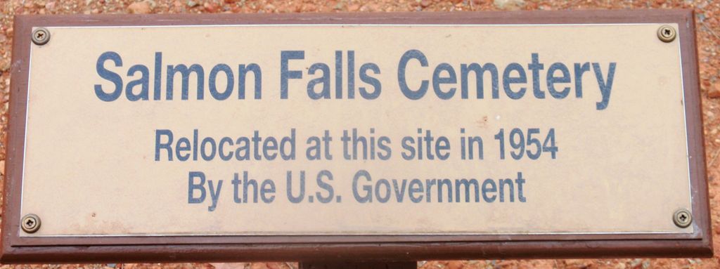
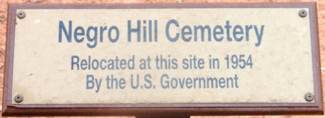
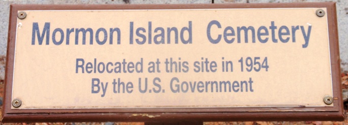
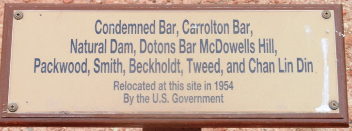
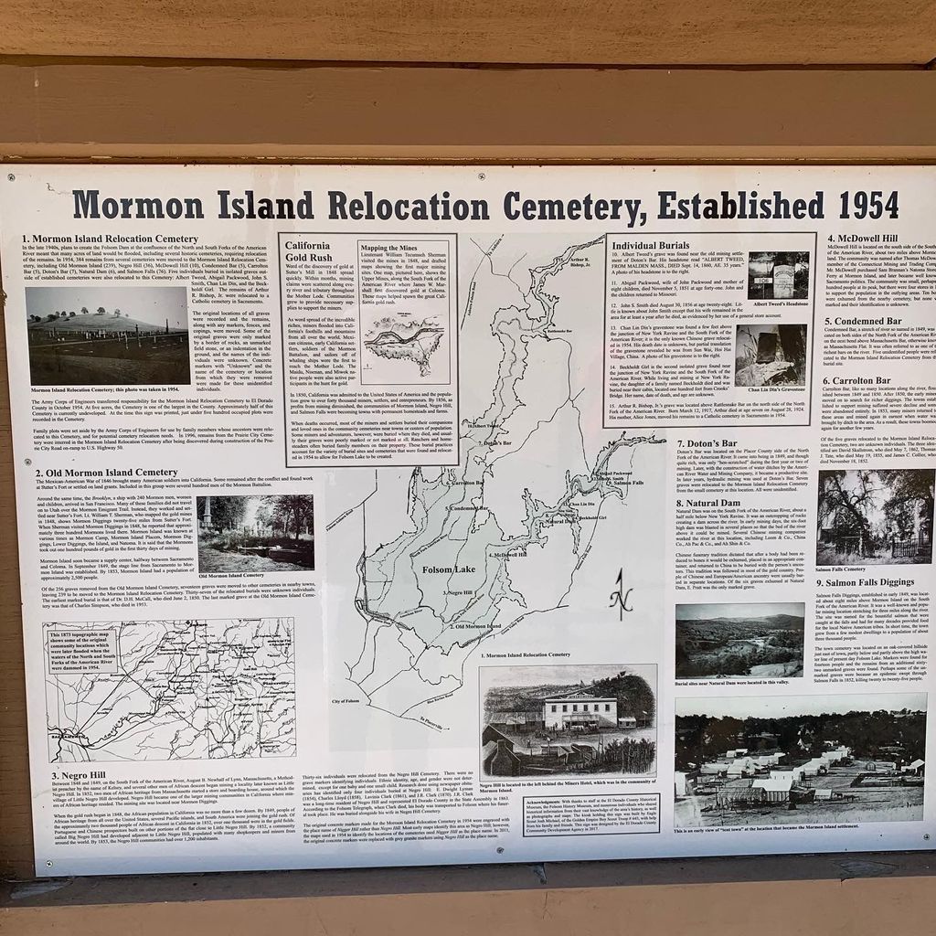
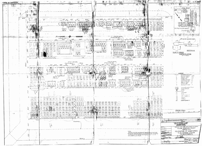
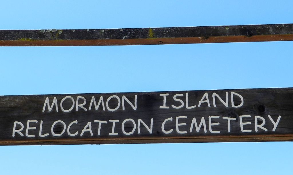
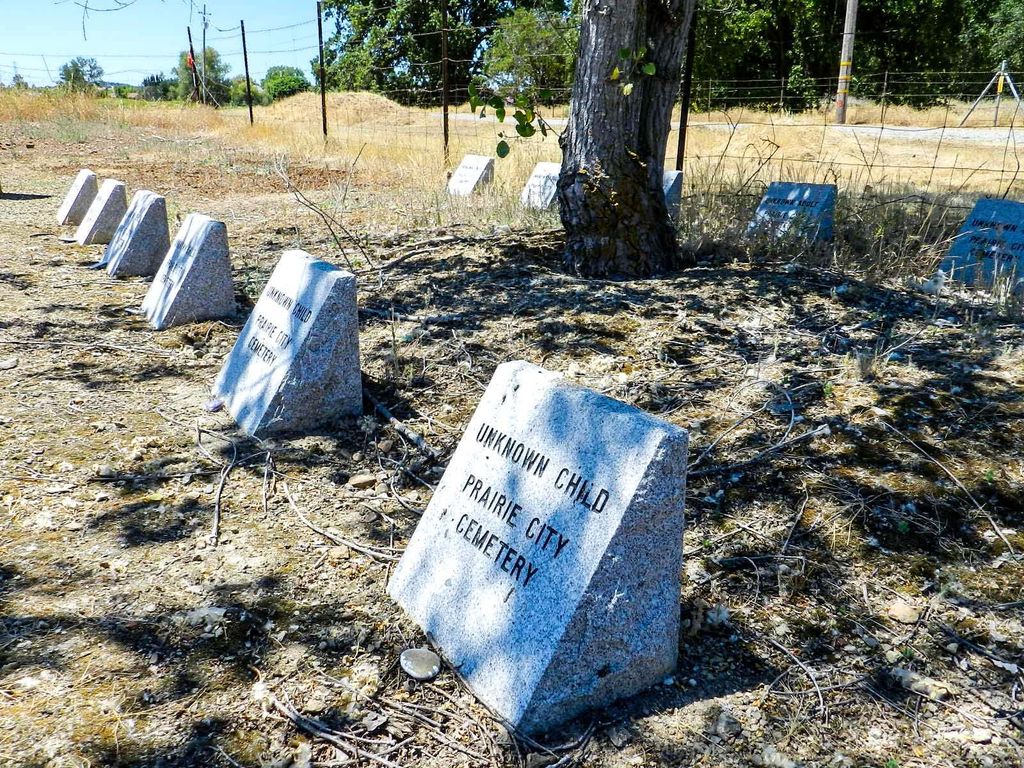
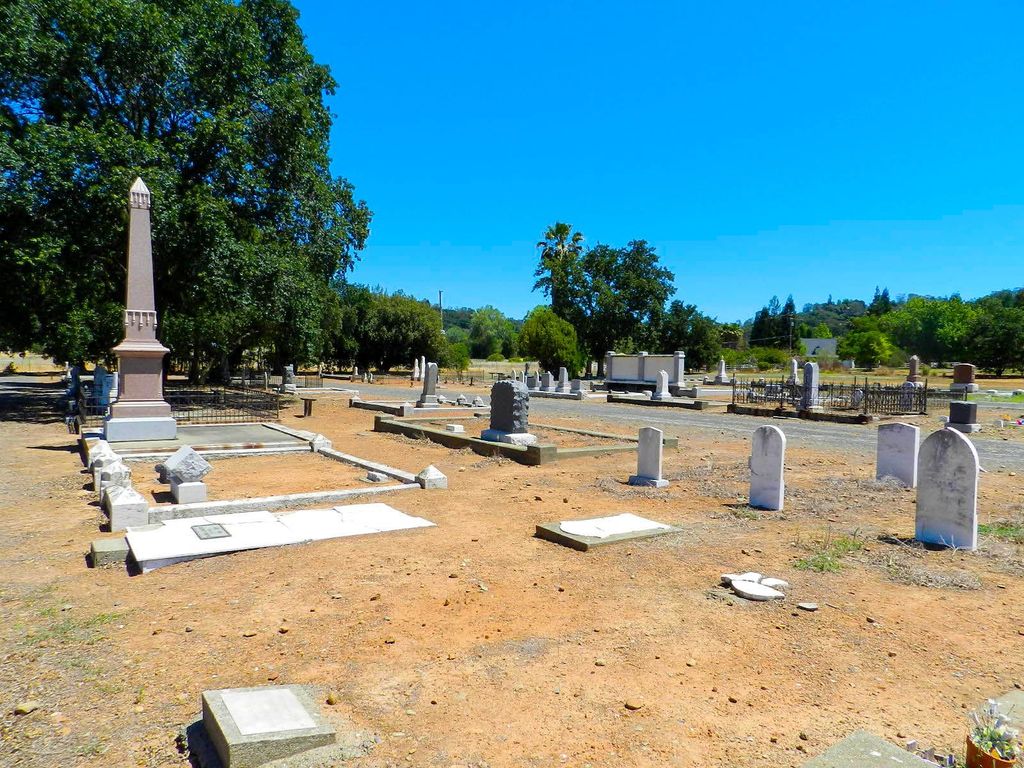
| Description | : | History: Mormon Island Relocation Cemetery was created in 1954 by the Army Corps of Engineers to replace the cemeteries at Salmon Falls, Negro Hill, Condemned Bar, McDowell's Hill, and Natural Dam in El Dorado County, the cemeteries at Dolton's Bar and Carrollton Bar in Placer County and Mormon Island in Sacramento County which were submerged below Folsom Lake when the Folsom Dam was built. Responsibility for the Mormon Island Cemetery was taken over by El Dorado County from the Army Corps of Engineers in October of 1954. Five individual graves were also relocated from various locations to the new Mormon Island... Read More |
frequently asked questions (FAQ):
-
Where is Mormon Island Relocation Cemetery?
Mormon Island Relocation Cemetery is located at 2547 Shadowfax Lane El Dorado Hills, El Dorado County ,California , 95762USA.
-
Mormon Island Relocation Cemetery cemetery's updated grave count on graveviews.com?
315 memorials
-
Where are the coordinates of the Mormon Island Relocation Cemetery?
Latitude: 38.6986084
Longitude: -121.1093521
Nearby Cemetories:
1. Folsom Prison Cemetery
Folsom, Sacramento County, USA
Coordinate: 38.6952860, -121.1636690
2. Clarksville Cemetery
Clarksville, El Dorado County, USA
Coordinate: 38.6546707, -121.0615387
3. Railroad House Cemetery
Clarksville, El Dorado County, USA
Coordinate: 38.6575699, -121.0516129
4. Saint John the Baptist Catholic Church Cemetery
Folsom, Sacramento County, USA
Coordinate: 38.6721900, -121.1803000
5. F.O.E. 929 Cemetery
Folsom, Sacramento County, USA
Coordinate: 38.6717010, -121.1801010
6. Young Wo Cemetery
Folsom, Sacramento County, USA
Coordinate: 38.6733400, -121.1835000
7. Lakeside Memorial Lawn Cemetery
Folsom, Sacramento County, USA
Coordinate: 38.6715300, -121.1841000
8. China Mission-Chung Wah Chinese Cemetery
Folsom, Sacramento County, USA
Coordinate: 38.6698410, -121.1851790
9. Rust Family Gravesite
Cameron Park, El Dorado County, USA
Coordinate: 38.6980160, -121.0207130
10. Morrison Ranch Family Cemetery
Clarksville, El Dorado County, USA
Coordinate: 38.6552887, -121.0368500
11. Green Valley Cemetery
Rescue, El Dorado County, USA
Coordinate: 38.6993790, -121.0081406
12. Saint Michaels Catholic Cemetery
Cameron Park, El Dorado County, USA
Coordinate: 38.6995010, -120.9985886
13. Skinner Ranch Cemetery
Cameron Park, El Dorado County, USA
Coordinate: 38.6981812, -120.9972763
14. Prosser Family Cemetery
Loomis, Placer County, USA
Coordinate: 38.8071900, -121.1285600
15. Shepherd of the Sierra Memorial Garden
Loomis, Placer County, USA
Coordinate: 38.7890800, -121.1944200
16. Litten-McDonald Cemetery
Rescue, El Dorado County, USA
Coordinate: 38.7078750, -120.9628310
17. Mansur Family Cemetery
Loomis, Placer County, USA
Coordinate: 38.8139600, -121.1214000
18. Mount Vernon Memorial Park
Fair Oaks, Sacramento County, USA
Coordinate: 38.6800003, -121.2566986
19. Duroc House Cemetery
Shingle Springs, El Dorado County, USA
Coordinate: 38.6528860, -120.9701690
20. Rattlesnake Bar Graveyard
Auburn, Placer County, USA
Coordinate: 38.8163050, -121.0895100
21. Jayhawk Cemetery
Rescue, El Dorado County, USA
Coordinate: 38.7308006, -120.9627991
22. Rocklin Cemetery
Rocklin, Placer County, USA
Coordinate: 38.7827670, -121.2337980
23. Rose Springs Cemetery
Rescue, El Dorado County, USA
Coordinate: 38.7146150, -120.9398390
24. Boothill Cemetery
Roseville, Placer County, USA
Coordinate: 38.7598730, -121.2712130