
| Memorials | : | 13 |
| Location | : | Folsom, Sacramento County, USA |
| Coordinate | : | 38.6952860, -121.1636690 |
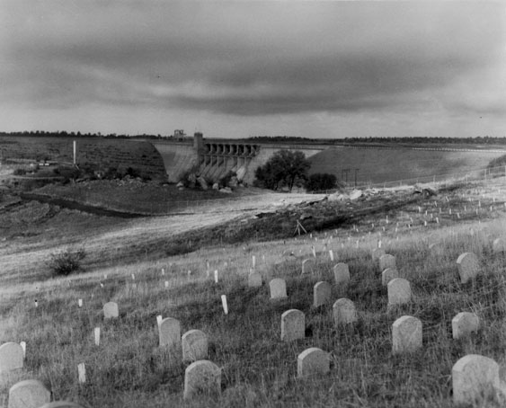
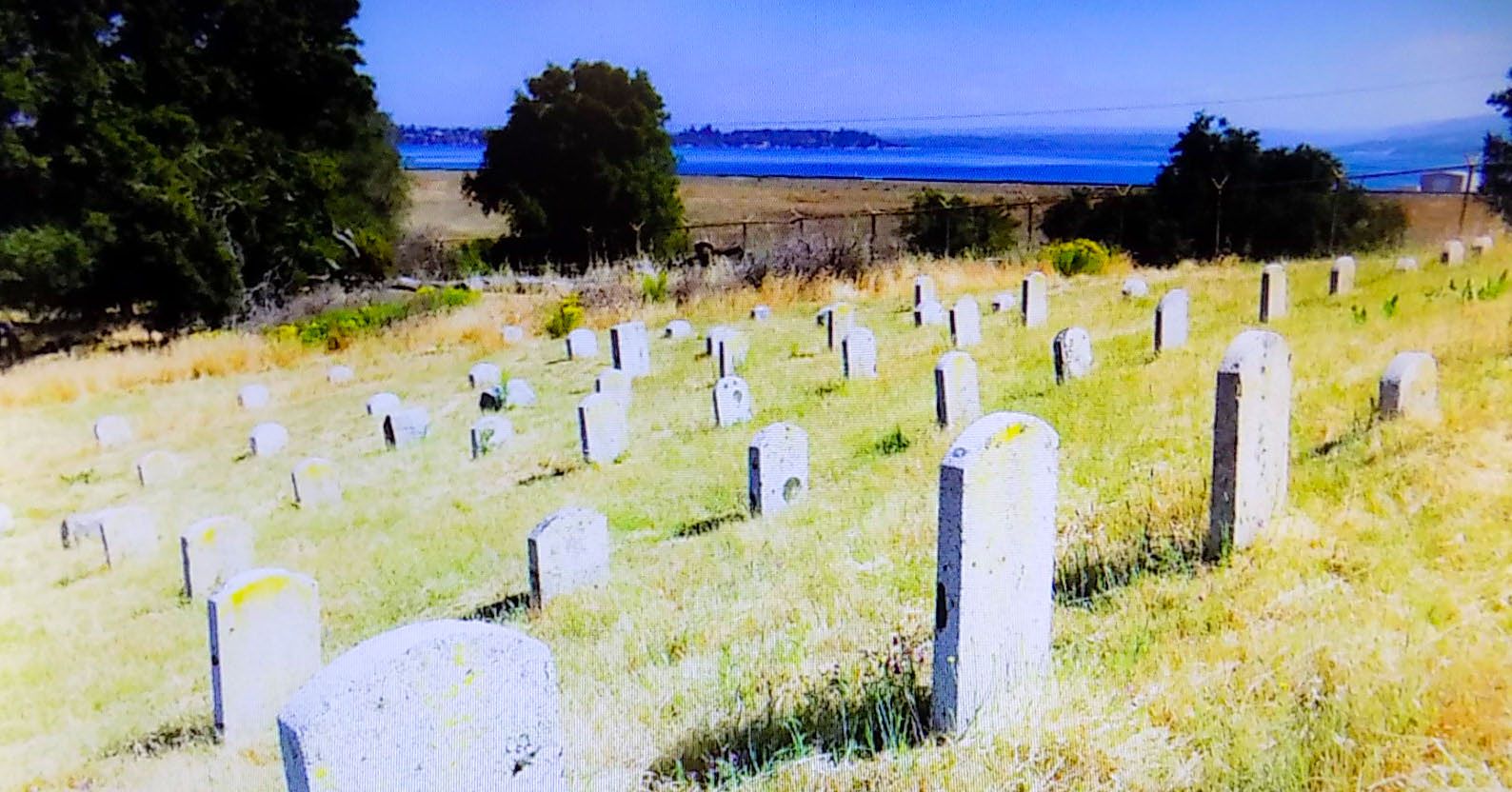
| Description | : | The Folsom Prison Cemetery was used from 1880 through 1959 with over 600 men buried there. The original location of the burial grounds was about a quarter of a mile above what is now Folsom Dam. In 1896 floodwaters swept coffins into the river, dislodging the corpses from their pine boxes. Prison officials then interred the remains in a new spot, about a half mile uphill from the original burial grounds. In 1913 the remains were exhumed and reburied at their present site which is another half mile uphill. Because the cemetery is next to a rifle range, visitors are... Read More |
frequently asked questions (FAQ):
-
Where is Folsom Prison Cemetery?
Folsom Prison Cemetery is located at 300 Prison Road Folsom, Sacramento County ,California , 95671USA.
-
Folsom Prison Cemetery cemetery's updated grave count on graveviews.com?
10 memorials
-
Where are the coordinates of the Folsom Prison Cemetery?
Latitude: 38.6952860
Longitude: -121.1636690
Nearby Cemetories:
1. Saint John the Baptist Catholic Church Cemetery
Folsom, Sacramento County, USA
Coordinate: 38.6721900, -121.1803000
2. F.O.E. 929 Cemetery
Folsom, Sacramento County, USA
Coordinate: 38.6717010, -121.1801010
3. Young Wo Cemetery
Folsom, Sacramento County, USA
Coordinate: 38.6733400, -121.1835000
4. Lakeside Memorial Lawn Cemetery
Folsom, Sacramento County, USA
Coordinate: 38.6715300, -121.1841000
5. China Mission-Chung Wah Chinese Cemetery
Folsom, Sacramento County, USA
Coordinate: 38.6698410, -121.1851790
6. Mormon Island Relocation Cemetery
El Dorado Hills, El Dorado County, USA
Coordinate: 38.6986084, -121.1093521
7. Mount Vernon Memorial Park
Fair Oaks, Sacramento County, USA
Coordinate: 38.6800003, -121.2566986
8. Clarksville Cemetery
Clarksville, El Dorado County, USA
Coordinate: 38.6546707, -121.0615387
9. Railroad House Cemetery
Clarksville, El Dorado County, USA
Coordinate: 38.6575699, -121.0516129
10. Shepherd of the Sierra Memorial Garden
Loomis, Placer County, USA
Coordinate: 38.7890800, -121.1944200
11. Sylvan Cemetery
Citrus Heights, Sacramento County, USA
Coordinate: 38.7001534, -121.2904587
12. Fair Oaks Cemetery
Fair Oaks, Sacramento County, USA
Coordinate: 38.6501167, -121.2792000
13. Fair Oaks United Methodist Church Memorial Garden
Fair Oaks, Sacramento County, USA
Coordinate: 38.6396300, -121.2744600
14. Rocklin Cemetery
Rocklin, Placer County, USA
Coordinate: 38.7827670, -121.2337980
15. Boothill Cemetery
Roseville, Placer County, USA
Coordinate: 38.7598730, -121.2712130
16. Roseville Public Cemetery District
Roseville, Placer County, USA
Coordinate: 38.7606010, -121.2707977
17. Morrison Ranch Family Cemetery
Clarksville, El Dorado County, USA
Coordinate: 38.6552887, -121.0368500
18. Rust Family Gravesite
Cameron Park, El Dorado County, USA
Coordinate: 38.6980160, -121.0207130
19. Prosser Family Cemetery
Loomis, Placer County, USA
Coordinate: 38.8071900, -121.1285600
20. Green Valley Cemetery
Rescue, El Dorado County, USA
Coordinate: 38.6993790, -121.0081406
21. Mansur Family Cemetery
Loomis, Placer County, USA
Coordinate: 38.8139600, -121.1214000
22. Calvary Catholic Cemetery and Mausoleum
Sacramento, Sacramento County, USA
Coordinate: 38.6937180, -121.3233109
23. Kilgore Cemetery
Rancho Cordova, Sacramento County, USA
Coordinate: 38.5978012, -121.2683029
24. Sierra Hills Memorial Park
Sacramento, Sacramento County, USA
Coordinate: 38.6843987, -121.3281021