
| Memorials | : | 2 |
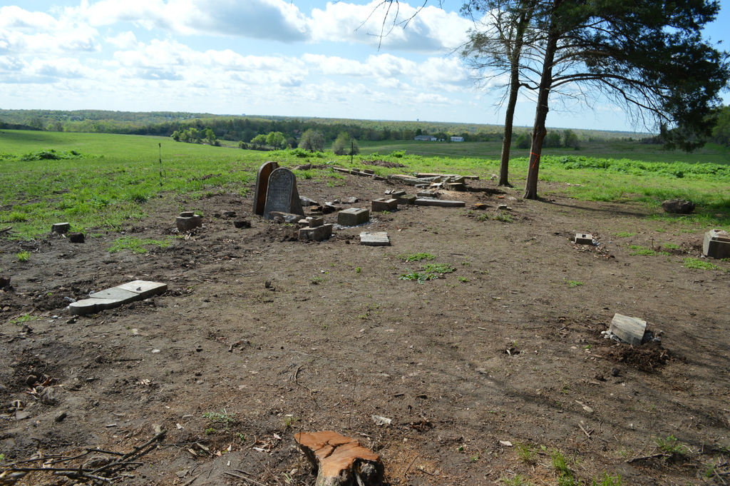
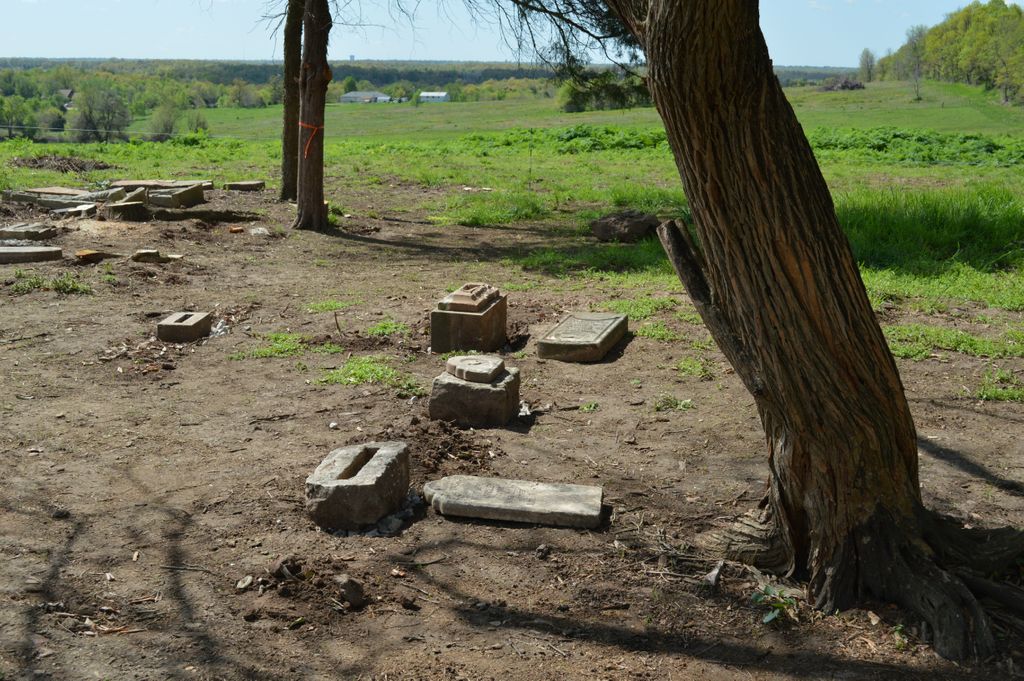
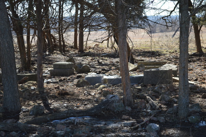
| Location | : | Greene County, USA |
| Coordinate | : | 37.3111110, -93.3197520 |
| Description | : | To get there, take N. Kansas Expressway north (13 hwy) from Kearney (744) to the O hwy exit (approximately 5.4 miles) exit to the east on O hwy and continue straight on to Austin Lane. Continue east on Austin lane (approximately .4miles) when the road turns sharply to the north, there is a small drive/parking area in front of a green gate. From here, you cross the gate and the cemetery is in a small stand of trees straight ahead of you. This cemetery is on private land in a cattle field surrounded by an electrified fence. Contact property owner. |
frequently asked questions (FAQ):
-
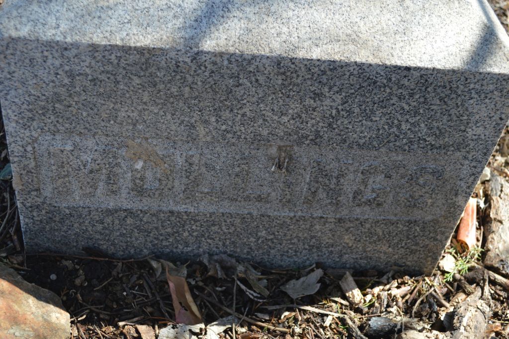
Where is Mullings Family Cemetery?
Mullings Family Cemetery is located at Greene County ,Missouri ,USA.
-
Mullings Family Cemetery cemetery's updated grave count on graveviews.com?
2 memorials
-
Where are the coordinates of the Mullings Family Cemetery?
Latitude: 37.3111110
Longitude: -93.3197520
Nearby Cemetories:
1. Wilson Cemetery
Robberson Number 2 Township, Greene County, USA
Coordinate: 37.2894530, -93.3388070
2. Sac River Cemetery AKA Slave Cemetery
Robberson Number 2 Township, Greene County, USA
Coordinate: 37.2898990, -93.3398060
3. Banfield Cemetery
Greene County, USA
Coordinate: 37.2779400, -93.3071900
4. Robberson Prairie Cemetery
Ebenezer, Greene County, USA
Coordinate: 37.3522600, -93.3366900
5. Bellview Cemetery
Springfield, Greene County, USA
Coordinate: 37.2880287, -93.2539215
6. Mount Comfort Cemetery
Springfield, Greene County, USA
Coordinate: 37.3250010, -93.2475450
7. Greenlawn Memorial Gardens
Springfield, Greene County, USA
Coordinate: 37.2611008, -93.2750015
8. Dysart Cemetery
Springfield, Greene County, USA
Coordinate: 37.2516020, -93.2913170
9. Antioch Cemetery
Springfield, Greene County, USA
Coordinate: 37.2505989, -93.3538971
10. Doling Park
Springfield, Greene County, USA
Coordinate: 37.2461815, -93.2902374
11. Old Salem Cemetery
Springfield, Greene County, USA
Coordinate: 37.3558006, -93.2380981
12. Friends of the Family Pet Memorial Gardens
Springfield, Greene County, USA
Coordinate: 37.2323600, -93.3673400
13. Alms House Cemetery
Springfield, Greene County, USA
Coordinate: 37.2319720, -93.3712130
14. Wesley Cemetery
Willard, Greene County, USA
Coordinate: 37.3260994, -93.4328003
15. Union Campground Cemetery
Springfield, Greene County, USA
Coordinate: 37.2609400, -93.2234000
16. Hughes Cemetery
Willard, Greene County, USA
Coordinate: 37.2871200, -93.4334600
17. Resurrection Cemetery
Springfield, Greene County, USA
Coordinate: 37.2276200, -93.3747550
18. Liberty Cemetery
Springfield, Greene County, USA
Coordinate: 37.3192000, -93.1993900
19. Murray Cemetery
Willard, Greene County, USA
Coordinate: 37.2872009, -93.4377975
20. New Hope Cemetery
Fruitland, Greene County, USA
Coordinate: 37.4006004, -93.2589035
21. White Chapel Memorial Gardens
Springfield, Greene County, USA
Coordinate: 37.2252998, -93.3906021
22. Hancock-Morton-Westmoreland Cemetery
Greene County, USA
Coordinate: 37.2489014, -93.2133026
23. Keet Burial
Springfield, Greene County, USA
Coordinate: 37.2069190, -93.2883940
24. Christ Episcopal Church Columbarium
Springfield, Greene County, USA
Coordinate: 37.2071800, -93.2862800