
| Memorials | : | 0 |
| Location | : | Robberson Number 2 Township, Greene County, USA |
| Coordinate | : | 37.2898990, -93.3398060 |
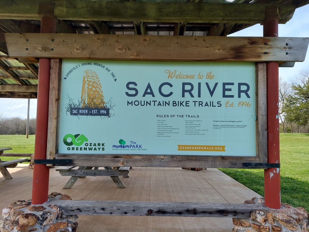
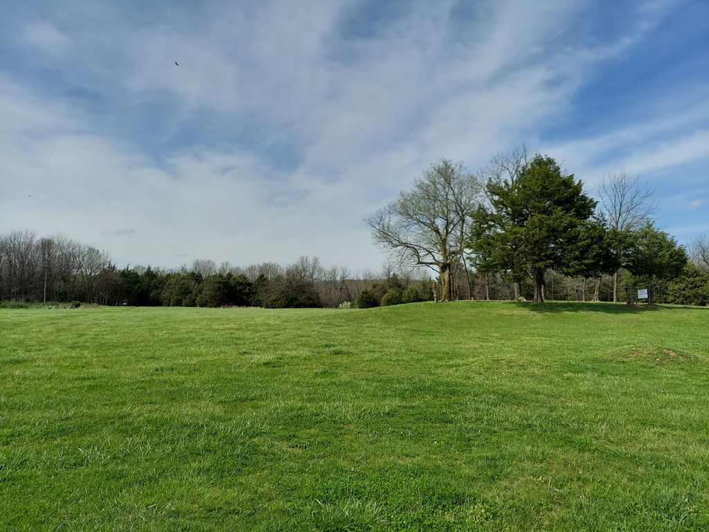
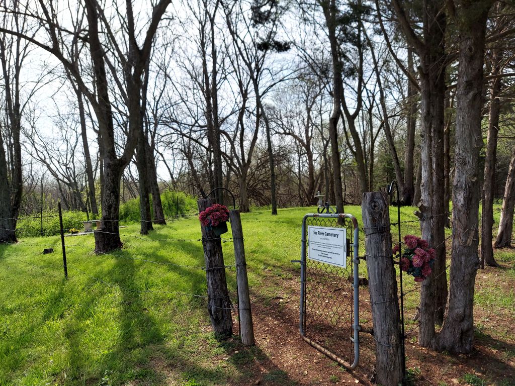
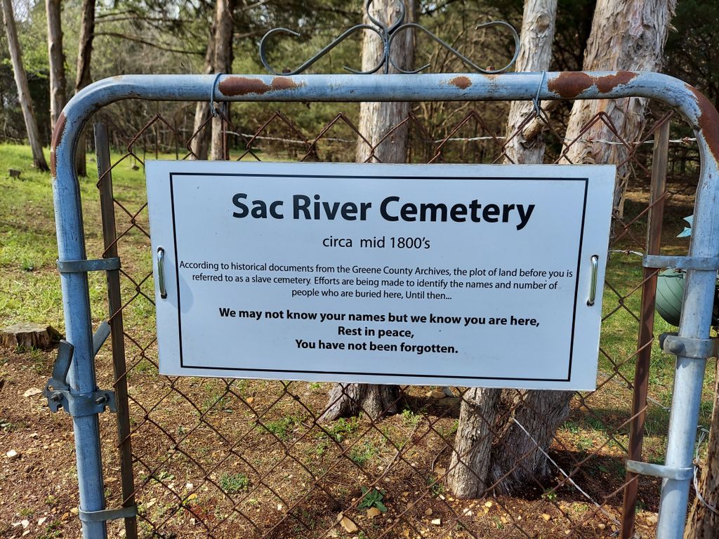
| Description | : | This was a Slave Cemetery that was across the road from the Wilson's Cemetery. From Springfield: Take Mo-13 (Kansas Expressway) north Just after the Little Sac River bridge, you will take a left onto Little Sac Road Go approximately 1/2 a mile to the Sac River Mountain Bike Trails Park in the parking lot for the mountain bike trails and then walk to the cemetery For the Sac River Cemetery (aka Slave Cemetery) will be about 350 feet northwest of the small pavilion's northeast corner. Both cemeteries were mentioned in Greene County deeds in 1840, 1853, and 1858. The City of Springfield now owns the property and... Read More |
frequently asked questions (FAQ):
-
Where is Sac River Cemetery AKA Slave Cemetery?
Sac River Cemetery AKA Slave Cemetery is located at Just past the Little Sac River Bridge Robberson Number 2 Township, Greene County ,Missouri ,USA.
-
Sac River Cemetery AKA Slave Cemetery cemetery's updated grave count on graveviews.com?
0 memorials
-
Where are the coordinates of the Sac River Cemetery AKA Slave Cemetery?
Latitude: 37.2898990
Longitude: -93.3398060

Nearby Cemetories:
1. Wilson Cemetery
Robberson Number 2 Township, Greene County, USA
Coordinate: 37.2894530, -93.3388070
2. Mullings Family Cemetery
Greene County, USA
Coordinate: 37.3111110, -93.3197520
3. Banfield Cemetery
Greene County, USA
Coordinate: 37.2779400, -93.3071900
4. Antioch Cemetery
Springfield, Greene County, USA
Coordinate: 37.2505989, -93.3538971
5. Dysart Cemetery
Springfield, Greene County, USA
Coordinate: 37.2516020, -93.2913170
6. Doling Park
Springfield, Greene County, USA
Coordinate: 37.2461815, -93.2902374
7. Greenlawn Memorial Gardens
Springfield, Greene County, USA
Coordinate: 37.2611008, -93.2750015
8. Friends of the Family Pet Memorial Gardens
Springfield, Greene County, USA
Coordinate: 37.2323600, -93.3673400
9. Robberson Prairie Cemetery
Ebenezer, Greene County, USA
Coordinate: 37.3522600, -93.3366900
10. Alms House Cemetery
Springfield, Greene County, USA
Coordinate: 37.2319720, -93.3712130
11. Resurrection Cemetery
Springfield, Greene County, USA
Coordinate: 37.2276200, -93.3747550
12. Bellview Cemetery
Springfield, Greene County, USA
Coordinate: 37.2880287, -93.2539215
13. Hughes Cemetery
Willard, Greene County, USA
Coordinate: 37.2871200, -93.4334600
14. White Chapel Memorial Gardens
Springfield, Greene County, USA
Coordinate: 37.2252998, -93.3906021
15. Murray Cemetery
Willard, Greene County, USA
Coordinate: 37.2872009, -93.4377975
16. Mount Comfort Cemetery
Springfield, Greene County, USA
Coordinate: 37.3250010, -93.2475450
17. Wesley Cemetery
Willard, Greene County, USA
Coordinate: 37.3260994, -93.4328003
18. Saint Marys Cemetery
Springfield, Greene County, USA
Coordinate: 37.2038994, -93.3249969
19. Clear Creek Cemetery
Springfield, Greene County, USA
Coordinate: 37.2538986, -93.4449997
20. Keet Burial
Springfield, Greene County, USA
Coordinate: 37.2069190, -93.2883940
21. Christ Episcopal Church Columbarium
Springfield, Greene County, USA
Coordinate: 37.2071800, -93.2862800
22. Union Campground Cemetery
Springfield, Greene County, USA
Coordinate: 37.2609400, -93.2234000
23. Rountree Cemetery
Springfield, Greene County, USA
Coordinate: 37.1913532, -93.3367156
24. Gilmore Cemetery
Greene County, USA
Coordinate: 37.3035200, -93.4645400