
| Memorials | : | 0 |
| Location | : | Robberson Number 2 Township, Greene County, USA |
| Coordinate | : | 37.2894530, -93.3388070 |
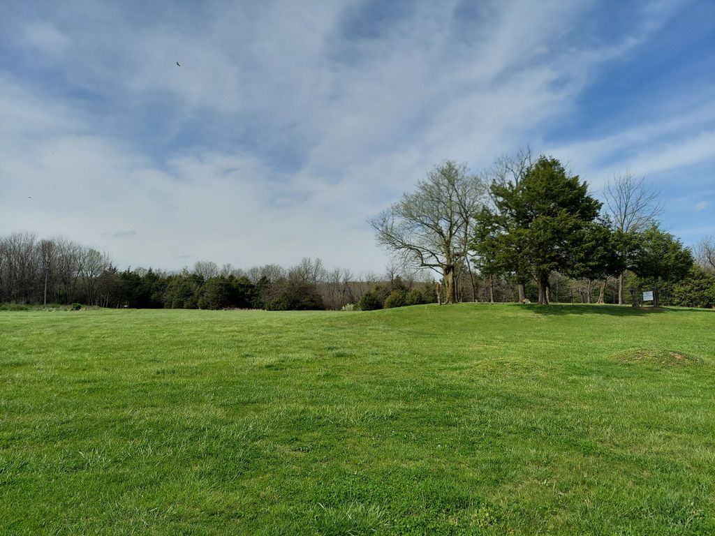
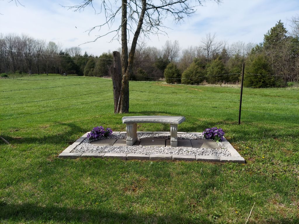
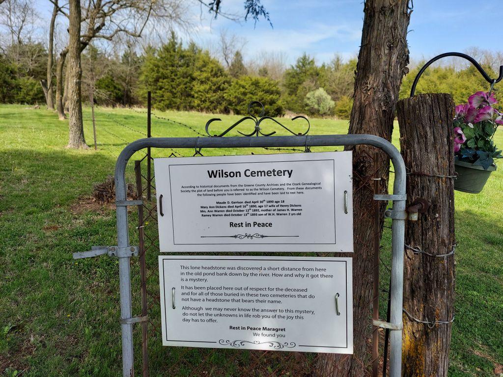
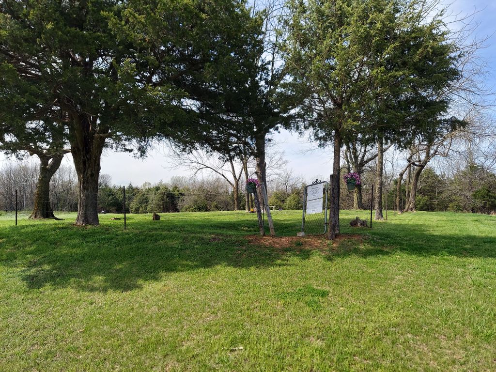
| Description | : | Wilson Cemetery Section 34, Township 30, Range 22 This description from page 97 Volume # III of Greene County, Missouri Cemeteries by Ozarks Genealogical Society. 3 miles north of Springfield, MO. State Highway 13 cross Sac River Bridge, left into entrance to Springfield NW Waste Water Treatment Plant. 1/4 mile west to gate cemetery 110 yards nw of Family Cemetery May 1, 1986. Abandoned cemetery, 50 sq. ft. atop knoll. Burials verified by published newspaper obits. Slave cemeteries uninscribed hand made brick markers found in random stacks. Old road can be seen on north side of both slave and family... Read More |
frequently asked questions (FAQ):
-
Where is Wilson Cemetery?
Wilson Cemetery is located at State Highway 13 across Sac River Bridge left into entrance of Springfield Waste Water Plant Robberson Number 2 Township, Greene County ,Missouri , 65617USA.
-
Wilson Cemetery cemetery's updated grave count on graveviews.com?
0 memorials
-
Where are the coordinates of the Wilson Cemetery?
Latitude: 37.2894530
Longitude: -93.3388070
Nearby Cemetories:
1. Sac River Cemetery AKA Slave Cemetery
Robberson Number 2 Township, Greene County, USA
Coordinate: 37.2898990, -93.3398060
2. Mullings Family Cemetery
Greene County, USA
Coordinate: 37.3111110, -93.3197520
3. Banfield Cemetery
Greene County, USA
Coordinate: 37.2779400, -93.3071900
4. Antioch Cemetery
Springfield, Greene County, USA
Coordinate: 37.2505989, -93.3538971
5. Dysart Cemetery
Springfield, Greene County, USA
Coordinate: 37.2516020, -93.2913170
6. Doling Park
Springfield, Greene County, USA
Coordinate: 37.2461815, -93.2902374
7. Greenlawn Memorial Gardens
Springfield, Greene County, USA
Coordinate: 37.2611008, -93.2750015
8. Friends of the Family Pet Memorial Gardens
Springfield, Greene County, USA
Coordinate: 37.2323600, -93.3673400
9. Robberson Prairie Cemetery
Ebenezer, Greene County, USA
Coordinate: 37.3522600, -93.3366900
10. Alms House Cemetery
Springfield, Greene County, USA
Coordinate: 37.2319720, -93.3712130
11. Bellview Cemetery
Springfield, Greene County, USA
Coordinate: 37.2880287, -93.2539215
12. Resurrection Cemetery
Springfield, Greene County, USA
Coordinate: 37.2276200, -93.3747550
13. Hughes Cemetery
Willard, Greene County, USA
Coordinate: 37.2871200, -93.4334600
14. White Chapel Memorial Gardens
Springfield, Greene County, USA
Coordinate: 37.2252998, -93.3906021
15. Murray Cemetery
Willard, Greene County, USA
Coordinate: 37.2872009, -93.4377975
16. Mount Comfort Cemetery
Springfield, Greene County, USA
Coordinate: 37.3250010, -93.2475450
17. Wesley Cemetery
Willard, Greene County, USA
Coordinate: 37.3260994, -93.4328003
18. Saint Marys Cemetery
Springfield, Greene County, USA
Coordinate: 37.2038994, -93.3249969
19. Clear Creek Cemetery
Springfield, Greene County, USA
Coordinate: 37.2538986, -93.4449997
20. Keet Burial
Springfield, Greene County, USA
Coordinate: 37.2069190, -93.2883940
21. Christ Episcopal Church Columbarium
Springfield, Greene County, USA
Coordinate: 37.2071800, -93.2862800
22. Union Campground Cemetery
Springfield, Greene County, USA
Coordinate: 37.2609400, -93.2234000
23. Rountree Cemetery
Springfield, Greene County, USA
Coordinate: 37.1913532, -93.3367156
24. Gilmore Cemetery
Greene County, USA
Coordinate: 37.3035200, -93.4645400