| Memorials | : | 1 |
| Location | : | Coalgate, Coal County, USA |
| Coordinate | : | 34.5345150, -96.3253070 |
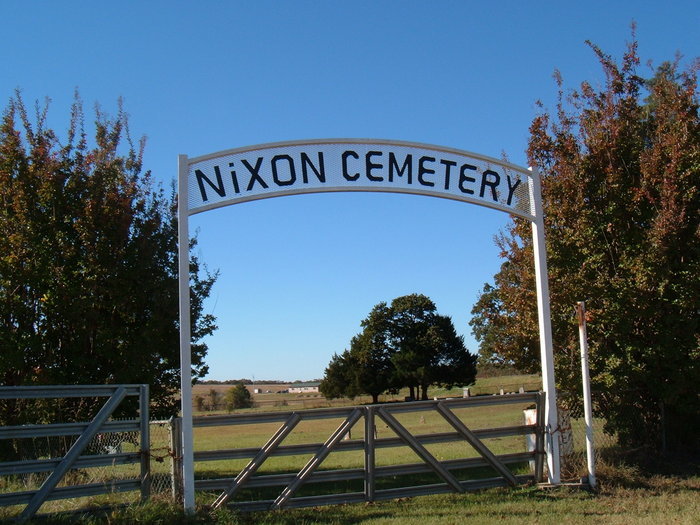
| Description | : | The cemetery is just past the old Nixon School and surrounded by a chain link fence. The land was allotted to a Native American named Plummer who staked off part of his land for a cemetery. A Mr. Smith came from Texas and settled in the area with a herd of cattle, so several Smith family members came to be buried there. The oldest stone in the cemetery is a Mr. Sneed who died in 1902. The cemetery did not have an official deed until Don and Kathleen Sprague Fleck moved back to Coalgate and began working on the cemetery.... Read More |
frequently asked questions (FAQ):
-
Where is Nixon Cemetery?
Nixon Cemetery is located at Coalgate, Coal County ,Oklahoma ,USA.
-
Nixon Cemetery cemetery's updated grave count on graveviews.com?
1 memorials
-
Where are the coordinates of the Nixon Cemetery?
Latitude: 34.5345150
Longitude: -96.3253070
Nearby Cemetories:
1. Round Lake Cemetery
Centrahoma, Coal County, USA
Coordinate: 34.5778008, -96.3371964
2. Keel Family Cemetery
Coal County, USA
Coordinate: 34.5064011, -96.3703003
3. Davis Cemetery
Coal County, USA
Coordinate: 34.4860992, -96.3321991
4. Sealy Cemetery
Coal County, USA
Coordinate: 34.4775009, -96.3202972
5. Centrahoma Cemetery
Centrahoma, Coal County, USA
Coordinate: 34.6061707, -96.3365326
6. Byrds Prairie Cemetery
Tupelo, Coal County, USA
Coordinate: 34.5792007, -96.4122009
7. James Family Cemetery
Olney, Coal County, USA
Coordinate: 34.4617100, -96.3872100
8. Wilson Cemetery
Clarita, Coal County, USA
Coordinate: 34.5196991, -96.4372025
9. Coalgate Cemetery
Coalgate, Coal County, USA
Coordinate: 34.5628014, -96.2155991
10. Calvary Cemetery
Phillips, Coal County, USA
Coordinate: 34.5121994, -96.2136002
11. Lehigh Cemetery
Lehigh, Coal County, USA
Coordinate: 34.4775900, -96.2319400
12. Selcer Cemetery
Coal County, USA
Coordinate: 34.6112301, -96.4042418
13. Woodman Cemetery
Coalgate, Coal County, USA
Coordinate: 34.5341988, -96.1996994
14. Moore Cemetery
Clarita, Coal County, USA
Coordinate: 34.4625015, -96.4261017
15. Whitehall Cemetery
Atoka County, USA
Coordinate: 34.4166985, -96.3230972
16. Old Lehigh Cemetery
Lehigh, Coal County, USA
Coordinate: 34.4435997, -96.2164001
17. Midway Cemetery
Lehigh, Coal County, USA
Coordinate: 34.4402800, -96.2081200
18. Pleasant Hill Cemetery
Coal County, USA
Coordinate: 34.5475006, -96.4894028
19. Clarita Amish Cemetery
Coal County, USA
Coordinate: 34.4343416, -96.4394419
20. Valley View Cemetery
Atoka County, USA
Coordinate: 34.4068985, -96.2632980
21. Ott Cemetery
Coal County, USA
Coordinate: 34.6244011, -96.1931000
22. Standing Rock Cemetery
Atoka County, USA
Coordinate: 34.3863983, -96.2810974
23. Worcester Cemetery
Coal County, USA
Coordinate: 34.4221000, -96.4589590
24. Globe Cemetery
Coal County, USA
Coordinate: 34.6921997, -96.3272018

