
| Memorials | : | 0 |
| Location | : | Brownfield, Oxford County, USA |
| Coordinate | : | 43.9104300, -70.9854200 |
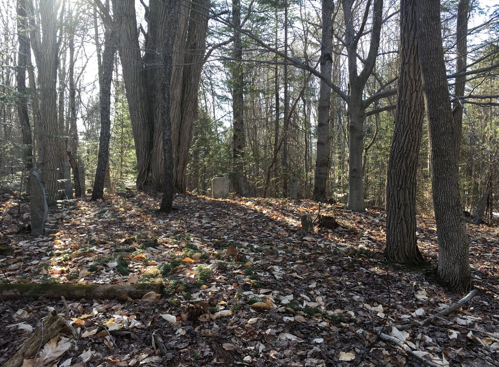
| Description | : | From its intersection with Porter Road, drive southwest on Thurston Road for 0.5 miles. The cemetery is in the woods on the right (northwest) side of the road just before a house and garage. Depending on the time of year, granite posts can be seen from the road. This cemetery is in poor condition with only one stone standing. |
frequently asked questions (FAQ):
-
Where is Joseph Meserve Cemetery?
Joseph Meserve Cemetery is located at Brownfield, Oxford County ,Maine ,USA.
-
Joseph Meserve Cemetery cemetery's updated grave count on graveviews.com?
0 memorials
-
Where are the coordinates of the Joseph Meserve Cemetery?
Latitude: 43.9104300
Longitude: -70.9854200
Nearby Cemetories:
1. George Hart Cemetery
Eaton Center, Carroll County, USA
Coordinate: 43.9161600, -70.9950900
2. Linscott Cemetery
Brownfield, Oxford County, USA
Coordinate: 43.8984500, -70.9886100
3. Thurston-Meserve Cemetery
Eaton, Carroll County, USA
Coordinate: 43.9105100, -71.0027800
4. Kenneson Cemetery
Eaton, Carroll County, USA
Coordinate: 43.9014700, -70.9997600
5. Frank Hart Cemetery
Eaton Center, Carroll County, USA
Coordinate: 43.9145100, -71.0039600
6. Cole Cemetery
Brownfield, Oxford County, USA
Coordinate: 43.8956000, -70.9768700
7. Brown-Johnson Cemetery
Brownfield, Oxford County, USA
Coordinate: 43.9163710, -70.9617450
8. Gray Gravesite
Eaton Center, Carroll County, USA
Coordinate: 43.9227780, -71.0058330
9. Dennett Cemetery
Brownfield, Oxford County, USA
Coordinate: 43.9289700, -70.9931000
10. Greenlaw Cemetery
Brownfield, Oxford County, USA
Coordinate: 43.9263992, -70.9677963
11. Walker-Rounds Cemetery
Brownfield, Oxford County, USA
Coordinate: 43.8909100, -70.9765200
12. Perkins Cemetery
Eaton, Carroll County, USA
Coordinate: 43.9115300, -71.0160000
13. Hatch Perkins Cemetery
Eaton Center, Carroll County, USA
Coordinate: 43.9181000, -71.0170000
14. Nathaniel Hill Cemetery
Brownfield, Oxford County, USA
Coordinate: 43.8926100, -70.9615000
15. Blake Cemetery
Brownfield, Oxford County, USA
Coordinate: 43.9063988, -70.9514008
16. Binford Cemetery
Brownfield, Oxford County, USA
Coordinate: 43.8936250, -70.9597380
17. McCartee Cemetery
Porter, Oxford County, USA
Coordinate: 43.8844430, -70.9770440
18. Wentworth-Brown Cemetery
Brownfield, Oxford County, USA
Coordinate: 43.9317200, -70.9555100
19. Ricker Cemetery
Brownfield, Oxford County, USA
Coordinate: 43.9061540, -70.9425500
20. Thompson-Stuart Cemetery
Eaton, Carroll County, USA
Coordinate: 43.9221000, -71.0274000
21. Garland Cemetery
Eaton, Carroll County, USA
Coordinate: 43.9111500, -71.0320300
22. Quint Cemetery
Brownfield, Oxford County, USA
Coordinate: 43.8984700, -70.9408400
23. Fernald Cemetery
Eaton, Carroll County, USA
Coordinate: 43.8825600, -71.0159200
24. Merrill Cemetery
Brownfield, Oxford County, USA
Coordinate: 43.9284000, -70.9423100