
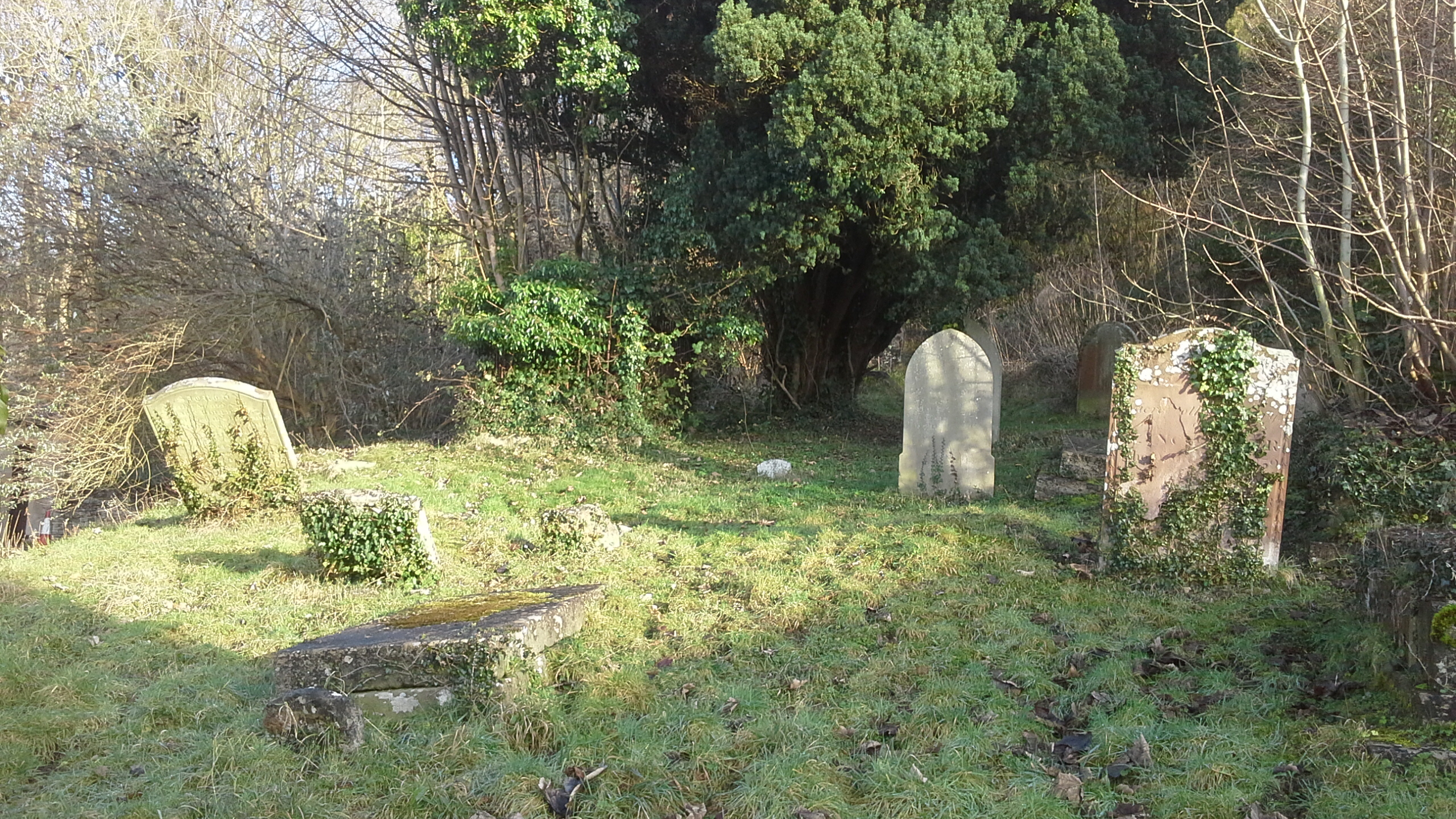
| Memorials | : | 37 |
| Location | : | Rodborough, Stroud District, England |
| Coordinate | : | 51.7345300, -2.2245700 |
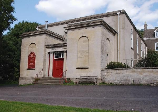
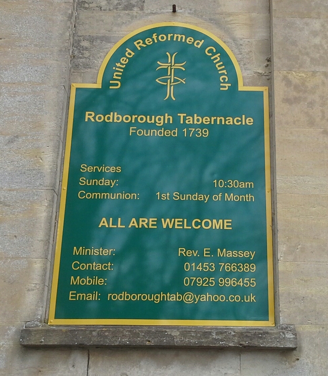
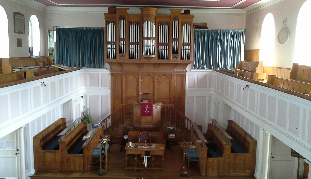
| Description | : | Rodborough Tabernacle dates back to the non-conformist preacher George Whitefield, who on Sunday July 1, 1739 gave an outdoor sermon on a barrow mound at Minchinhampton Common that is now known as 'Whitefield's Tump". A young man in the crowd named Thomas Adams was so moved by Whitefield's preaching that he donated the land in 1749 to serve as a site for an independent non-conformist place of worship. The central three bays at the north front of the Tabernacle were built in 1750, with four more bays being added in 1836/7 when the chapel was enlarged to create the present... Read More |
frequently asked questions (FAQ):
-
Where is Rodborough Tabernacle?
Rodborough Tabernacle is located at Tabernacle Walk Rodborough, Stroud District ,Gloucestershire , GL5 3UJEngland.
-
Rodborough Tabernacle cemetery's updated grave count on graveviews.com?
37 memorials
-
Where are the coordinates of the Rodborough Tabernacle?
Latitude: 51.7345300
Longitude: -2.2245700
Nearby Cemetories:
1. St. Mary Magdalene Churchyard
Rodborough, Stroud District, England
Coordinate: 51.7384180, -2.2284060
2. Stroud Old Cemetery
Stroud, Stroud District, England
Coordinate: 51.7337658, -2.2094599
3. St. Laurence Churchyard
Stroud, Stroud District, England
Coordinate: 51.7459470, -2.2153950
4. St Mary's Churchyard
Woodchester, Stroud District, England
Coordinate: 51.7224900, -2.2333920
5. All Saints Churchyard
Selsley, Stroud District, England
Coordinate: 51.7327800, -2.2487900
6. Saint Matthews Churchyard
Cainscross, Stroud District, England
Coordinate: 51.7430640, -2.2469780
7. Stroud Hill Cemetery
Stroud, Stroud District, England
Coordinate: 51.7415670, -2.2002660
8. Amberley Methodist Church - Littleworth Wesleyan C
Amberley, Stroud District, England
Coordinate: 51.7123580, -2.2202540
9. Kings Stanley Baptist Cemetery
Kings Stanley, Stroud District, England
Coordinate: 51.7269460, -2.2621780
10. Amberley Church Cemetery
Amberley, Stroud District, England
Coordinate: 51.7091900, -2.2196100
11. St Paul Churchyard
Whiteshill, Stroud District, England
Coordinate: 51.7597750, -2.2321540
12. Holy Trinity Churchyard
Amberley, Stroud District, England
Coordinate: 51.7087660, -2.2177170
13. Priory Church of the Annunciation Churchyard
Woodchester, Stroud District, England
Coordinate: 51.7080680, -2.2305250
14. Brimscombe Cemetery
Brimscombe, Stroud District, England
Coordinate: 51.7165900, -2.1900600
15. St. John the Baptist Churchyard
Randwick, Stroud District, England
Coordinate: 51.7587400, -2.2514000
16. St George's Churchyard
Kings Stanley, Stroud District, England
Coordinate: 51.7352650, -2.2765210
17. St. Michael's and All Angels Churchyard
Bisley, Stroud District, England
Coordinate: 51.7301150, -2.1715900
18. St. Mary of the Angels Churchyard
Chalford, Stroud District, England
Coordinate: 51.7219000, -2.1708000
19. Holy Trinity Churchyard
Minchinhampton, Stroud District, England
Coordinate: 51.7063600, -2.1860700
20. Holy Trinity Churchyard
Slad, Stroud District, England
Coordinate: 51.7647770, -2.1866550
21. St John the Baptist Churchyard
Pitchcombe, Stroud District, England
Coordinate: 51.7727590, -2.2166790
22. Minchinhampton Baptist Churchyard
Minchinhampton, Stroud District, England
Coordinate: 51.7039614, -2.1853756
23. Eastcombe Baptist Churchyard
Eastcombe, Stroud District, England
Coordinate: 51.7378009, -2.1606789
24. St. Cyr Churchyard
Stonehouse, Stroud District, England
Coordinate: 51.7433750, -2.2917980