
| Memorials | : | 92 |
| Location | : | Randwick, Stroud District, England |
| Website | : | www.achurchnearyou.com/church/14061/ |
| Coordinate | : | 51.7587400, -2.2514000 |
| Description | : | Description from The National Gazetteer (1868): RANDWICK, a parish in the upper division of Whitstone hundred, county Gloucester, 1½ mile N.W. of Stroud, its nearest railway station and post town, and 8 miles S. of Gloucester. The village, which is considerable, is situated on the slope of a hill on the line of the Great Western railway, and near the Thames and Severn canal. A portion of the inhabitants are engaged in the woollen mills. Oolite stone is quarried for building. The surface is hilly, and the soil light and stony, but there is some rich pasture land. From the summit of... Read More |
frequently asked questions (FAQ):
-
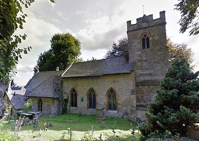
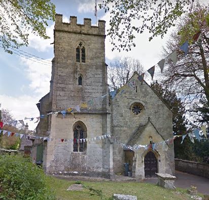
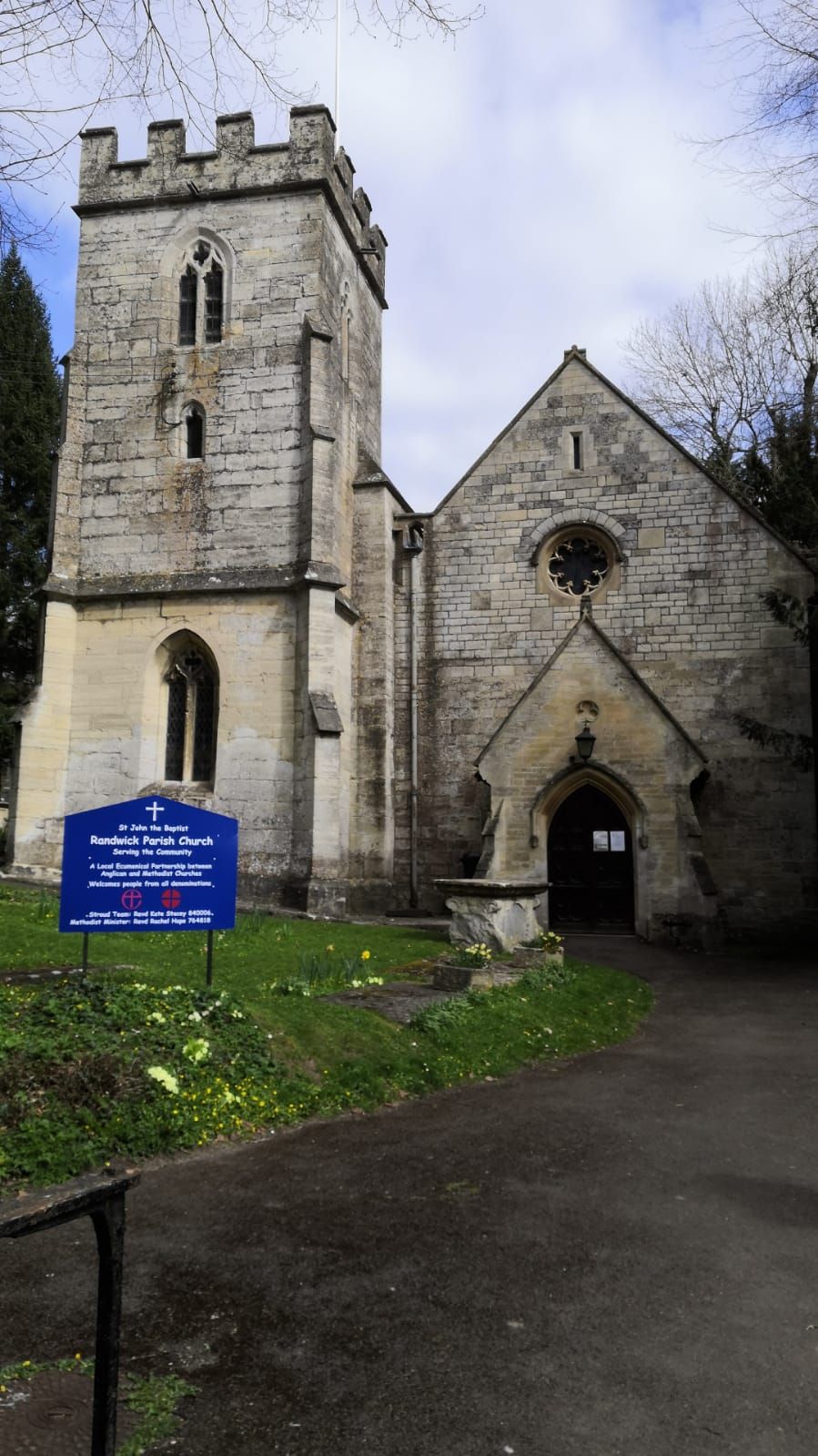
Where is St. John the Baptist Churchyard?
St. John the Baptist Churchyard is located at Randwick, Stroud District ,Gloucestershire , GL6 6HHEngland.
-
St. John the Baptist Churchyard cemetery's updated grave count on graveviews.com?
92 memorials
-
Where are the coordinates of the St. John the Baptist Churchyard?
Latitude: 51.7587400
Longitude: -2.2514000
Nearby Cemetories:
1. St Paul Churchyard
Whiteshill, Stroud District, England
Coordinate: 51.7597750, -2.2321540
2. Saint Matthews Churchyard
Cainscross, Stroud District, England
Coordinate: 51.7430640, -2.2469780
3. St. Mary Magdalene Churchyard
Rodborough, Stroud District, England
Coordinate: 51.7384180, -2.2284060
4. St John the Baptist Churchyard
Pitchcombe, Stroud District, England
Coordinate: 51.7727590, -2.2166790
5. St. Laurence Churchyard
Stroud, Stroud District, England
Coordinate: 51.7459470, -2.2153950
6. All Saints Churchyard
Selsley, Stroud District, England
Coordinate: 51.7327800, -2.2487900
7. St George's Churchyard
Kings Stanley, Stroud District, England
Coordinate: 51.7352650, -2.2765210
8. St. Cyr Churchyard
Stonehouse, Stroud District, England
Coordinate: 51.7433750, -2.2917980
9. Rodborough Tabernacle
Rodborough, Stroud District, England
Coordinate: 51.7345300, -2.2245700
10. Kings Stanley Baptist Cemetery
Kings Stanley, Stroud District, England
Coordinate: 51.7269460, -2.2621780
11. St John the Baptist Churchyard
Harescombe, Stroud District, England
Coordinate: 51.7921570, -2.2373260
12. Stroud Hill Cemetery
Stroud, Stroud District, England
Coordinate: 51.7415670, -2.2002660
13. Stroud Old Cemetery
Stroud, Stroud District, England
Coordinate: 51.7337658, -2.2094599
14. St. Peter's Churchyard
Haresfield, Stroud District, England
Coordinate: 51.7921323, -2.2767870
15. St Mary's Churchyard
Woodchester, Stroud District, England
Coordinate: 51.7224900, -2.2333920
16. Holy Trinity Churchyard
Slad, Stroud District, England
Coordinate: 51.7647770, -2.1866550
17. St. Michael and All Angels Churchyard
Eastington, Stroud District, England
Coordinate: 51.7501680, -2.3161330
18. St. Mary the Virgin Churchyard
Painswick, Stroud District, England
Coordinate: 51.7852975, -2.1947224
19. Saint Andrew's Churchyard
Frocester, Stroud District, England
Coordinate: 51.7273322, -2.3129734
20. Amberley Methodist Church - Littleworth Wesleyan C
Amberley, Stroud District, England
Coordinate: 51.7123580, -2.2202540
21. St. Swithun Churchyard
Brookthorpe, Stroud District, England
Coordinate: 51.8087500, -2.2402900
22. St. Stephen's Churchyard
Moreton Valence, Stroud District, England
Coordinate: 51.7857492, -2.3208765
23. Priory Church of the Annunciation Churchyard
Woodchester, Stroud District, England
Coordinate: 51.7080680, -2.2305250
24. Painswick Cemetery
Painswick, Stroud District, England
Coordinate: 51.7971040, -2.1918690