
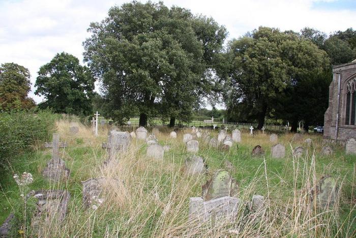
| Memorials | : | 0 |
| Location | : | Conington, Huntingdonshire District, England |
| Coordinate | : | 52.4581985, -0.2642000 |
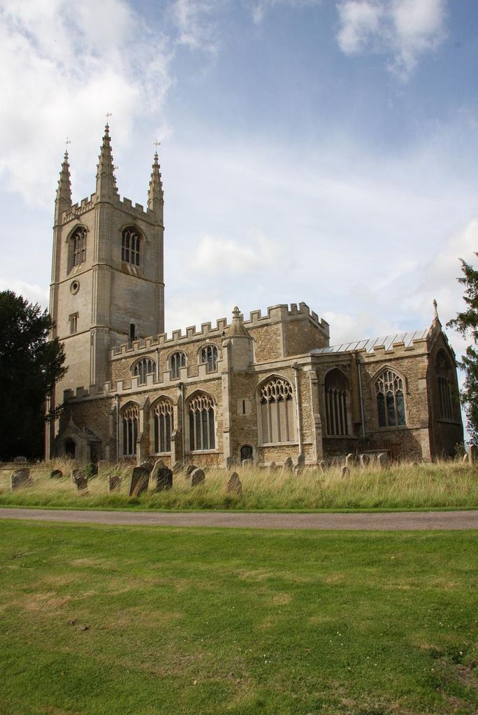
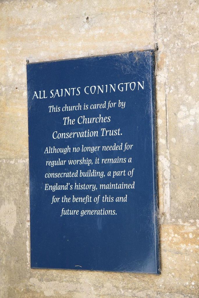
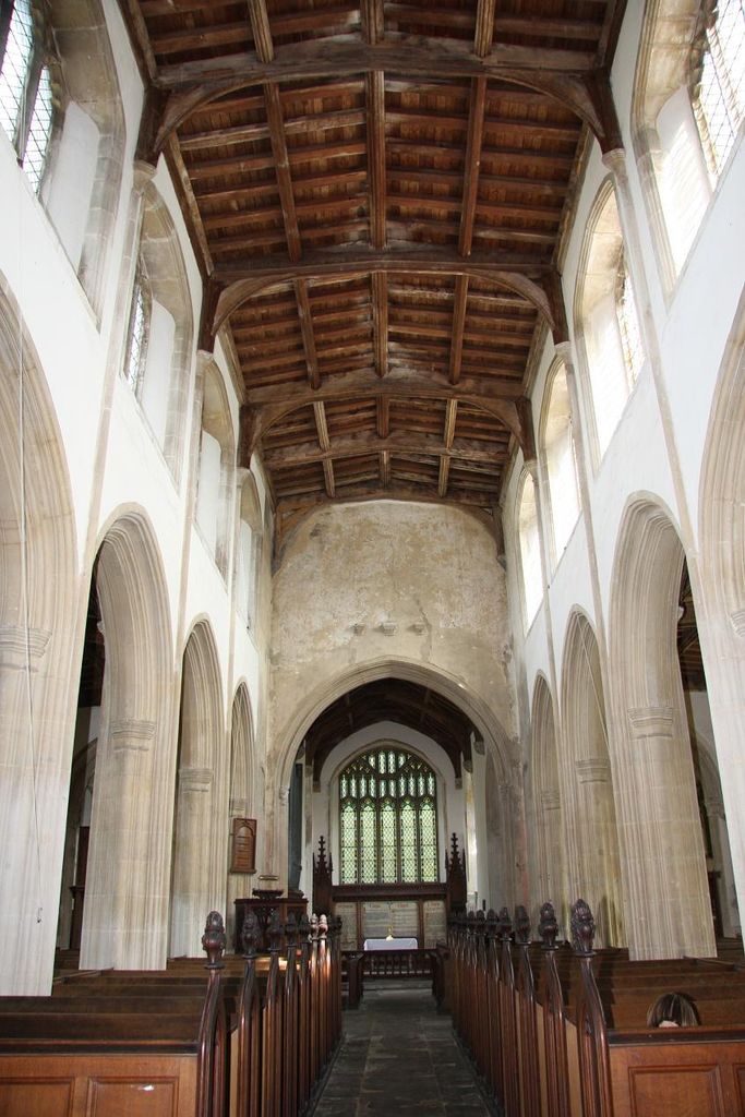
| Description | : | The presence of a church close to where All Saints Church now stands, was recorded already in Domesday Book in 1086. The present building dates almost certainly from the late 15th century. Conington means the king's manor, the 'ton' of the King. For many centuries the property was held by members of the Royal House of Scotland who were also Earls of Huntingdon. The Manor later passed to the Cotton family and afterwards to the Heathcotes. By the mid-1970s the parish found the cost of maintaining the church beyond its means. In June 1976 Conington was united with another parish, in Holme.... Read More |
frequently asked questions (FAQ):
-
Where is All Saints Churchyard?
All Saints Churchyard is located at Church Lane Conington, Huntingdonshire District ,Cambridgeshire , PE7 3QJEngland.
-
All Saints Churchyard cemetery's updated grave count on graveviews.com?
0 memorials
-
Where are the coordinates of the All Saints Churchyard?
Latitude: 52.4581985
Longitude: -0.2642000
Nearby Cemetories:
1. Sawtry St Andrew
Sawtry, Huntingdonshire District, England
Coordinate: 52.4406931, -0.2716515
2. Sawtry All Saints
Sawtry, Huntingdonshire District, England
Coordinate: 52.4410949, -0.2771430
3. Holme Cemetery
Holme, Huntingdonshire District, England
Coordinate: 52.4726120, -0.2408410
4. St. Giles' Churchyard
Holme, Huntingdonshire District, England
Coordinate: 52.4767090, -0.2502880
5. St Nicholas Churchyard
Glatton, Huntingdonshire District, England
Coordinate: 52.4607440, -0.3035450
6. Sawtry Abbey
Sawtry, Huntingdonshire District, England
Coordinate: 52.4270330, -0.2411420
7. Stilton Cemetery
Stilton, Huntingdonshire District, England
Coordinate: 52.4895230, -0.2923260
8. St Andrew's Churchyard, Wood Walton
Woodwalton, Huntingdonshire District, England
Coordinate: 52.4239863, -0.2235789
9. Saint Peter's Churchyard
Yaxley, Huntingdonshire District, England
Coordinate: 52.5117400, -0.2672200
10. Yaxley Cemetery
Peterborough, Peterborough Unitary Authority, England
Coordinate: 52.5137400, -0.2700500
11. St. Andrew's Churchyard
Steeple Gidding, Huntingdonshire District, England
Coordinate: 52.4184500, -0.3368200
12. Great Gidding Baptist Church Cemetery
Great Gidding, Huntingdonshire District, England
Coordinate: 52.4336468, -0.3575526
13. All Saints
Morborne, Huntingdonshire District, England
Coordinate: 52.5094990, -0.3228910
14. St.Margaret Churchyard
Upton, Huntingdonshire District, England
Coordinate: 52.3918700, -0.2753400
15. All Saints Churchyard
Hamerton, Huntingdonshire District, England
Coordinate: 52.4028700, -0.3308800
16. St. Mary's Churchyard
Peterborough, Peterborough Unitary Authority, England
Coordinate: 52.5184227, -0.3295881
17. Upwood Cemetery
Upwood, Huntingdonshire District, England
Coordinate: 52.4240800, -0.1525400
18. St Andrew Churchyard
Abbots Ripton, Huntingdonshire District, England
Coordinate: 52.3863790, -0.1932260
19. All Saints Church
Buckworth, Huntingdonshire District, England
Coordinate: 52.3770200, -0.3147570
20. St. Peter & St. Paul Churchyard
Alconbury, Huntingdonshire District, England
Coordinate: 52.3697800, -0.2610200
21. St James the Great
Thurning, East Northamptonshire Borough, England
Coordinate: 52.4327883, -0.4042219
22. St. Thomas Churchyard
Pondersbridge, Fenland District, England
Coordinate: 52.5107400, -0.1427800
23. St. Martin’s Churchyard
Little Stukeley, Huntingdonshire District, England
Coordinate: 52.3659040, -0.2252790
24. Stanground Cemetery
Stanground, Peterborough Unitary Authority, England
Coordinate: 52.5516860, -0.2273100