
| Memorials | : | 31 |
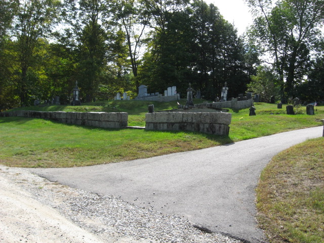
| Location | : | Eaton Center, Carroll County, USA |
| Coordinate | : | 43.9109250, -71.0617630 |
| Description | : | From its intersection with Route 153, drive east on Brownfield Road 0.7 miles. The large cemetery is on the right (south) side of the road. |
frequently asked questions (FAQ):
-
Where is Snowville Cemetery?
Snowville Cemetery is located at Brownfield and Drew Point Roads Eaton Center, Carroll County ,New Hampshire , 03832USA.
-
Snowville Cemetery cemetery's updated grave count on graveviews.com?
27 memorials
-
Where are the coordinates of the Snowville Cemetery?
Latitude: 43.9109250
Longitude: -71.0617630


Nearby Cemetories:
1. Bachelder Cemetery
Eaton, Carroll County, USA
Coordinate: 43.9140200, -71.0643600
2. Drew-Kenneson Cemetery
Eaton Center, Carroll County, USA
Coordinate: 43.9038890, -71.0572220
3. Eaton Center Cemetery
Eaton Center, Carroll County, USA
Coordinate: 43.9087000, -71.0801000
4. Sawyer-Drew Cemetery
Eaton Center, Carroll County, USA
Coordinate: 43.9022200, -71.0453300
5. Palmer Cemetery
Eaton, Carroll County, USA
Coordinate: 43.8973200, -71.0803000
6. Glines Hill Cemetery
Eaton, Carroll County, USA
Coordinate: 43.9105500, -71.0889300
7. Ward-Stuart Cemetery
Eaton, Carroll County, USA
Coordinate: 43.8995300, -71.0391100
8. Littlefield-Bean Cemetery
Eaton Center, Carroll County, USA
Coordinate: 43.9205560, -71.0372220
9. Jones Cemetery
Eaton, Carroll County, USA
Coordinate: 43.9310600, -71.0595400
10. Garland Cemetery
Eaton, Carroll County, USA
Coordinate: 43.9111500, -71.0320300
11. Flood Cemetery
Eaton Center, Carroll County, USA
Coordinate: 43.8988890, -71.0333330
12. Elwell Cemetery
Eaton, Carroll County, USA
Coordinate: 43.8905200, -71.0819300
13. Thompson-Stuart Cemetery
Eaton, Carroll County, USA
Coordinate: 43.9221000, -71.0274000
14. Brooks Cemetery
Eaton, Carroll County, USA
Coordinate: 43.8860600, -71.0409300
15. Jenness-Leavitt Cemetery
Eaton, Carroll County, USA
Coordinate: 43.8804900, -71.0565000
16. Perkins Cemetery
Eaton, Carroll County, USA
Coordinate: 43.9115300, -71.0160000
17. Hatch Perkins Cemetery
Eaton Center, Carroll County, USA
Coordinate: 43.9181000, -71.0170000
18. Drew Family Cemetery
Conway, Carroll County, USA
Coordinate: 43.9374280, -71.0999050
19. Potter Cemetery
Conway, Carroll County, USA
Coordinate: 43.9490000, -71.0523000
20. Allen Cemetery
Eaton, Carroll County, USA
Coordinate: 43.8698200, -71.0591800
21. Dolloff
Conway, Carroll County, USA
Coordinate: 43.9443525, -71.0954582
22. Frank Hart Cemetery
Eaton Center, Carroll County, USA
Coordinate: 43.9145100, -71.0039600
23. Gray Gravesite
Eaton Center, Carroll County, USA
Coordinate: 43.9227780, -71.0058330
24. Thurston Cemetery
Eaton Center, Carroll County, USA
Coordinate: 43.8690000, -71.0658000