
| Memorials | : | 4 |
| Location | : | Eaton Center, Carroll County, USA |
| Coordinate | : | 43.9181000, -71.0170000 |
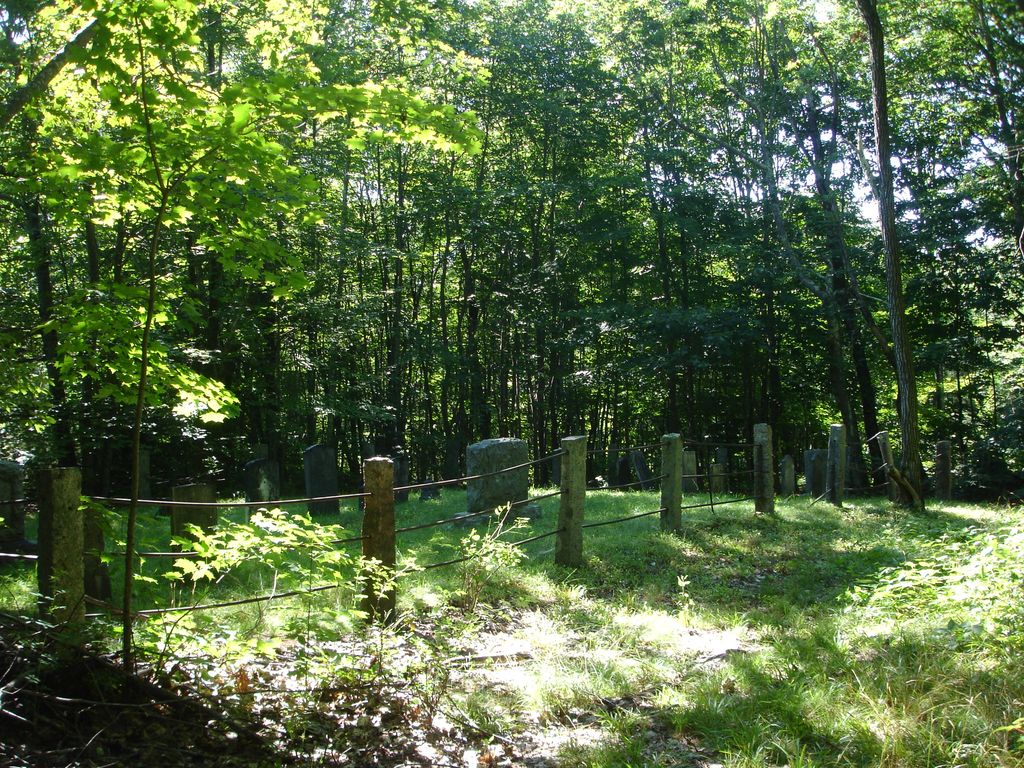
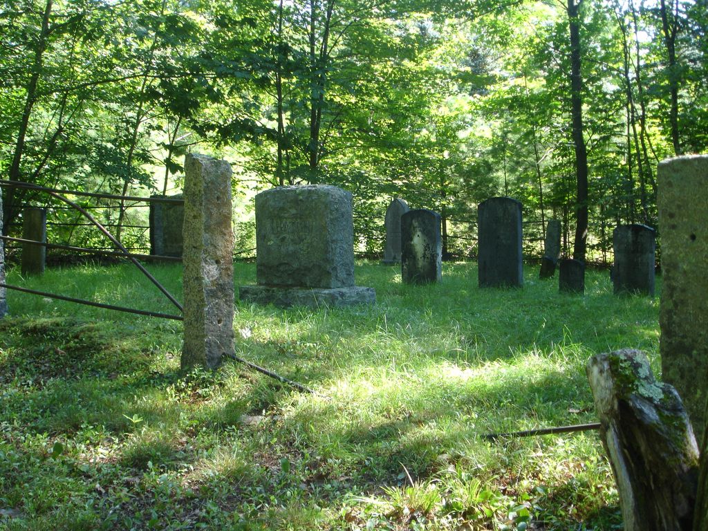
| Description | : | From its intersection with Brownfield Road, drive east 0.25 miles on Hatch Road. There is a grassy drive on the right (south) side, just before a house. Follow the drive south 400 feet. The cemetery, surrounded by an iron bar fence, is on the left (east) side of the drive. |
frequently asked questions (FAQ):
-
Where is Hatch Perkins Cemetery?
Hatch Perkins Cemetery is located at Hatch Road Eaton Center, Carroll County ,New Hampshire ,USA.
-
Hatch Perkins Cemetery cemetery's updated grave count on graveviews.com?
4 memorials
-
Where are the coordinates of the Hatch Perkins Cemetery?
Latitude: 43.9181000
Longitude: -71.0170000
Nearby Cemetories:
1. Perkins Cemetery
Eaton, Carroll County, USA
Coordinate: 43.9115300, -71.0160000
2. Thompson-Stuart Cemetery
Eaton, Carroll County, USA
Coordinate: 43.9221000, -71.0274000
3. Gray Gravesite
Eaton Center, Carroll County, USA
Coordinate: 43.9227780, -71.0058330
4. Frank Hart Cemetery
Eaton Center, Carroll County, USA
Coordinate: 43.9145100, -71.0039600
5. Thurston-Meserve Cemetery
Eaton, Carroll County, USA
Coordinate: 43.9105100, -71.0027800
6. Garland Cemetery
Eaton, Carroll County, USA
Coordinate: 43.9111500, -71.0320300
7. Littlefield-Bean Cemetery
Eaton Center, Carroll County, USA
Coordinate: 43.9205560, -71.0372220
8. George Hart Cemetery
Eaton Center, Carroll County, USA
Coordinate: 43.9161600, -70.9950900
9. Dennett Cemetery
Brownfield, Oxford County, USA
Coordinate: 43.9289700, -70.9931000
10. Kenneson Cemetery
Eaton, Carroll County, USA
Coordinate: 43.9014700, -70.9997600
11. Flood Cemetery
Eaton Center, Carroll County, USA
Coordinate: 43.8988890, -71.0333330
12. Joseph Meserve Cemetery
Brownfield, Oxford County, USA
Coordinate: 43.9104300, -70.9854200
13. Ward-Stuart Cemetery
Eaton, Carroll County, USA
Coordinate: 43.8995300, -71.0391100
14. Sawyer-Drew Cemetery
Eaton Center, Carroll County, USA
Coordinate: 43.9022200, -71.0453300
15. Linscott Cemetery
Brownfield, Oxford County, USA
Coordinate: 43.8984500, -70.9886100
16. Bean-West Cemetery
Wentworth Location, Coos County, USA
Coordinate: 43.9472220, -71.0280560
17. Drew-Kenneson Cemetery
Eaton Center, Carroll County, USA
Coordinate: 43.9038890, -71.0572220
18. Snowville Cemetery
Eaton Center, Carroll County, USA
Coordinate: 43.9109250, -71.0617630
19. Jones Cemetery
Eaton, Carroll County, USA
Coordinate: 43.9310600, -71.0595400
20. Bachelder Cemetery
Eaton, Carroll County, USA
Coordinate: 43.9140200, -71.0643600
21. Fernald Cemetery
Eaton, Carroll County, USA
Coordinate: 43.8825600, -71.0159200
22. Brooks Cemetery
Eaton, Carroll County, USA
Coordinate: 43.8860600, -71.0409300
23. Greenlaw Cemetery
Brownfield, Oxford County, USA
Coordinate: 43.9263992, -70.9677963
24. Cole Cemetery
Brownfield, Oxford County, USA
Coordinate: 43.8956000, -70.9768700