
| Memorials | : | 0 |
| Location | : | Eaton Center, Carroll County, USA |
| Coordinate | : | 43.8988890, -71.0333330 |
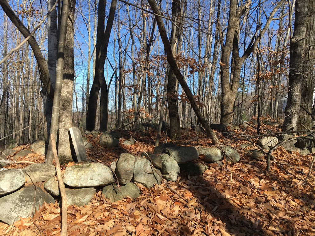
| Description | : | From its intersection with Bull Pasture Road, drive 0.35 miles east on Stewart Road. The small rectangular cemetery is 50 feet uphill on the right (south) side of the road and is surrounded by a stone wall. There is room for one other grave, but there is only one gravestone. |
frequently asked questions (FAQ):
-
Where is Flood Cemetery?
Flood Cemetery is located at Stewart Road Eaton Center, Carroll County ,New Hampshire , 03849USA.
-
Flood Cemetery cemetery's updated grave count on graveviews.com?
0 memorials
-
Where are the coordinates of the Flood Cemetery?
Latitude: 43.8988890
Longitude: -71.0333330
Nearby Cemetories:
1. Ward-Stuart Cemetery
Eaton, Carroll County, USA
Coordinate: 43.8995300, -71.0391100
2. Sawyer-Drew Cemetery
Eaton Center, Carroll County, USA
Coordinate: 43.9022200, -71.0453300
3. Garland Cemetery
Eaton, Carroll County, USA
Coordinate: 43.9111500, -71.0320300
4. Brooks Cemetery
Eaton, Carroll County, USA
Coordinate: 43.8860600, -71.0409300
5. Perkins Cemetery
Eaton, Carroll County, USA
Coordinate: 43.9115300, -71.0160000
6. Drew-Kenneson Cemetery
Eaton Center, Carroll County, USA
Coordinate: 43.9038890, -71.0572220
7. Fernald Cemetery
Eaton, Carroll County, USA
Coordinate: 43.8825600, -71.0159200
8. Littlefield-Bean Cemetery
Eaton Center, Carroll County, USA
Coordinate: 43.9205560, -71.0372220
9. Hatch Perkins Cemetery
Eaton Center, Carroll County, USA
Coordinate: 43.9181000, -71.0170000
10. Thompson-Stuart Cemetery
Eaton, Carroll County, USA
Coordinate: 43.9221000, -71.0274000
11. Snowville Cemetery
Eaton Center, Carroll County, USA
Coordinate: 43.9109250, -71.0617630
12. Kenneson Cemetery
Eaton, Carroll County, USA
Coordinate: 43.9014700, -70.9997600
13. Jenness-Leavitt Cemetery
Eaton, Carroll County, USA
Coordinate: 43.8804900, -71.0565000
14. Thurston-Meserve Cemetery
Eaton, Carroll County, USA
Coordinate: 43.9105100, -71.0027800
15. Frank Hart Cemetery
Eaton Center, Carroll County, USA
Coordinate: 43.9145100, -71.0039600
16. Bachelder Cemetery
Eaton, Carroll County, USA
Coordinate: 43.9140200, -71.0643600
17. Merrow-Gannett Cemetery
Eaton Center, Carroll County, USA
Coordinate: 43.8745200, -71.0153300
18. Currier-Wilkinson Cemetery
Eaton, Carroll County, USA
Coordinate: 43.8708500, -71.0433400
19. Gray Gravesite
Eaton Center, Carroll County, USA
Coordinate: 43.9227780, -71.0058330
20. Linscott Cemetery
Brownfield, Oxford County, USA
Coordinate: 43.8984500, -70.9886100
21. Wilkinson Cemetery
Eaton, Carroll County, USA
Coordinate: 43.8663900, -71.0331800
22. George Hart Cemetery
Eaton Center, Carroll County, USA
Coordinate: 43.9161600, -70.9950900
23. Palmer Cemetery
Eaton, Carroll County, USA
Coordinate: 43.8973200, -71.0803000
24. Allen Cemetery
Eaton, Carroll County, USA
Coordinate: 43.8698200, -71.0591800