
| Memorials | : | 1 |
| Location | : | Eaton, Carroll County, USA |
| Coordinate | : | 43.8860600, -71.0409300 |
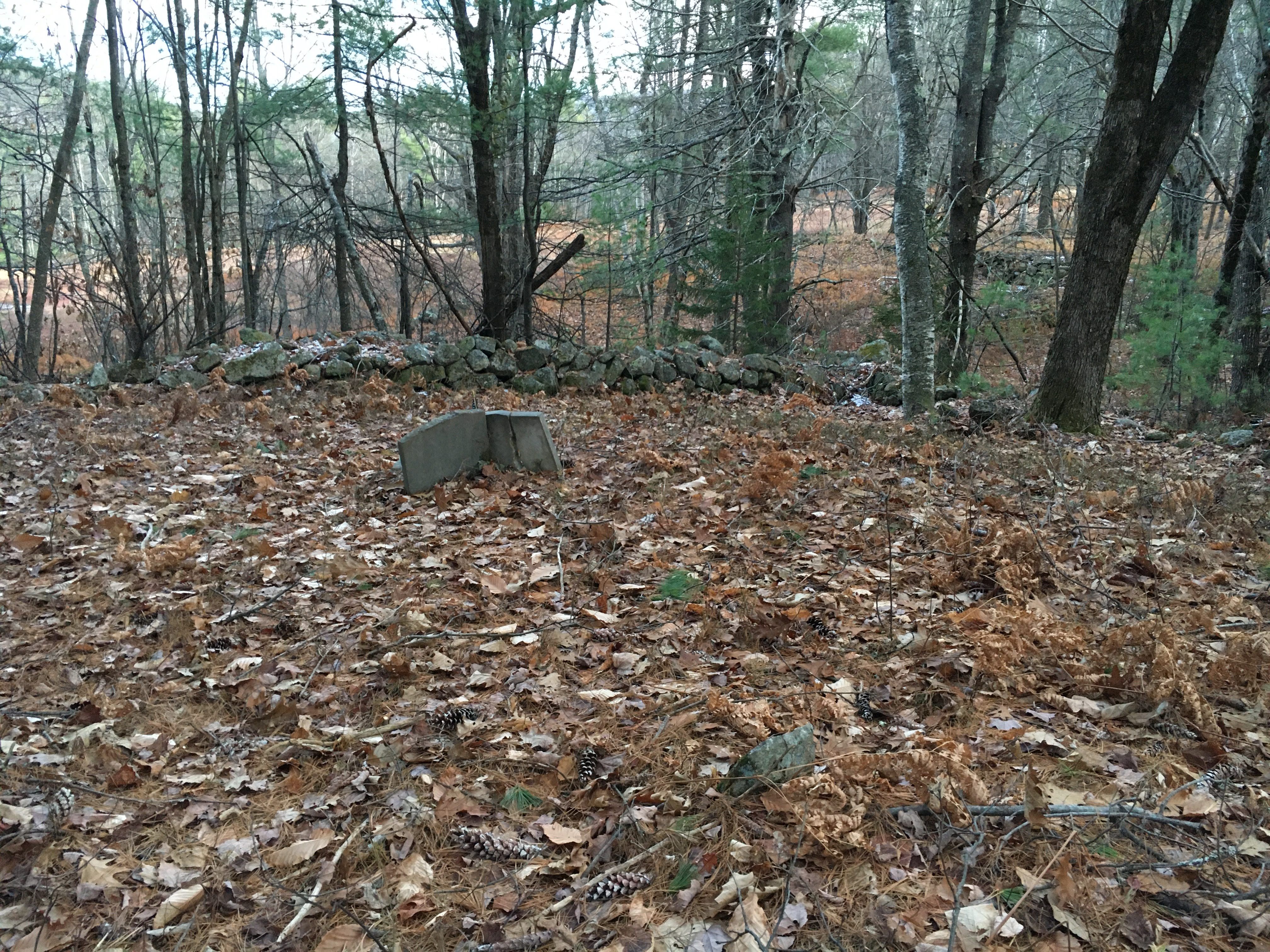
| Description | : | From its intersection with Stewart Road, drive southeast on Foss Mountain Road 1.25 miles to the Foss Mountain trailhead. Follow the trail west 800 feet to a cellar hole and sign on the right (north). The stone-walled cemetery is 250 feet to the north. There is one broken gravestone but room for many more graves. |
frequently asked questions (FAQ):
-
Where is Brooks Cemetery?
Brooks Cemetery is located at Foss Mountain Road Eaton, Carroll County ,New Hampshire ,USA.
-
Brooks Cemetery cemetery's updated grave count on graveviews.com?
1 memorials
-
Where are the coordinates of the Brooks Cemetery?
Latitude: 43.8860600
Longitude: -71.0409300
Nearby Cemetories:
1. Jenness-Leavitt Cemetery
Eaton, Carroll County, USA
Coordinate: 43.8804900, -71.0565000
2. Ward-Stuart Cemetery
Eaton, Carroll County, USA
Coordinate: 43.8995300, -71.0391100
3. Flood Cemetery
Eaton Center, Carroll County, USA
Coordinate: 43.8988890, -71.0333330
4. Currier-Wilkinson Cemetery
Eaton, Carroll County, USA
Coordinate: 43.8708500, -71.0433400
5. Sawyer-Drew Cemetery
Eaton Center, Carroll County, USA
Coordinate: 43.9022200, -71.0453300
6. Fernald Cemetery
Eaton, Carroll County, USA
Coordinate: 43.8825600, -71.0159200
7. Wilkinson Cemetery
Eaton, Carroll County, USA
Coordinate: 43.8663900, -71.0331800
8. Allen Cemetery
Eaton, Carroll County, USA
Coordinate: 43.8698200, -71.0591800
9. Drew-Kenneson Cemetery
Eaton Center, Carroll County, USA
Coordinate: 43.9038890, -71.0572220
10. Merrow-Gannett Cemetery
Eaton Center, Carroll County, USA
Coordinate: 43.8745200, -71.0153300
11. Thurston Cemetery
Eaton Center, Carroll County, USA
Coordinate: 43.8690000, -71.0658000
12. Garland Cemetery
Eaton, Carroll County, USA
Coordinate: 43.9111500, -71.0320300
13. Drew Cemetery
Freedom, Carroll County, USA
Coordinate: 43.8607000, -71.0327000
14. Allard Cemetery
Freedom, Carroll County, USA
Coordinate: 43.8599600, -71.0485000
15. Smart Cemetery
Freedom, Carroll County, USA
Coordinate: 43.8598700, -71.0483200
16. Snowville Cemetery
Eaton Center, Carroll County, USA
Coordinate: 43.9109250, -71.0617630
17. Elwell Cemetery
Eaton, Carroll County, USA
Coordinate: 43.8905200, -71.0819300
18. Palmer Cemetery
Eaton, Carroll County, USA
Coordinate: 43.8973200, -71.0803000
19. Perkins Cemetery
Eaton, Carroll County, USA
Coordinate: 43.9115300, -71.0160000
20. Bachelder Cemetery
Eaton, Carroll County, USA
Coordinate: 43.9140200, -71.0643600
21. Kenneson Cemetery
Eaton, Carroll County, USA
Coordinate: 43.9014700, -70.9997600
22. Durgin Cemetery
Eaton Center, Carroll County, USA
Coordinate: 43.8700000, -71.0816670
23. Littlefield-Bean Cemetery
Eaton Center, Carroll County, USA
Coordinate: 43.9205560, -71.0372220
24. Swett Hill Cemetery
Freedom, Carroll County, USA
Coordinate: 43.8547000, -71.0183000