
| Memorials | : | 0 |
| Location | : | Chesterfield, Chesterfield County, USA |
| Coordinate | : | 34.7919380, -80.0813360 |
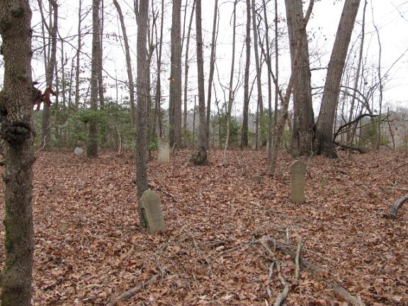
| Description | : | From Chesterfield, S.C. take Highway 145 North. At the forks take the left fork which is Highway 742. Go about one mile and turn right on Vaughn Drive. This will have no outlet and will be a circle. Turn right at the first road. Go down until the road straightens to the left. Cemetery will be down the first drive on the right after road straightens out. At present this is a vacant lot. |
frequently asked questions (FAQ):
-
Where is Stroud Family Cemetery?
Stroud Family Cemetery is located at Chesterfield, Chesterfield County ,South Carolina ,USA.
-
Stroud Family Cemetery cemetery's updated grave count on graveviews.com?
0 memorials
-
Where are the coordinates of the Stroud Family Cemetery?
Latitude: 34.7919380
Longitude: -80.0813360

Nearby Cemetories:
1. Davids Grove Baptist Church Cemetery
Chesterfield, Chesterfield County, USA
Coordinate: 34.7928009, -80.0903015
2. Dred Cemetery
Chesterfield, Chesterfield County, USA
Coordinate: 34.7821920, -80.0837230
3. Griggs Family Cemetery
Chesterfield, Chesterfield County, USA
Coordinate: 34.8042150, -80.0732200
4. Mount Level Baptist Church Cemetery
Chesterfield, Chesterfield County, USA
Coordinate: 34.7990910, -80.0970350
5. Friendship United Methodist Church Cemetery
Chesterfield, Chesterfield County, USA
Coordinate: 34.7655983, -80.0883026
6. Adams Family Cemetery
Chesterfield, Chesterfield County, USA
Coordinate: 34.8073080, -80.1096060
7. Smith Cemetery
Chesterfield, Chesterfield County, USA
Coordinate: 34.7974840, -80.0480710
8. Sowell Cemetery
Chesterfield, Chesterfield County, USA
Coordinate: 34.7654220, -80.0933680
9. Campbell Family Cemetery
Chesterfield, Chesterfield County, USA
Coordinate: 34.8048360, -80.0441280
10. Rickets Cemetery
Wadesboro, Anson County, USA
Coordinate: 34.8186700, -80.1066000
11. Vaughn-Campbell Cemetery
Cason Old Field, Anson County, USA
Coordinate: 34.8187140, -80.1066880
12. Williams Cemetery
Cason Old Field, Anson County, USA
Coordinate: 34.8237430, -80.1060340
13. Davis Cemetery
Chesterfield, Chesterfield County, USA
Coordinate: 34.7676600, -80.0456570
14. Bittle Family Cemetery
Chesterfield, Chesterfield County, USA
Coordinate: 34.7535050, -80.0828380
15. Burr Cemetery
Cason Old Field, Anson County, USA
Coordinate: 34.8319120, -80.0709340
16. Sandy Plains United Methodist Church Cemetery
Morven, Anson County, USA
Coordinate: 34.8245800, -80.0488600
17. Teal Family Cemetery
Chesterfield, Chesterfield County, USA
Coordinate: 34.7583530, -80.0463330
18. Short Cemetery
Cason Old Field, Anson County, USA
Coordinate: 34.8294550, -80.1128950
19. Hurst Family Cemetery
Chesterfield, Chesterfield County, USA
Coordinate: 34.7704190, -80.1322070
20. Hurst Cemetery
Chesterfield, Chesterfield County, USA
Coordinate: 34.7552910, -80.1179504
21. New Hope United Methodist Church Cemetery
Wadesboro, Anson County, USA
Coordinate: 34.8382390, -80.0943390
22. Rivers Family Cemetery
Chesterfield, Chesterfield County, USA
Coordinate: 34.7484950, -80.0539370
23. Griggs Cemetery
Chesterfield, Chesterfield County, USA
Coordinate: 34.7757988, -80.1382980
24. James Ratliff Cemetery
Cason Old Field, Anson County, USA
Coordinate: 34.8346590, -80.1147080